1. Couldn't load AI content — try another language or refresh
Showing information forSouth Fulton·Georgia·United Statesauto-detected
📱 Get the app
CJLmedium airport

Chitral Airport

Chitral, Pakistan
Routes out
2
Destinations
2
ICAO
OPCH
Elevation
4920 ft
The gateway in a glance

The Essence of Chitral Airport

CJL
Location
Chitral · KP · Pakistan
Connectivity
2 routes · 2 destinations
Position
35.886°, 71.800° · 4920 ft elev.
Visa & Entry
e-Visa, Visa on Arrival (select countries)
AI Travel Editor

A closer look

Living guide content for Chitral Airport — read or listen in 46+ languages.

Language
TravelerPulse profile

Gateway to Pakistan's remote and scenic Chitral Valley.

Location
Chitral, Pakistan
Chitral Airport (IATA: CJL, ICAO: OPCH) is a small domestic airport serving the town of Chitral in Khyber Pakhtunkhwa province, Pakistan. Situated at an elevation of approximately 4,946 feet (1,507 meters) above sea level, it operates amid the dramatic Hindu Kush mountain range, making it one of the more challenging airports in the region. The airport primarily supports domestic connectivity for the isolated Chitral district, which is otherwise accessible only by mountain roads that can be closed during winter months. It plays a vital role in maintaining year-round links for local residents, government officials, and tourists visiting the area. Due to its mountainous surroundings and high elevation, flight operations at Chitral Airport are highly dependent on weather conditions and are subject to frequent cancellations and delays. The runway and facilities are modest, suited to smaller turboprop aircraft.
Terminals
The airport has a single small terminal building handling all domestic passenger traffic.
Getting to & from
Ground transport from the airport to Chitral town is mainly via private taxis and local vehicles, as no formal public bus service connects the airport.
Airlines here
Pakistan International Airlines (PIA) is the primary carrier operating scheduled domestic flights at Chitral Airport.
Notable facts
  • ›Located at approximately 4,946 feet (1,507 m) elevation in the Hindu Kush mountains.
  • ›Flights are frequently cancelled or delayed due to adverse mountain weather conditions.
  • ›The airport is critical for connectivity during winter when mountain roads may be blocked by snow.
  • ›It serves a predominantly domestic route network with no international services.
  • ›The surrounding terrain makes approaches and departures technically demanding for pilots.
This profile is provided for general information only. Details may be inaccurate or outdated — always verify with the airport's official website before acting on them.

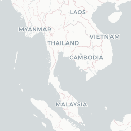
Route map (2 destinations)
Leaflet © OpenStreetMap © CARTO

Airlines serving this airport

Routes

CJL → PEWPK · ATR
CJL → ISBPK · ATR
Hotels near CJL

Pick what matters for your layover or early flight, then compare on your favorite booking site.

Compare stays for your dates

TravelerPulse may receive compensation when you book or purchase through some of the links on this page, at no additional cost to you. Prices and availability are set by the booking provider and may change. We never share your private trip details with partners — only the destination, dates and party size you searched.

City & Place Guide

No guide exists for this place yet — Click to generate a Traveler Pulse guide.

Passport, Visa & Immigration

Flying internationally via CJL? Check entry, transit and customs requirements for Pakistan from official government sources.

Chitral Airport
Encyclopaedia

Chitral Airport is a small domestic airport situated 2 NM (3.7 km) north of the city centre of Chitral, in the Khyber Pakhtunkhwa province of Pakistan.

Read full article on Wikipedia
About on Wikipedia

Chitral Airport

Airport in Chitral

Chitral Airport is a small domestic airport situated 2 NM (3.7 km) north of the city centre of Chitral, in the Khyber Pakhtunkhwa province of Pakistan.

Read on Wikipedia

Text from Wikipedia, licensed under CC BY-SA. May be out of date — verify important details.

My Social Pulse
Get the My Social Pulse app
Scan a QR and it's on your phone in seconds.