1. Couldn't load AI content — try another language or refresh
Showing information forWheaton·Illinois·United Statesauto-detected
📱 Get the app
MVYsmall airport

Martha's Vineyard Airport

Martha's Vineyard, United States
Routes out
4
Destinations
4
ICAO
KMVY
Elevation
67 ft
The gateway in a glance

The Essence of Martha's Vineyard Airport

MVY
Location
Martha's Vineyard · MA · United States
Connectivity
4 routes · 4 destinations
Position
41.393°, -70.614° · 67 ft elev.
Visa & Entry
Visa Waiver Program (ESTA), B-1/B-2 Visitor VisasOfficial
AI Travel Editor

A closer look

Living guide content for Martha's Vineyard Airport — read or listen in 46+ languages.

Language
TravelerPulse profile

Island gateway serving Martha's Vineyard year-round.

Opened
1943
Location
West Tisbury, United States
Martha's Vineyard Airport (MVY/KMVY) is a public airport located in West Tisbury, Massachusetts, serving the island of Martha's Vineyard. It operates year-round but sees significantly increased traffic during summer months when the island's population swells with tourists and seasonal residents. The airport is owned and operated by Dukes County and serves as a vital transportation link for an island otherwise accessible only by ferry or private boat. It handles both scheduled commercial service and a large volume of general aviation traffic. The facility gained notable fame as a preferred destination for high-profile travelers, including former U.S. presidents and celebrities who vacation on the island. Its runway and facilities accommodate a range of aircraft from small propeller planes to regional jets.
Terminals
The airport features a single small terminal building designed to handle regional commercial and general aviation passengers.
Getting to & from
Ground transportation from the airport includes taxis, rental cars, and shuttle services connecting to the island's towns.
Airlines here
Cape Air is the primary scheduled commercial carrier serving Martha's Vineyard Airport, offering connections to Boston and other regional New England destinations.
Notable facts
  • ›The airport is situated in West Tisbury, near the center of Martha's Vineyard island.
  • ›John F. Kennedy Jr. departed from this airport on the evening of his fatal 1999 plane crash.
  • ›It serves as a critical lifeline for island residents, especially for medical transport.
  • ›General aviation traffic surges dramatically during the summer tourist season.
  • ›The airport is owned and operated by Dukes County, the county that encompasses Martha's Vineyard.
This profile is provided for general information only. Details may be inaccurate or outdated — always verify with the airport's official website before acting on them.

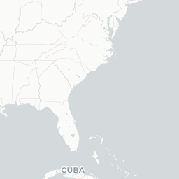
Route map (4 destinations)

Leaflet © OpenStreetMap © CARTO

Airlines serving this airport

Routes

MVY → ACK9K · CNA
MVY → BOS9K · CNA
MVY → EWB9K · CNA
MVY → HPN9K · CNA

Aircraft operating here

Hotels near MVY

Pick what matters for your layover or early flight, then compare on your favorite booking site.

Compare stays for your dates

TravelerPulse may receive compensation when you book or purchase through some of the links on this page, at no additional cost to you. Prices and availability are set by the booking provider and may change. We never share your private trip details with partners — only the destination, dates and party size you searched.

City & Place Guide

No guide exists for this place yet — Click to generate a Traveler Pulse guide.

Martha's Vineyard Airport
Encyclopaedia

Martha's Vineyard Airport is a public airport located in the middle of the island of Martha's Vineyard, 3 mi (4.8 km) south of the central business district of Vineyard Haven, in Dukes County, Massachusetts, United States. This airport is owned by Dukes County and lies on the border between the towns of West Tisbury and Edgartown.

Read full article on Wikipedia
About on Wikipedia

Martha's Vineyard Airport

Civilian airport in Dukes County, Massachusetts, United States

Martha's Vineyard Airport is a public airport located in the middle of the island of Martha's Vineyard, 3 mi (4.8 km) south of the central business district of Vineyard Haven, in Dukes County, Massachusetts, United States. This airport is owned by Dukes County and lies on the border between the…

Read on Wikipedia

Text from Wikipedia, licensed under CC BY-SA. May be out of date — verify important details.

My Social Pulse
Get the My Social Pulse app
Scan a QR and it's on your phone in seconds.