
12
Routes
6
Hubs
GLG
ICAO
2K
IATA
TravelerPulse profile
Connecting Ecuador and the Galápagos Islands.
Founded
1986
Headquarters
Quito, Ecuador
Aerolineas Galápagos, commonly known as Aerogal, was an Ecuadorian airline founded in 1986 and headquartered in Quito, Ecuador. It operated scheduled domestic and international services, with a particular focus on linking mainland Ecuador to the Galápagos Islands, a route of significant tourist and ecological importance.
In 2012, Aerogal was acquired by Avianca Holdings, the major Latin American airline group, and was subsequently integrated into the Avianca brand. The airline's operations were gradually absorbed and rebranded under the Avianca name, effectively ending Aerogal as an independent carrier.
During its independent years, Aerogal served key domestic destinations including Quito, Guayaquil, and the Galápagos, as well as select international routes to cities in Colombia and Peru. It played an important role in Ecuador's aviation landscape and in supporting tourism to the Galápagos Islands.
Hubs & network
Aerogal's primary hub was Mariscal Sucre International Airport in Quito, with secondary operations through José Joaquín de Olmedo International Airport in Guayaquil.
Fleet
Aerogal operated a fleet that included Airbus A319 and A320 aircraft during its later years of independent operation.
Notable facts
- ›Aerogal was founded in 1986 and became one of Ecuador's leading domestic carriers.
- ›The airline was a key operator of flights to the Galápagos Islands, supporting Ecuador's tourism industry.
- ›Avianca Holdings acquired Aerogal in 2012 and integrated it into the Avianca brand.
- ›Aerogal held IATA code 2K and ICAO code GLG before being absorbed by Avianca.
- ›The airline operated both domestic Ecuadorian routes and limited international services to neighboring countries.
This profile is provided for general information only. Contact details may be inaccurate or outdated — always verify with the airline's official website before acting on them.
Primary hubs
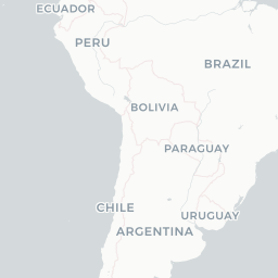
Route network map (12 legs)




Leaflet © OpenStreetMap © CARTO
Route network
BOG → GYE319
BOG → UIO319 320
CLO → GYE319
GYE → BOG319
GYE → CLO319
GYE → SCY319 320
GYE → UIO320 319
OCC → UIO319
SCY → GYE319 320
UIO → BOG319 320
UIO → GYE319
UIO → OCC319
Fleet (aircraft types operated)
Latest news
No recent news found.
