Routes out
2
Destinations
2
ICAO
WBGF
Elevation
1400 ft
The gateway in a glance
The Essence of Long Lellang Airport
LGL
Location
Long Datih · 13 · Malaysia
Connectivity
2 routes · 2 destinations
Position
3.421°, 115.154° · 1400 ft elev.
Visa & Entry
Visa-free entry (many countries), MDAC (Malaysia Digital Arrival Card)
AI Travel Editor
A closer look
Living guide content for Long Lellang Airport — read or listen in 46+ languages.
Language
TravelerPulse profile
Remote highland gateway serving interior Sarawak communities.
Location
Long Datih, Malaysia
Long Lellang Airport is a small rural airstrip located in the remote interior of Sarawak, Malaysian Borneo, serving the settlement of Long Datih and surrounding indigenous Kenyah communities in the Baram district. The airport plays a vital role in connecting isolated longhouse communities to the coast, as road access to the region is extremely limited or nonexistent.
The airport is served by small turboprop aircraft operated by MASwings, which provides essential air services linking the interior of Sarawak to larger towns such as Miri. These flights are critical for residents who depend on air travel for medical emergencies, commerce, and general transport.
The facility is a basic airstrip without significant terminal infrastructure, typical of the many rural air access points maintained across interior Sarawak to support remote indigenous populations.
Terminals
The airport has no formal terminal building, only basic minimal facilities consistent with a rural interior Sarawak airstrip.
Getting to & from
Ground transport options are extremely limited due to the remote location, with most residents relying on the airport itself as the primary means of access.
Airlines here
MASwings operates scheduled Twin Otter or ATR turboprop services connecting Long Lellang to Miri and other interior Sarawak destinations.
Notable facts
- ›Located in the Baram district of interior Sarawak, Malaysian Borneo.
- ›Serves predominantly Kenyah indigenous communities living in the surrounding rainforest.
- ›One of many small rural airstrips in Sarawak maintained to support remote populations.
- ›MASwings operates the route as part of the Rural Air Service subsidized by the Malaysian government.
- ›Road access to Long Lellang is extremely poor or absent, making the airport essential.
This profile is provided for general information only. Details may be inaccurate or outdated — always verify with the airport's official website before acting on them.
Route map (2 destinations)
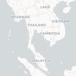






Leaflet © OpenStreetMap © CARTO
Airlines serving this airport
Routes
LGL → MURMH · DHT
LGL → MYYMH · DHT
Aircraft operating here
Hotels near LGL
Pick what matters for your layover or early flight, then compare on your favorite booking site.
Compare stays for your dates
TravelerPulse may receive compensation when you book or purchase through some of the links on this page, at no additional cost to you. Prices and availability are set by the booking provider and may change. We never share your private trip details with partners — only the destination, dates and party size you searched.
City & Place Guide
No guide exists for this place yet — Click to generate a Traveler Pulse guide.
Encyclopaedia
Latest news
mediaselangor.com· 9/8/2026
Family confirms death of doctor in a Long Lellang helicopter crash
Read at mediaselangor.com
Malay Mail· 9/8/2026
Flying Doctor Service helicopter carrying five crashes near Long Lellang airport
Read at Malay Mail
NST Online· 9/12/2026
Sarawak govt leaves heli crash probe to CAAM, says state minister
Read at NST Online
Bernama· 9/13/2026
Sarawak To Review Aviation Safety Needs After Long Lellang Helicopter Crash
Read at Bernama
The Mirror· 9/8/2026
Five feared dead after medical helicopter crashes at airport in Borneo
Read at The Mirror
Newswav· 9/8/2026
Helicopter tragedy: Family informed of Dr Ainul’s death by Health Ministry
Read at Newswav
