The Essence of Alberto Carnevalli Airport
A closer look
Living guide content for Alberto Carnevalli Airport — read or listen in 46+ languages.
Gateway to the Venezuelan Andes, high above sea level.
- ›Named after Alberto Carnevalli, a Venezuelan physician and anti-dictatorship politician from Mérida.
- ›Located at approximately 1,495 meters (4,905 feet) above sea level, making it one of Venezuela's higher-altitude airports.
- ›The surrounding Andes mountains create challenging approach and departure conditions for pilots.
- ›Mérida is also known for having the world's highest and longest cable car, a major tourist attraction near the city.
- ›The airport primarily serves domestic routes, with Caracas being the key connection.
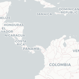
Route map (1 destinations)




Airlines serving this airport
Routes
Aircraft operating here
Pick what matters for your layover or early flight, then compare on your favorite booking site.
TravelerPulse may receive compensation when you book or purchase through some of the links on this page, at no additional cost to you. Prices and availability are set by the booking provider and may change. We never share your private trip details with partners — only the destination, dates and party size you searched.
City & Place Guide
No guide exists for this place yet — Click to generate a Traveler Pulse guide.
Passport, Visa & Immigration
Flying internationally via MRD? Check entry, transit and customs requirements for Venezuela from official government sources.

Alberto Carnevalli Airport is an airport located 3 km (1.9 mi) southwest of downtown Mérida, the capital of Mérida State in Venezuela. It is named in honor of Alberto Carnevalli, a Venezuelan lawyer and political activist.
Read full article on WikipediaLatest news
Alberto Carnevalli Airport
Alberto Carnevalli Airport is an airport located 3 km (1.9 mi) southwest of downtown Mérida, the capital of Mérida State in Venezuela. It is named in honor of Alberto Carnevalli, a Venezuelan lawyer and political activist.
Read on WikipediaText from Wikipedia, licensed under CC BY-SA. May be out of date — verify important details.
