1. Couldn't load AI content — try another language or refresh
Showing information forTownship of Orland·Cook County·Illinois·United States of Americaauto-detected
📱 Get the app
PEUsmall airport

Puerto Lempira Airport

Puerto Lempira, Honduras
Routes out
2
Destinations
2
ICAO
MHPL
Elevation
33 ft
The gateway in a glance

The Essence of Puerto Lempira Airport

PEU
Location
Puerto Lempira · GD · Honduras
Connectivity
2 routes · 2 destinations
Position
15.262°, -83.781° · 33 ft elev.
Visa & Entry
Official visa, passport and entry information for Honduras is published by its government,
AI Travel Editor

A closer look

Living guide content for Puerto Lempira Airport — read or listen in 46+ languages.

Language
TravelerPulse profile

Remote gateway serving Honduras's Mosquitia region.

Location
Puerto Lempira, Honduras
Puerto Lempira Airport (IATA: PEU, ICAO: MHPL) is a small regional airport serving Puerto Lempira, the capital of the Gracias a Dios Department in eastern Honduras. The airport provides a critical air link for one of the most geographically isolated regions in Central America, known as La Mosquitia, where road access is extremely limited. Given the lack of overland routes into the region, air travel is the primary means of reaching Puerto Lempira for most visitors and residents. The airport handles light aircraft and small turboprop operations, supporting both commercial and humanitarian flights serving the surrounding communities.
Terminals
The airport has a basic, single small terminal building suited to low-volume regional traffic.
Getting to & from
Ground transport within Puerto Lempira is limited to local taxis and informal vehicles, as the town has no significant road connections to the rest of Honduras.
Airlines here
Regional carriers such as Aerolíneas Sosa have historically operated routes connecting Puerto Lempira with Tegucigalpa and other Honduran cities.
Notable facts
  • ›Puerto Lempira is the administrative capital of Gracias a Dios, Honduras's largest and most sparsely populated department.
  • ›La Mosquitia is one of the most remote and biologically diverse regions in Central America, making air access essential.
  • ›The airport primarily handles small turboprop and light aircraft due to limited runway infrastructure.
  • ›Humanitarian and NGO flights play a significant role in airport operations given the region's isolation.
  • ›Road connections to the rest of Honduras are virtually nonexistent, making the airport vital for supplies and personnel.
This profile is provided for general information only. Details may be inaccurate or outdated — always verify with the airport's official website before acting on them.

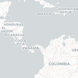
Route map (2 destinations)
Leaflet © OpenStreetMap © CARTO

Routes

PEU → TGUCC · SF3
PEU → LCEP4 · L4T

Aircraft operating here

Hotels near PEU

Pick what matters for your layover or early flight, then compare on your favorite booking site.

Compare stays for your dates

TravelerPulse may receive compensation when you book or purchase through some of the links on this page, at no additional cost to you. Prices and availability are set by the booking provider and may change. We never share your private trip details with partners — only the destination, dates and party size you searched.

City & Place Guide

No guide exists for this place yet — Click to generate a Traveler Pulse guide.

Puerto Lempira Airport
Encyclopaedia

Puerto Lempira Airport is an airport serving Puerto Lempira in Gracias a Dios Department, Honduras. It handles regional air traffic for the city. It is also a hub for general aviation and the Honduran Air Force.

Read full article on Wikipedia
About on Wikipedia

Puerto Lempira Airport

Airport

Puerto Lempira Airport is an airport serving Puerto Lempira in Gracias a Dios Department, Honduras. It handles regional air traffic for the city. It is also a hub for general aviation and the Honduran Air Force.

Read on Wikipedia

Text from Wikipedia, licensed under CC BY-SA. May be out of date — verify important details.

My Social Pulse
Get the My Social Pulse app
Scan a QR and it's on your phone in seconds.