Overview
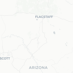
Grand Canyon is a small unincorporated community on the South Rim of Grand Canyon National Park in northern Arizona, sitting at roughly 6,900 feet (2,100 m) elevation. With a permanent population of around 1,400, it exists almost entirely to support one of the most visited national parks in the United States, which draws roughly 5–6 million visitors in a typical year.
The canyon itself stretches approximately 277 miles (446 km) along the Colorado River, reaches widths of up to 18 miles (29 km), and drops more than a mile (1,600 m) to the river below. Exposed rock layers span nearly two billion years of Earth's geological history, making it as scientifically significant as it is visually dramatic.
The South Rim — where most visitor infrastructure is concentrated — is open year-round. The more remote North Rim is generally accessible only from mid-May through mid-October, depending on snowfall. Services at Grand Canyon Village include lodging, restaurants, a visitor center, ranger programs, and shuttle systems, all managed primarily by the National Park Service (NPS) and its concessionaire partners.
Beyond sightseeing, the park offers serious hiking, mule trips, river rafting through the Inner Gorge, guided tours, and stargazing in one of North America's largest Dark Sky places.
Before You Go
Entry and Visas
Grand Canyon is located in the continental United States. Visa requirements depend entirely on your nationality and travel history. Check TravelerPulse's Visas section and the official U.S. Customs and Border Protection website (cbp.gov) for current requirements before booking.
Park Passes
Entrance to Grand Canyon National Park requires a fee, payable per vehicle, per motorcycle, or per individual arriving on foot or by bicycle. The America the Beautiful Annual Pass (Interagency Pass) covers entrance to all U.S. national parks and federal recreation areas for a single annual fee and is worth considering if you plan to visit multiple parks. Verify current fees at nps.gov/grca before your trip.
Reservations Are Essential
- Lodging inside the park books out months — sometimes more than a year — in advance, especially for summer and holiday periods. Reserve as early as possible through the official park concessionaire.
- Phantom Ranch (the only lodging at the canyon bottom) operates a lottery system; check the concessionaire's site for current booking procedures.
- Mule trips also require advance reservations.
- Rim-to-Rim hikers should research backcountry permit requirements through the NPS Backcountry Information Center well ahead of travel.
What to Pack
- Sunscreen, hat, and UV-protective clothing — sun exposure at the rim and in the canyon is intense
- More water than you think you need (at least 1 liter per hour while hiking in heat)
- Electrolyte supplements for any below-rim hiking
- Layers — temperatures at the rim can be 20°F (11°C) or more cooler than at the canyon floor, and evenings cool significantly
Getting There
By Air
The nearest major airport is Phoenix Sky Harbor International Airport (PHX), approximately 230 miles (370 km) south of the South Rim — roughly a 3.5–4 hour drive. Flagstaff Pulliam Airport (FLG), about 80 miles (130 km) south, has limited commercial service and is a closer option. Grand Canyon National Park Airport (GCN) in Tusayan (just south of the park entrance) serves small commuter flights and air tour operators; check current scheduled service as it changes.
By Car
Most visitors arrive by private vehicle. From Flagstaff, take US-180 north or US-89 north to AZ-64 west — both routes take roughly 1.5–2 hours. From Las Vegas, the drive is approximately 4–4.5 hours via US-93 south and AZ-93/US-89 east. Note that parking inside Grand Canyon Village is limited and congested in peak season; using the park's free shuttle system from parking areas is strongly recommended.
By Bus and Shuttle
Flagstaff's Amtrak station (on the Southwest Chief line) and Greyhound stop make it a practical gateway. Several private shuttle and tour operators run day trips and transfers between Flagstaff, Las Vegas, and the South Rim — verify current operators and schedules locally or through the NPS site.
By Train
Grand Canyon Railway operates a historic excursion train between Williams, Arizona and Grand Canyon Village. The journey takes roughly 2.25 hours each way. Williams itself is accessible by car from Flagstaff (about 35 miles/56 km west on I-40). Verify current schedules and fares at thetrain.com.
Getting Around
Free Shuttle Buses
The National Park Service operates a free shuttle system along several routes on the South Rim, including the Village Route, Kaibab Rim Route, and Hermit Road Route (Hermit Road is closed to private vehicles most of the year). Shuttles run frequently during peak hours; check the NPS app or posted schedules at stops for current times.
Walking and Cycling
The Rim Trail runs approximately 13 miles (21 km) along the South Rim and is mostly paved or hard-packed, making it accessible to a wide range of visitors. Bicycles are permitted on the Rim Trail and Greenway Trail system; rental bikes are available inside the park — verify availability and locations on-site or via the concessionaire's website.
Private Vehicles
Driving is practical for reaching trailheads and the Desert View area (the eastern section of the South Rim, about 25 miles from the Village), which is not served by the main shuttle routes. Fuel is available inside the park at the Desert View area and in Tusayan just outside the south entrance — prices are typically higher than in Flagstaff or Williams.
Tours
Guided bus tours, jeep tours, and helicopter/fixed-wing air tours operate from Tusayan and from Las Vegas. For the North Rim, no shuttle connection between the two rims is operated by the park itself — the Trans-Canyon Shuttle is a private service that runs seasonally; verify current availability before relying on it.
Where to Stay
Inside the Park
Several lodging options operate within Grand Canyon National Park on the South Rim, run by the park's primary concessionaire (currently Xanterra Travel Collection). These range from historic lodge rooms to basic motel-style units and include Bright Angel Lodge, El Tovar Hotel, Maswik Lodge, Thunderbird Lodge, and Yavapai Lodge, among others. Phantom Ranch, at the canyon bottom, is the only below-rim accommodation and is accessible only on foot or by mule. All in-park lodging should be booked as far in advance as possible — verify availability and current rates at the official concessionaire website.
Camping
Mather Campground (South Rim) accepts reservations through recreation.gov and is the largest campground in the park. Desert View Campground (seasonal) is first-come, first-served. Bright Angel Campground and Cottonwood Campground require backcountry permits for overnight stays. Verify all campground statuses and reservation requirements at nps.gov/grca before arrival.
Outside the Park
Tusayan, the small gateway community immediately south of the park entrance, has a cluster of hotels and motels — useful if in-park lodging is full. Flagstaff, about 80 miles south, offers a broader range of accommodation at generally lower prices and is a practical base for a multi-day visit.
Things to See & Do
Rim Viewing
Simply standing at the rim and taking in the scale of the canyon is, for many visitors, the central experience. Key viewpoints on the South Rim include Mather Point (near the Visitor Center and one of the busiest), Yavapai Geology Museum overlook, Hopi Point (renowned for sunsets), and Desert View Watchtower at the east end — a historic stone structure designed by architect Mary Colter in 1932.
Day Hiking
- Bright Angel Trail: The most popular below-rim trail, starting at the South Rim and descending to Indian Garden (now known as Havasupai Gardens) and eventually the Colorado River. Even a short walk down 1–2 miles reveals dramatically different terrain and temperatures. Hiking to the river and back in a single day is strongly discouraged by the NPS.
- South Kaibab Trail: Steeper, more exposed, with sweeping ridge views. Ooh Aah Point (0.9 miles/1.4 km round trip) and Cedar Ridge (3 miles/4.8 km round trip) are manageable day turnaround points.
- Rim Trail: Flat to gently rolling, connecting the main visitor areas along the rim. Suitable for all fitness levels.
Multi-Day and Backcountry Hiking
Rim-to-Rim hiking — typically South Kaibab Trail down, then Bright Angel Trail up from the North Rim, or vice versa — is one of the great American hiking experiences. It requires backcountry permits, solid fitness, and careful planning around water and heat. The NPS Backcountry Information Center issues permits; demand is high and a lottery system applies for popular corridors in peak season.
Colorado River Rafting
Whitewater rafting through the Grand Canyon is a bucket-list experience for many — full canyon trips run 15–21 days, while partial trips entering or exiting at Phantom Ranch are shorter. Licensed outfitters handle all logistics; permits for private river trips are issued by lottery years in advance. Verify current licensed operators through the NPS website.
Ranger Programs and Stargazing
The NPS runs free ranger-led talks, guided rim walks, and evening programs throughout the year — schedules are posted at visitor centers and on the NPS app. Grand Canyon is designated an International Dark Sky Park, and ranger-led astronomy programs are offered periodically; verify current schedule on-site.
North Rim
The North Rim sits about 1,000 feet (300 m) higher than the South Rim and receives far fewer visitors. Its single lodge, campground, and fewer developed trails give it a quieter, more remote character. It is accessible by car from Jacob Lake, Arizona, and is generally open mid-May through mid-October.
Food & Drink
Inside the Park
Dining inside Grand Canyon National Park ranges from sit-down restaurants to cafeterias and delis. El Tovar Dining Room, inside the historic El Tovar Hotel on the South Rim, is the park's most formal restaurant and typically requires reservations — verify current reservation procedures through the concessionaire. Bright Angel Restaurant, Arizona Room (seasonal), and Maswik Food Court offer more casual options. A deli and market at the Canyon Village Market & Deli can supply groceries, snacks, and picnic supplies.
Expect prices inside the park to reflect the remote location and captive audience — meals are noticeably more expensive than equivalents in Flagstaff or Williams. All food service operators and hours are managed by the concessionaire; verify current hours and availability, as operations can change seasonally.
Tusayan and Beyond
Tusayan has a small number of restaurants, fast food options, and a general store. For a wider selection at more typical prices, Flagstaff is the practical choice — it has a full range of dining, including several well-regarded independent restaurants, breweries, and cafes.
Practical Information
Connectivity
Cell service inside the park is unreliable and often absent below the rim. Download offline maps and the NPS Grand Canyon app before arrival. Wi-Fi is available at some lodge lobbies — verify locally.
Water
Drinking water is available at multiple filling stations along the South Rim and at certain points below the rim (Havasupai Gardens/Indian Garden, Bright Angel Campground, Bright Angel Creek). Water sources below the rim require treatment or purification unless from a designated tap. Carry more than you think you'll need for any below-rim activity.
Altitude
The South Rim sits at approximately 6,860 feet (2,090 m). Visitors coming from sea level may notice the effects of altitude — mild shortness of breath or fatigue — particularly when combined with hiking. Allow a day to acclimatize if possible before strenuous activity.
Accessibility
The Rim Trail between Mather Point and Bright Angel Trailhead is paved and accessible for wheelchairs and strollers. Many rim viewpoints are accessible. Below-rim trails are steep, unpaved, and not accessible. The NPS accessibility page (nps.gov/grca/planyourvisit/accessibility.htm) has detailed current information — verify before travel.
Emergency Services
The park has a clinic at the South Rim. For serious emergencies, evacuation to a hospital in Flagstaff may be required. The general U.S. emergency number is 911. Cell service for calling 911 is not reliable throughout the park — inform a ranger or fellow hiker if you encounter an emergency below the rim.
Safety
Heat and Dehydration
Heat-related illness is the leading cause of medical emergencies in the Grand Canyon. Canyon temperatures can exceed 110°F (43°C) in summer, and the hike back to the rim is always uphill. The NPS advises against hiking below the rim during midday hours in summer (roughly 10 a.m.–4 p.m.) and recommends drinking water consistently — not just when thirsty — along with salty snacks to maintain electrolyte balance.
Trail Conditions and Overconfidence
The Grand Canyon reverses the typical mountain hiking experience: going down is easy and deceptively fast; coming back up is strenuous and time-consuming. Many rescues involve visitors who underestimated the return trip. Turn around before you feel tired, and always reserve enough water, food, and energy for the return.
Wildlife
California condors are frequently seen along the South Rim — do not feed or approach them. Rock squirrels at rim viewpoints are habituated to humans and can bite; do not feed any wildlife. Rattlesnakes are present below the rim; watch where you place hands and feet on rocky trails. Mountain lions are present in the park but encounters are very rare.
Flash Floods
Side canyons and the inner gorge are susceptible to flash floods, which can occur with no local warning if storms are happening many miles away. If you hear a roaring sound or see rapidly rising, muddy water, move immediately to higher ground. Check weather forecasts and be aware of conditions both locally and upstream before entering side canyons.