Translate


Overview
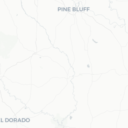
Mountain Pine is a small incorporated town in Garland County, Arkansas, with a population of roughly 780 people. It sits in the Ouachita Mountains region, close to the confluence of some of Arkansas's most prized natural assets: Lake Ouachita to the west and the sprawling Ouachita National Forest surrounding it on multiple sides.
The town itself is quiet and residential, with few commercial amenities, but its geographic position makes it a practical and low-key staging point for visitors drawn to outdoor recreation. Travelers who prefer to avoid the more developed resort atmosphere of nearby Hot Springs will find Mountain Pine an unpretentious alternative.
Historically, the area's economy was tied to the timber industry, and the Ouachita National Forest — the oldest national forest in the South — reflects that legacy in its managed pine and hardwood stands. Today, tourism oriented around the lake and forest is a secondary economic thread for the surrounding region.
Getting There
Mountain Pine does not have its own airport or intercity transit hub. The most practical entry point is Hot Springs Memorial Field Airport (HOT) in Hot Springs, approximately 15–20 miles to the east, though it offers limited commercial service. Bill and Hillary Clinton National Airport (LIT) in Little Rock, roughly 65 miles to the east, is the nearest airport with reliable commercial connections and major car rental agencies.
A personal vehicle or rental car is essential. From Little Rock, take US-70 or I-30 west and then connect via US-270 west toward Hot Springs and onward toward Mountain Pine. Verify current road conditions locally, particularly after heavy rain in the Ouachita Mountains.
There is no scheduled intercity bus or rail service to Mountain Pine.
Getting Around
A personal vehicle is the only practical means of getting around Mountain Pine and the surrounding area. The town is small enough to walk end-to-end, but accessing Lake Ouachita, trailheads, and recreation areas requires driving.
Road signage for forest roads and boat launches can be inconsistent. Download offline maps before arriving, as cellular coverage can be spotty in the more remote sections of the Ouachita National Forest. Fuel up in Mountain Pine or Hot Springs before heading into the backcountry.
Where to Stay
Lodging options within Mountain Pine itself are minimal. Most visitors stay at campgrounds, cabins, or resorts along Lake Ouachita, or in Hot Springs where hotel inventory is considerably larger.
Camping
The U.S. Army Corps of Engineers operates several campgrounds around Lake Ouachita. The U.S. Forest Service also manages campgrounds within the Ouachita National Forest. Availability, fees, and reservation procedures should be confirmed directly with the respective agency or via Recreation.gov.
Cabins and Vacation Rentals
Private cabin rentals around Lake Ouachita are available through various vacation rental platforms. Availability varies by season; spring and summer weekends book up quickly. Verify cancellation policies before booking.
Hot Springs
For travelers who prefer hotel amenities, Hot Springs offers the nearest substantial hotel inventory, including national chain properties and historic bed-and-breakfast options along its resort corridor.
Things to See & Do
The primary draw for visitors is the natural environment surrounding Mountain Pine.
Lake Ouachita
Lake Ouachita is one of the clearest lakes in the United States and among the largest man-made lakes in Arkansas. It offers boating, fishing (bass, crappie, catfish, and striped bass are common), kayaking, swimming, and scuba diving. Several public access points and marinas serve the lake; verify current operating status and fees locally or via the U.S. Army Corps of Engineers, which manages the lake.
Ouachita National Forest
The forest surrounding Mountain Pine provides hiking, mountain biking, camping, and wildlife observation. The Ouachita National Recreation Trail passes through the region and extends for over 200 miles; day-hike segments are accessible near the town. Contact the U.S. Forest Service's Ouachita National Forest office for current trail conditions and permit requirements.
Hunting and Wildlife Viewing
The Ouachita Mountains support white-tailed deer, wild turkey, migratory songbirds, and occasionally black bear. Hunting seasons and regulations are set by the Arkansas Game and Fish Commission — verify current rules before planning a hunt.
Stargazing
Light pollution is minimal in this part of the Ouachita Mountains, making clear nights genuinely rewarding for amateur astronomers.
Food & Drink
Mountain Pine has very limited dining options within the town itself. Travelers should not plan to rely on a range of local restaurants. Most visitors stock up on groceries or eat meals before arriving, or drive to nearby Hot Springs for a broader selection.
Hot Springs, approximately 15–20 miles east, has a well-developed dining scene ranging from casual diners to more formal restaurants along Central Avenue. Verify current restaurant hours and availability locally, as smaller establishments in rural Arkansas can keep irregular hours or close seasonally.
If camping or staying at a lake cabin, self-catering is a realistic and common approach.
Practical Information
- Cellular service: Coverage can be weak to nonexistent in parts of the Ouachita National Forest and around the lake's more remote coves. Download offline maps and inform someone of your itinerary before backcountry trips.
- Weather: Summer temperatures regularly exceed 90°F (32°C) with high humidity. Winters are mild but can bring ice storms. Spring and fall are generally the most comfortable seasons.
- Water: Tap water in Mountain Pine is municipally supplied. Carry sufficient water when hiking or boating, especially in summer.
- Emergency services: Garland County has sheriff and emergency services. For life-threatening emergencies, dial 911. The nearest hospital facilities with significant capacity are in Hot Springs — verify specific locations and hours with local sources.
- Fuel and supplies: Basic fuel and convenience supplies are available in Mountain Pine. For a broader grocery selection, plan a stop in Hot Springs.
- Visitors with mobility needs: The town and many outdoor areas have limited accessibility infrastructure. Contact the U.S. Forest Service or Army Corps of Engineers for information on accessible recreation facilities.
Safety
Mountain Pine is a quiet, low-crime rural community. Standard common-sense precautions apply.
Outdoor safety is the more relevant concern for most visitors. When hiking or boating in the Ouachita Mountains and Lake Ouachita area, be aware of changing weather, particularly afternoon thunderstorms in summer. Flash flooding can occur in creek drainages after heavy rain. Ticks and chiggers are common in brushy and forested areas — use appropriate repellent and check for ticks after outdoor activity. Copperhead and timber rattlesnake encounters are possible; watch where you step on rocky trails.
Boaters on Lake Ouachita should carry required safety equipment and file a float plan with someone onshore. Water conditions can change with boat traffic and weather.