Overview
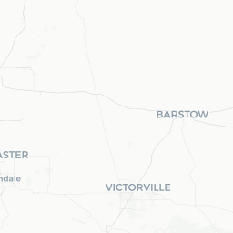
Anza is a small, unincorporated community in Riverside County, California, sitting at roughly 4,000 feet elevation in the Cahuilla Valley between the Santa Rosa and San Jacinto Mountains. With a population of just over 3,000, it functions as a quiet, working ranching town rather than a tourist destination in the conventional sense — which is precisely its appeal for travelers looking for open space, silence, and genuine high-desert character.
The area takes its name from Juan Bautista de Anza, the Spanish explorer whose 1774 and 1775–76 expeditions passed through this valley en route from Sonora, Mexico to San Francisco. That heritage is commemorated by the Juan Bautista de Anza National Historic Trail, which threads through the region. The surrounding landscape shifts dramatically within short distances — chaparral-covered slopes, meadows grazed by cattle, and the stark boulder fields that descend toward the Anza-Borrego Desert below.
Anza is not a place of polished visitor infrastructure. Services are limited, and that reality should be factored into any trip plan. Those who come prepared, however, find it a genuinely rewarding gateway to some of Southern California's least-crowded backcountry.
Before You Go
Visas
Anza is located in the United States. For visa requirements, check TravelerPulse's Visas section and the official U.S. Customs and Border Protection website for guidance specific to your nationality.
What to Pack
- Temperatures vary widely with elevation. Even in summer, evenings can drop significantly; layering is essential year-round.
- In winter, snow and ice are possible on the mountain roads leading into town — carry chains or drive an appropriate vehicle and check Caltrans road conditions before traveling.
- Fuel up before arriving. Gas stations in Anza are limited; verify current availability locally.
- Cell service is inconsistent throughout the valley. Download offline maps before you go.
- Bring sufficient water, especially if you plan to hike. The dry air at altitude is deceptively dehydrating.
Seasonal Notes
Spring wildflower season (typically March–April) can be spectacular in the valley and on the descent toward Anza-Borrego, though bloom intensity varies year to year. Summer days are warm but rarely as extreme as lower desert elevations. Winter brings occasional snow that makes the landscape striking but can affect road access.
Getting There
Anza sits roughly 30 miles southeast of Hemet and about 85 miles southeast of central Los Angeles. The primary road access is via Highway 74 (the Palms to Pines Scenic Byway), which connects Hemet to the west and drops down to Palm Desert to the east — the eastern descent is steep and winding. Highway 371 provides another approach from the Temecula/Aguanga direction to the southwest.
The nearest commercial airports with meaningful service are Palm Springs International Airport (approximately 50 miles northeast) and San Diego International Airport (roughly 85 miles southwest). Both require a car for the final leg; there is no public transit serving Anza directly. Renting a vehicle is effectively mandatory for visiting this area.
Highway 74 east of Anza is a designated scenic byway and is worth driving slowly. Be aware that GPS routing through this region can occasionally suggest unpaved or poorly maintained roads; stick to named state highways and verify your route before departure.
Getting Around
A personal vehicle is the only practical way to get around Anza and its surrounding area. There is no local bus service or rideshare coverage to rely on. Roads within the valley are largely paved but can be rough, and some points of interest require short stretches of unpaved track — a standard passenger car handles most of the area, but higher clearance is useful for backcountry access.
Fuel and basic supplies are available in town, but verify availability when you arrive, as a small community's services can change. For longer excursions into adjacent wilderness areas or down into Anza-Borrego, plan fuel and water needs carefully before departing.
Where to Stay
Formal hotel accommodation within Anza itself is minimal to nonexistent at the level of branded properties. Travelers typically rely on vacation rental platforms (search for properties in the Anza or Cahuilla Valley area) or camping. The surrounding public lands — including BLM parcels and adjacent state and national monument land — offer dispersed camping opportunities; confirm regulations and any permit requirements with the relevant land management agency before camping.
For those who prefer conventional lodging, Hemet (to the west) and Palm Desert or Palm Springs (to the east) provide a full range of hotels and motels and work as a base for day trips into the Anza area. Temecula to the southwest is another option with broad accommodation choices.
If a rural rental property or bed-and-breakfast in the valley appeals, verify listings and recent reviews carefully, as availability and quality in small rural communities can vary considerably.
Things to See & Do
Juan Bautista de Anza National Historic Trail
The trail commemorates the 1,200-mile route de Anza's 1775–76 colonizing expedition traveled. Portions of the trail pass through the Cahuilla Valley, and interpretive markers provide historical context. The National Park Service manages the trail; verify current trail access and conditions at nps.gov/juba before visiting.
Anza-Borrego Desert State Park (Nearby)
The eastern descent on Highway 74 leads directly toward Anza-Borrego Desert State Park, California's largest state park. The upper reaches are accessible as a day trip from Anza and offer a striking transition from high-chaparral to open desert. Wildflower season draws significant visitors to the park; plan accordingly.
Dark Sky Stargazing
Anza's elevation, low population density, and distance from major urban light pollution make it a legitimate destination for amateur astronomy. The Cahuilla Valley Astronomy Club has historically hosted public star parties in the area; verify current schedules locally. At minimum, the night sky on a clear, moonless night here is notably impressive compared to the Southern California coast.
Palms to Pines Scenic Byway
Highway 74 between Hemet and Palm Desert is one of California's recognized scenic byways. Driving the full route — or just the section through and east of Anza — offers sweeping views across the desert floor and the Santa Rosa Mountains. Allow extra time and stop at pullouts; the views from the eastern grades are particularly dramatic.
Hiking and Equestrian Use
The Santa Rosa and San Jacinto Mountains National Monument surrounds much of the area. Trails in the monument range from gentle valley walks to strenuous mountain routes. Trail conditions and access points should be verified with the Bureau of Land Management (BLM) office responsible for the monument before heading out.
Food & Drink
Dining options in Anza are very limited. The community has a small number of local establishments — a general store, a tavern, and occasional small eateries — but hours and availability shift, and travelers should not assume any specific business is open without verifying locally or calling ahead.
The practical approach is to stock up on groceries and supplies in Hemet or Temecula before arriving, particularly if you plan to stay overnight. Both towns have full supermarkets and a wide range of restaurants. If you're based in Anza for a day or two of hiking and stargazing, self-catering is the most reliable strategy.
The nearby town of Aguanga (along Highway 371) and the communities along Highway 74 toward Hemet add a few more options, but this remains genuinely rural territory. Adjust expectations accordingly and treat any open local establishment as a welcome find rather than a given.
Practical Information
Emergency Services
For emergencies in the United States, dial 911. The nearest hospitals with emergency departments are in Hemet and the Palm Springs/Coachella Valley area. Given the rural location, response times for emergency services can be longer than in urban settings — factor this into any outdoor activity risk assessment.
Connectivity
Cell coverage in Anza is inconsistent across carriers. Download offline maps (Google Maps, Maps.me, or similar) before arriving. If you plan to hike in remote areas, consider carrying a satellite communicator device.
Supplies
Buy fuel, food, water, and any medications or specialized gear before arriving. Anza has basic services but limited commercial infrastructure. ATM availability should be verified locally.
Respect for Private Land
Much of the valley is privately held ranch land. Stay on public roads and designated trails unless you have explicit permission from landowners. Unmarked tracks crossing private property are common in the area and easy to mistake for public access routes.
Safety
Anza is a low-crime rural community. The primary safety considerations here are environmental rather than social.
Weather and temperature: The elevation means conditions change quickly. Afternoon thunderstorms occur in late summer. Winter roads can ice over, particularly at night. Check weather forecasts and Caltrans road conditions (verify current URL at dot.ca.gov) before travel.
Wildlife: Mountain lions, rattlesnakes, and black bears are present in the surrounding mountains and desert transition zone. Standard precautions — making noise on trails, keeping food secured while camping, watching where you step — are appropriate.
Dehydration and sun exposure: The dry air at elevation reduces perceived heat stress while accelerating fluid loss. Drink water consistently, even when you don't feel thirsty.
Remote hiking: If hiking in the Santa Rosa and San Jacinto Mountains or descending toward Anza-Borrego, tell someone your itinerary and expected return time. Trails can be unmarked and cell service unreliable.