Translate
Overview
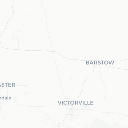
Barstow Heights is a census-designated and incorporated community in San Bernardino County, California, situated in the Mojave Desert just northeast of the city of Barstow. With a population of roughly 24,000, it functions largely as a residential area rather than a standalone tourist destination, though its location makes it a convenient base for exploring the wider high-desert region.
The community sits at an elevation that brings classic Mojave characteristics: wide-open skies, dramatic temperature swings between day and night, sparse desert vegetation, and distant mountain views. Visitors passing through on Interstate 15 or Historic Route 66 will find Barstow Heights woven into the fabric of this iconic desert corridor.
For most travelers, Barstow Heights is best understood in the context of its neighbors — the city of Barstow and the surrounding public lands. That said, the community itself reflects everyday life in California's high desert, and spending time here offers an unvarnished look at the region beyond its tourist highlights.
Before You Go
Climate and Packing
The Mojave Desert climate means very hot summers (temperatures regularly exceeding 100°F / 38°C) and cold winters, with occasional freezing nights. Spring and fall offer the most comfortable conditions. Year-round, the desert sun is intense — pack sunscreen, sunglasses, a hat, and layers for cool evenings even in warmer months.
Water and Supplies
Always carry more water than you think you need, especially if planning any outdoor activity. Services in and around Barstow Heights are more limited than in a major city, so stock up on supplies before heading into the backcountry.
Visas
Barstow Heights is located in the United States. For entry requirements, check TravelerPulse's Visas section and consult the U.S. Customs and Border Protection official website to confirm what applies to your nationality and travel situation.
Connectivity
Cell coverage in the immediate Barstow area is generally available from major US carriers, but signal can drop quickly in surrounding desert and canyon areas. Download offline maps before arriving.
Getting There
By Car
Barstow Heights is most easily reached by car. Interstate 15 connects the area to Los Angeles (approximately 120 miles southwest) and Las Vegas (approximately 155 miles northeast), making it a common stopping point on that heavily traveled corridor. Interstate 40 also intersects near Barstow, offering access from the east.
By Bus
Greyhound and Flixbus serve the Barstow area with stops connecting to Los Angeles and Las Vegas. Verify current schedules and stops directly with carriers, as desert route timetables can change.
By Train
Amtrak's Southwest Chief line stops at Barstow Station, linking the area to Los Angeles and cities across the southwestern and midwestern United States. Confirm current schedules on the Amtrak website before traveling.
By Air
The nearest commercial airports are Hollywood Burbank Airport and Ontario International Airport, both roughly 75–90 miles away. Los Angeles International Airport (LAX) is approximately 120 miles distant. Car rental upon arrival is strongly recommended for the final leg.
Getting Around
A personal vehicle is essentially required to get around Barstow Heights and the surrounding desert region. The community is spread out and pedestrian infrastructure is limited. Ride-share availability (Uber, Lyft) exists in the broader Barstow area but can be inconsistent — verify availability before relying on it.
For exploring nearby attractions such as the Calico Mountains, Mojave Road, or Rainbow Basin, a vehicle with reasonable ground clearance is advisable. Some backcountry roads require a high-clearance 4WD vehicle; check conditions with the Bureau of Land Management (BLM) before setting out.
Things to See & Do
Calico Ghost Town
Located just a few miles from Barstow Heights, Calico is a preserved silver-mining town from the 1880s, now operated as a San Bernardino County Regional Park. It offers historic buildings, mine tours, and a window into 19th-century desert life. Verify current admission fees and hours on the park's official site before visiting.
Rainbow Basin Natural Area
A BLM-managed site north of Barstow featuring colorful, layered geological formations and fossil-rich badlands. A short loop road winds through the canyon. It's best visited in cooler months and requires a vehicle.
Mojave Road
A historic desert trail following an old Native American and wagon route across the Mojave. Accessible sections near Barstow attract off-road enthusiasts and desert history buffs. A high-clearance 4WD vehicle is needed for much of the route.
Route 66 Heritage
Barstow and its surroundings preserve remnants of Historic Route 66, including signage, old motels, and roadside Americana. The Route 66 Mother Road Museum in central Barstow is a worthwhile stop for context on the highway's history.
Dark Sky Viewing
The low light pollution of the Mojave Desert makes Barstow Heights and surrounding areas excellent for stargazing. Nights away from main road lighting can yield outstanding views of the Milky Way with no equipment required.
Food & Drink
Dining options in Barstow Heights itself are limited, with most restaurants concentrated in the adjacent city of Barstow along Main Street and the Interstate 15 corridor. Expect a mix of national fast-food chains, diners, and a handful of locally owned Mexican and American restaurants.
Barstow's position as a major highway rest stop means that practical, filling meals are easy to find, though fine dining is not a feature of the area. If you have specific dietary requirements or preferences, it is worth stocking up at a grocery store before arriving, as choices narrow considerably outside the main commercial strips.
Alcohol is available at licensed restaurants and grocery stores. The legal drinking age in California is 21. Always carry water, particularly if you plan to be outdoors — dehydration in the desert is a genuine risk.
Practical Information
Emergency Services
For emergencies in the United States, dial 911. The nearest hospital with full emergency services is in Barstow — verify the current facility name and address locally or via Google Maps before your visit, as healthcare infrastructure in smaller desert communities can change.
Money
ATMs are available in the Barstow area. Major credit cards are accepted at most businesses. Cash can be useful for smaller vendors or roadside stops in rural areas.
Fuel
If you are continuing into the desert or toward Nevada, fill up in Barstow. Gas stations become sparse quickly outside of town, and prices can be higher at isolated stations.
Internet and Phone
Major carrier coverage (AT&T, Verizon, T-Mobile) is generally available in the Barstow Heights and Barstow area. Desert areas beyond the main roads may have no signal. Free Wi-Fi is available at some fast-food chains and the public library in Barstow.
Time Zone
Barstow Heights observes Pacific Time (PT). California observes Daylight Saving Time, so UTC offsets shift seasonally — verify current offset when planning.
Safety
Barstow Heights is a quiet residential community and does not present unusual safety concerns for travelers. Standard precautions apply: secure your belongings, do not leave valuables visible in parked vehicles, and be aware of your surroundings.
The primary safety considerations in this region are environmental. Desert heat is a serious hazard, particularly from May through September. Always carry ample water (the general guidance for desert hiking is at least one liter per hour of activity), inform someone of your plans if venturing off main roads, and avoid strenuous outdoor activity during peak afternoon heat.
For desert drives, keep your fuel tank well above empty and carry a basic emergency kit including water, a first-aid kit, and a charged phone or satellite communicator if going into remote areas. Flash floods, while less common, can occur in desert canyons during monsoon season (typically July–September); check weather forecasts before heading into low-lying canyon areas.