Overview
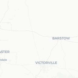
Palmdale sits in the Antelope Valley at the western edge of the Mojave Desert, roughly 60 miles north of downtown Los Angeles via the Antelope Valley Freeway (CA-14). At just under 160,000 residents, it is one of the larger cities in Los Angeles County by area, yet it retains a distinctly suburban and semi-rural character compared with the dense urban core to the south.
The city's identity is closely tied to aerospace. Lockheed Martin's famous Skunk Works facility has called the area home for decades, and the corridor along CA-14 hosts a cluster of defense and aviation contractors. That heritage shapes local pride and gives Palmdale a working-class, industry-focused personality uncommon among Southern California cities of similar size.
For visitors, the main draw is the natural landscape. The surrounding high desert produces some of California's most spectacular wildflower displays in good rain years, and the city serves as a practical gateway to the Antelope Valley California Poppy Reserve, Joshua Tree areas to the east, and Angeles National Forest to the south.
Before You Go
Visas & Entry
Palmdale is a domestic U.S. destination. International travelers entering the United States should review entry requirements through the official U.S. Customs and Border Protection website and check TravelerPulse's Visas section for general guidance — requirements vary significantly by nationality.
Climate
Palmdale sits at roughly 2,660 feet elevation, which moderates summer heat compared with the low desert, but temperatures still regularly exceed 100 °F (38 °C) in July and August. Winters are noticeably cooler than coastal Los Angeles and occasional light snowfall is possible. Spring (March–May) and fall (September–November) offer the most comfortable conditions for outdoor activity.
What to Pack
- Sun protection (sunscreen, hat, sunglasses) year-round
- Layers for spring and fall — desert nights turn cold quickly
- Sturdy walking shoes if you plan to visit poppy fields or trail areas
- Water bottles; hydration is critical in the high desert
Health & Utilities
Tap water is safe to drink. There are hospitals and urgent-care clinics in the city; verify current locations and hours locally before you travel.
Getting There
By Car
The most common way to reach Palmdale is via California State Route 14 (Antelope Valley Freeway) from the Los Angeles basin — typically a 60–90 minute drive depending on traffic. Interstate 5 via Newhall Pass is an alternative southern approach. A car is strongly recommended for exploring the region once you arrive.
By Train (Metrolink)
Metrolink's Antelope Valley Line connects Los Angeles Union Station to Palmdale and Lancaster stations, making a car-free arrival possible. The journey takes roughly 90 minutes depending on the service. Schedules and fares should be verified at the official Metrolink website, as they change seasonally.
Nearest Major Airports
- Los Angeles International Airport (LAX) — approximately 75–90 miles south; the most flight-connected option
- Hollywood Burbank Airport (BUR) — roughly 50 miles south via CA-14; often more convenient for visitors coming from the east or from airlines serving Burbank
- Palmdale Regional Airport (PMD) — serves limited commercial and charter flights; verify current airline service before booking
Getting Around
Palmdale is a spread-out suburban city and a personal vehicle is by far the most practical way to get around. The street grid is wide, distances between attractions are significant, and most points of interest are not walkable from one another.
Antelope Valley Transit Authority (AVTA) operates local bus routes connecting Palmdale with neighboring Lancaster and some surrounding communities. Schedules and route maps are available on the AVTA website; verify current information before relying on transit. Ride-hailing services operate in the area but coverage can be inconsistent outside of commercial corridors.
For day trips into Angeles National Forest or out to the poppy reserve, a reliable car with a full tank of gas is essential — gas stations thin out quickly once you leave the main city corridors.
Things to See & Do
Antelope Valley California Poppy Reserve
The reserve, managed by California State Parks, is the signature natural attraction for the region. In years of adequate winter rainfall (typically March–April), the hillsides turn vivid orange with California's state flower. Bloom intensity varies year to year — check California State Parks' poppy hotline or social media before making the trip. The reserve is located a short drive west of Palmdale near Lancaster.
Air Force Flight Test Museum (Edwards AFB)
Edwards Air Force Base, roughly 25 miles northeast of Palmdale, houses one of the country's premier aviation museums tracing the history of experimental flight and test pilots. Access to the base requires advance coordination; confirm visitor procedures and hours directly with the museum before visiting, as base access rules can change.
Saddleback Butte State Park
This state park east of Palmdale preserves a rare example of undisturbed Mojave Desert habitat, including Joshua trees and a prominent granite butte. Hiking trails are relatively short but rewarding, particularly for desert flora and fauna.
Apollo Community Regional Park
Palmdale's largest municipal park includes sports fields, a lake, trails, and picnic areas — a good option for families or a relaxing afternoon. Verify current amenities and operating hours with Los Angeles County Parks.
DryTown Water Park
A seasonal water park located in Palmdale, popular with local families during summer months. Hours and operating season should be confirmed on the park's official website before planning a visit.
Food & Drink
Palmdale's dining scene reflects its working-class, multicultural suburban character. You'll find a solid range of Mexican and Latin American restaurants — taquerias in particular are plentiful and reliably good — along with the full range of American chain restaurants concentrated around the Antelope Valley Mall corridor and Rancho Vista Boulevard.
Independent restaurants serving Filipino, Chinese, and Middle Eastern cuisines are present throughout the city, reflecting the diversity of the local population. For the most current and highly regarded local spots, checking recent reviews on Yelp or Google Maps is the most reliable approach, as independent restaurant turnover in suburban cities can be significant.
There are no notable craft breweries or wine bars that have achieved regional recognition at the time of writing, though the broader Antelope Valley has seen gradual growth in small food and beverage businesses. Visitors looking for a more developed dining or nightlife scene should plan an evening in Los Angeles.
Practical Information
Emergency Services
In any emergency in the United States, dial 911 for police, fire, or medical services.
Connectivity
Cellular coverage from major U.S. carriers (Verizon, AT&T, T-Mobile) is generally reliable in the city center and along main roads. Coverage may weaken on desert trails and in the hills surrounding the valley.
Money
ATMs are widely available at banks and supermarkets. Credit and debit cards are accepted at virtually all established businesses. Some smaller taquerias and food vendors may be cash-preferred; carry a modest amount of cash.
Useful Contacts
- City of Palmdale official site: palmdalecity.gov (verify URL before use)
- California State Parks (poppy reserve info): parks.ca.gov
- Metrolink: metrolinktrains.com
- AVTA: avta.com
Safety
Palmdale is a typical large California suburban city. Most visitor-facing areas around the mall, major parks, and commercial corridors are safe and unremarkable from a security standpoint. As with any city, exercise standard awareness after dark, keep valuables out of sight in parked vehicles, and stay on marked trails when hiking.
Heat safety is a genuine concern from June through September. Carry more water than you think you need on any outdoor excursion, wear sun protection, and avoid hiking during the hottest midday hours in summer. The high desert can also experience rapid temperature drops after sunset year-round — carry a layer even on warm days.
If you venture into Angeles National Forest or remote desert areas, inform someone of your plans and carry a physical map; cell service is unreliable in canyons and backcountry zones.