Translate
Overview
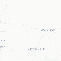
Rosedale is a small, unincorporated community of roughly 14,000 residents situated on the northwest fringe of Bakersfield in Kern County, California. It sits in the southern San Joaquin Valley at an elevation just above sea level, surrounded by flat agricultural land and suburban development that has grown steadily outward from Bakersfield proper.
The community is largely residential and does not have a traditional downtown core or major tourist attractions of its own. Most visitors pass through Rosedale as part of a broader Bakersfield trip, using it as affordable, quieter accommodation or as a convenient stop when traveling along Highway 99 or the roads leading toward the Sierra Nevada foothills.
The surrounding valley landscape—cotton fields, almond and pistachio orchards, and oil infrastructure—gives Rosedale an unmistakably Central California character. Sunsets over the flat terrain can be striking, and the community offers a genuine glimpse of everyday life in one of California's most productive agricultural regions.
Before You Go
Visas and Entry
Rosedale is located in the United States. Entry requirements depend on your nationality. For accurate, up-to-date visa information, check the TravelerPulse Visas section and the official U.S. Customs and Border Protection website.
Climate
Rosedale shares the San Joaquin Valley's semi-arid climate: summers are long and intensely hot, with daytime highs frequently exceeding 100°F (38°C) from June through September. Winters are mild but foggy—the region's notorious Tule fog can reduce visibility to near zero on winter mornings and affect driving safety significantly. Spring and autumn offer the most pleasant conditions for outdoor activity.
Air Quality
Kern County regularly experiences poor air quality, especially in summer, due to valley inversions and agricultural and industrial activity. Travelers with respiratory conditions should monitor the AirNow.gov index before and during their visit.
What to Bring
- Sun protection (sunscreen, hat, sunglasses) year-round
- A warm layer for winter evenings and fog-chilled mornings
- Water—the dry heat demands consistent hydration
- A personal vehicle, as public transit options are limited
Getting There
By Air
The nearest commercial airport is Meadows Field Airport (BFL) in Bakersfield, approximately 5–10 miles from central Rosedale. It offers limited regional service; verify current routes with the airport directly. A larger selection of flights is available at Los Angeles International Airport (LAX), roughly 110 miles south via Highway 99 and Interstate 5, or at Fresno Yosemite International Airport (FAT) to the north.
By Road
Most visitors arrive by car. State Highway 99 is the primary north-south corridor through the Central Valley; from it, Rosedale is accessible via several local connector roads on Bakersfield's northwest side. From Los Angeles, the drive typically takes around 1.5 to 2 hours depending on traffic. From San Francisco, plan for approximately 3 to 3.5 hours.
By Bus
Greyhound serves Bakersfield with intercity routes. From the Bakersfield station, local transit or a rideshare can cover the remaining distance to Rosedale. Verify schedules and routes directly with Greyhound and the local transit authority before travel.
By Rail
Amtrak's San Joaquin route stops in Bakersfield, connecting the city to the Bay Area and the Sacramento Valley. Rosedale is not directly served but is a short drive from the Bakersfield station.
Getting Around
A personal vehicle is the most practical way to get around Rosedale and the surrounding area. The community is laid out in a typical suburban grid, and most points of interest—grocery stores, restaurants, and parks—are spread out across low-density blocks.
Golden Empire Transit (GET) provides bus service in Bakersfield and reaches parts of the Rosedale area; verify specific routes and schedules on the GET website before relying on it. Rideshare services such as Uber and Lyft operate in the Bakersfield metro area and are generally available in Rosedale.
Cycling is feasible on quieter residential streets but the surrounding arterial roads can be fast-moving. Pedestrian infrastructure varies; confirm walkability to your specific destination before assuming you can complete errands on foot.
Things to See & Do
Rosedale itself is primarily a residential area, so the most rewarding experiences in the vicinity draw on the broader Bakersfield area and the surrounding natural landscape.
Near the Community
- Panorama Park and Bluffs (Bakersfield): A short drive east leads to the Panorama Vista Preserve and the bluffs above the Kern River, offering walking trails and views over the valley.
- Kern River Parkway: A multi-use trail follows the Kern River through Bakersfield, suitable for walking, jogging, and cycling.
- California Living Museum (CALM): A zoo and botanical garden in Bakersfield featuring native California wildlife—verify opening hours and admission fees on the official website.
- Buck Owens' Crystal Palace: A music venue, restaurant, and museum dedicated to Bakersfield Sound country music, one of the most culturally significant stops in the city.
- Buena Vista Museum of Natural History: A natural history museum in Bakersfield with exhibits on the area's fossil record and geology—verify current hours before visiting.
Day Trips
Sequoia National Park's foothills are accessible within roughly an hour to the northeast. The Carrizo Plain National Monument, known for spring wildflowers and ancient rock art, lies to the west via Highway 58. Both options make excellent day excursions from a Rosedale base.
Food & Drink
Rosedale's dining options are concentrated along its commercial corridors and blend into the wider Bakersfield restaurant scene. You will find fast-food chains and casual family restaurants within or immediately adjacent to the community. For a broader range, central Bakersfield is only a short drive away.
Bakersfield has a well-regarded food culture rooted in its diverse population, including strong Mexican and Basque culinary traditions. Basque-style family-service restaurants (a regional specialty dating to the area's ranching heritage) are worth seeking out—several established spots operate in central Bakersfield. Verify specific restaurant recommendations locally or through current review platforms, as businesses change.
The agricultural surroundings mean fresh produce is often available at roadside stands during harvest seasons, particularly citrus, stone fruits, and nuts. Farmers' markets in Bakersfield can be a good source of locally grown goods; check current schedules before visiting.
Practical Information
Emergency Services
Dial 911 for all emergencies in the United States (police, fire, medical). Non-emergency matters can be directed to the Kern County Sheriff's Department, which serves unincorporated areas like Rosedale.
Healthcare
Several hospitals and urgent care facilities operate in Bakersfield, a short drive from Rosedale. Travelers from outside the U.S. should carry comprehensive travel health insurance, as medical costs without coverage can be substantial.
Money
ATMs and bank branches are available in the area. Major credit cards are widely accepted. Inform your bank of travel plans to avoid card blocks.
Connectivity
Mobile coverage from major U.S. carriers (AT&T, Verizon, T-Mobile) is generally reliable in Rosedale. Wi-Fi is available at most accommodation options and many commercial establishments.
Tipping
Tipping is customary in the United States. A standard tip at sit-down restaurants is 18–20% of the pre-tax bill. Verify what is appropriate in other service contexts.
Safety
Rosedale is generally a quiet, low-key suburban community. Standard urban precautions apply: keep valuables out of sight in parked vehicles, be aware of your surroundings at night, and secure accommodation belongings appropriately.
The primary safety concern for most visitors is road-related. Tule fog in winter can cause extremely dangerous driving conditions with minimal warning. If dense fog is forecast, delay travel, reduce speed significantly, use low-beam headlights, and follow California Highway Patrol guidance. Summer heat presents its own risks—never leave children or pets in a parked vehicle, carry extra water when outdoors, and recognize signs of heat exhaustion.
For current local conditions and any community-specific advisories, consult the Kern County Sheriff's Department and local Bakersfield news sources.