Overview
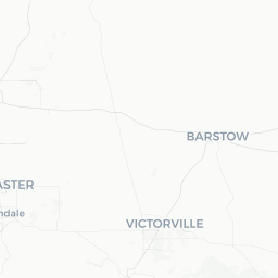
Searles Valley is a small, unincorporated community in San Bernardino County, California, situated in a high desert basin east of the Sierra Nevada and south of Death Valley. The valley sits at roughly 1,700 feet elevation and is defined geologically by the dry lakebed of Searles Lake, one of a chain of Pleistocene-era lakes that once filled the eastern Mojave. Today the lakebed is a vast flat of crystallized salts and minerals, still actively mined.
The community's population of roughly 1,700 is centered on Trona, the main settlement in the valley, which grew up around mineral extraction beginning in the late 19th century. Searles Valley is not a conventional tourist destination — there are no resort hotels, themed attractions, or curated experiences. What it offers instead is an authentic encounter with an industrial desert landscape that very few travelers ever see.
Visitors typically come for the geological curiosity of the Trona Pinnacles, roadside desert exploration, photography, or as a transit stop on the way to Death Valley or the Eastern Sierra. The valley rewards travelers who are self-sufficient, curious, and comfortable with solitude.
Before You Go
Visas and Entry
Searles Valley is in the United States. For entry requirements, check TravelerPulse's Visas section and the U.S. Customs and Border Protection website for guidance relevant to your nationality.
Preparation Is Essential
This is a remote desert location. Services are extremely limited — there is a small grocery store and basic fuel available in Trona, but travelers should not rely on finding specific items or services on arrival. Stock up on water, food, fuel, and any medications before entering the valley. Cell service is unreliable throughout much of the area; download offline maps before you go.
Climate
Summer temperatures regularly exceed 110°F (43°C) and can be genuinely dangerous. The October–April window is far more comfortable for outdoor activity, with daytime highs typically in the 50s–70s°F (10–25°C). Nights can drop near or below freezing in winter. Wind is common year-round and dust storms can occur with little warning. Check weather forecasts carefully before any visit.
Getting There
Searles Valley has no commercial air or rail service. The nearest major airports are Bakersfield Meadows Field (BFL) to the northwest and Ontario International Airport (ONT) to the south, both roughly two or more hours by road depending on route and conditions. Las Vegas (LAS) is approximately three hours to the east and is commonly used as a gateway for trips combining the Eastern Mojave with Nevada.
The primary road access is via State Route 178, which connects the valley westward through Ridgecrest to U.S. Highway 395, and State Route 14 further south. From the east, SR-178 continues toward Death Valley Junction. A high-clearance vehicle is not required to reach Trona via paved roads, but many unpaved side routes in the surrounding desert require it.
There is no public transportation serving Searles Valley. A personal vehicle is the only practical means of arrival.
Getting Around
Within the valley, all travel is by private vehicle. Trona's streets are paved, but most points of interest outside of town — including the Trona Pinnacles and surrounding desert terrain — require driving on unpaved BLM roads. Road conditions vary seasonally and after rain; verify current conditions with the Bureau of Land Management's Ridgecrest Field Office before venturing off paved routes.
A standard passenger car with good ground clearance can reach the Trona Pinnacles via the designated access road in dry conditions, but a truck or SUV is preferable. There are no rideshare services, taxis, or rental car agencies in the valley itself. Carry a spare tire, tow strap, and basic recovery gear when driving off-pavement.
Where to Stay
There are no established hotels or motels within Searles Valley itself. The closest lodging options are in Ridgecrest, which has a range of chain motels and independent hotels serving the regional workforce and travelers; verify availability and current options directly with Ridgecrest lodging providers.
Dispersed camping on BLM land surrounding the valley is permitted in most areas, subject to standard BLM rules (generally a 14-day stay limit per site, no established fee for dispersed camping — verify current regulations with the BLM Ridgecrest Field Office). There are no developed campgrounds with hookups or amenities in the immediate valley. Campers must be fully self-sufficient with water, food, waste disposal supplies, and fire safety equipment.
Things to See & Do
Trona Pinnacles
The Trona Pinnacles are the valley's most visited natural feature and one of the more unusual geological sites in the American West. These are tufa spires — calcium carbonate towers — that formed underwater in ancient Searles Lake thousands of years ago. There are more than 500 pinnacles, ranging from a few feet to nearly 140 feet tall, spread across the dry lakebed. The site is managed by the Bureau of Land Management and is freely accessible. No admission fee is charged (verify locally), and there are no services on site. The area is a popular film and photography location, particularly around sunrise and sunset when the light hits the pinnacles dramatically.
Desert Photography and Stargazing
The valley's distance from major population centers and its flat open terrain make it one of the darker sky zones in Southern California. Astrophotography enthusiasts visit for views of the Milky Way on clear nights, especially outside the summer months. The vast salt flat and the pinnacles provide compelling foreground subjects.
Searles Lake (Dry Lakebed)
The lakebed itself — largely off-limits due to active mining operations by Searles Valley Minerals — is visible from roads and viewpoints throughout the valley. The white mineral surface and industrial infrastructure give the landscape an otherworldly character that photographers find compelling. Do not access active industrial areas.
Desert Hiking and Exploration
The surrounding BLM land offers informal hiking and exploration opportunities. There are no maintained hiking trails in the immediate valley, but the open desert terrain invites careful, map-equipped wandering. Always tell someone your plans, carry more water than you think you need, and be aware of flash flood risk in canyon areas during monsoon season (July–September).
Food & Drink
Dining options in Searles Valley/Trona are extremely limited. There are a small number of basic local establishments in Trona; availability and hours change frequently — verify locally before relying on any specific restaurant being open.
The safest approach is to bring food and water with you. Travelers coming from Ridgecrest (approximately 20 miles west) will find a wider range of restaurants, grocery stores, and fast food chains. If you plan to spend more than a day in the valley, Ridgecrest is the logical resupply point.
Potable water should be treated as a critical supply item, not an afterthought. Carry at least one gallon per person per day in summer, and ensure your vehicle water supply is topped up before leaving Ridgecrest.
Practical Information
Emergency Services
The nearest hospital-level medical services are in Ridgecrest (Ridgecrest Regional Hospital). Trona has limited emergency services. In a serious emergency, call 911 — but be aware that cell coverage in parts of the valley is unreliable. Consider carrying a satellite communicator device on remote excursions.
Fuel
Fuel is available in Trona, but hours and reliability can vary. Fill your tank in Ridgecrest before heading into the valley. Never let your tank drop below half when in remote desert areas.
Connectivity
Cell service ranges from weak to nonexistent in many parts of the valley and the surrounding desert. Do not assume you will be able to call for help or access navigation apps in real time. Download offline maps (e.g., Gaia GPS, Google Maps offline) before arrival.
Waste
Pack out all trash. There are no waste facilities at the Trona Pinnacles or on BLM dispersed camping areas. Practice Leave No Trace principles throughout your visit.
Safety
Heat is the primary safety hazard for visitors. Dehydration and heat-related illness develop quickly in extreme desert temperatures and can become life-threatening before symptoms are obvious. Avoid strenuous outdoor activity during midday in summer, wear light-colored loose clothing, and drink water proactively rather than reactively.
Vehicle breakdowns in remote areas are a serious risk. Ensure your vehicle is mechanically sound before the trip, carry extra water (beyond what you plan to drink), and consider bringing a basic toolkit. If your vehicle breaks down on an unpaved road in a remote area, stay with the vehicle — it is far easier for rescuers to spot a vehicle than a person on foot in open desert.
The Trona Pinnacles and surrounding BLM land have no ranger presence and no emergency call stations. Let someone outside the area know your itinerary and expected return time whenever you venture into the backcountry.