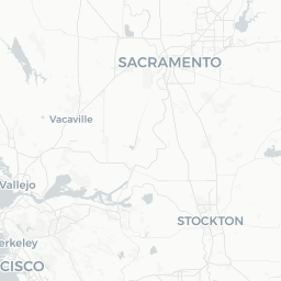
Overview
Tamalpais Valley is a small unincorporated community in southern Marin County, California, nestled between the slopes of Mount Tamalpais and the Pacific coast. With a population of roughly 7,000, it functions less as a tourist destination in its own right and more as a quiet residential enclave that sits at the doorstep of some of the Bay Area's most celebrated open space.
The community sits just inland from Muir Beach and a short drive from the entrance to Muir Woods National Monument, making it a logical base for hikers, cyclists, and anyone seeking a slower pace after the energy of San Francisco, roughly 15 miles to the southeast.
The surrounding landscape is defined by coast redwood groves, chaparral-covered ridgelines, and creeks that run toward the Pacific. The area belongs to the broader Mill Valley–Sausalito corridor and shares many of its services, restaurants, and cultural amenities with those neighboring towns.
Before You Go
Visas and Entry
Tamalpais Valley is in the United States. For visa and entry requirements, check TravelerPulse's Visas section and the official U.S. Customs and Border Protection website for the most current guidance.
What to Pack
- Layers are essential year-round. Coastal fog can roll in rapidly even on warm afternoons.
- Sturdy hiking shoes if you plan to explore Mount Tamalpais or Muir Woods trails.
- Sun protection for exposed ridgeline hikes; the fog can thin by midday.
- A reusable water bottle — many trailheads have limited or no water access.
Reservations
Muir Woods National Monument requires timed entry reservations, which sell out well in advance, especially on weekends and holidays. Book through recreation.gov before your visit. Parking at the Muir Woods lot also requires advance reservation.
Getting There
By Car
Tamalpais Valley is most easily reached by car. From San Francisco, take US-101 north across the Golden Gate Bridge, exit at Shoreline Highway (CA-1), and follow signs toward Muir Woods and Mill Valley. The drive typically takes 25–40 minutes depending on traffic.
By Public Transit
Golden Gate Transit operates bus routes connecting Marin County to San Francisco. From the Marin City Transit Hub, local Marin Transit routes serve the area around Tamalpais Valley. Service frequency and routes change periodically — verify current schedules on the Golden Gate Transit and Marin Transit websites before travel.
Muir Woods Shuttle
During peak season a seasonal shuttle connects Sausalito and Marin City to Muir Woods, passing through the Tamalpais Valley area. This is a practical option for visitors who want to avoid driving the narrow roads and limited parking near Muir Woods. Check the Marin Transit website for current seasonal availability and stops.
Getting Around
A personal vehicle is the most practical way to move around Tamalpais Valley and access surrounding trailheads, beaches, and neighboring towns. The road network includes narrow, winding roads — CA-1 (Shoreline Highway) and Panoramic Highway — that require attentive driving, particularly in fog or after rain.
Cycling is popular among locals but the hilly terrain and lack of dedicated bike lanes on main roads makes it best suited to experienced riders. Many cyclists use the area as part of longer road routes over Mount Tamalpais.
For visits focused on Muir Woods or the mountain, consider using the seasonal shuttle where available to reduce parking stress and road congestion.
Things to See & Do
Mount Tamalpais State Park
The state park encompasses more than 6,300 acres of trails, fire roads, and scenic overlooks immediately above the valley. Trails range from gentle creek-side walks to steep summit climbs. The East Peak summit at roughly 2,571 feet offers panoramic views of San Francisco Bay on clear days. Verify current trail conditions and any fire restrictions with California State Parks before setting out.
Muir Woods National Monument
One of the few remaining old-growth coast redwood groves in the Bay Area, Muir Woods is a short drive from Tamalpais Valley. The main loop trail is accessible and well-maintained. Remember to book timed entry reservations in advance at recreation.gov.
Muir Beach
A small, relatively uncrowded Pacific beach at the foot of the Marin headlands, about a 10-minute drive from the valley. The beach is part of the Golden Gate National Recreation Area and is open to leashed dogs in some areas — verify current pet policies on the NPS website.
Hiking and Birding
The network of trails connecting Tennessee Valley, Pirates Cove, and the Marin Headlands is accessible within a short drive and offers coastal scenery distinct from the redwood interior. The area is also notable for hawk and raptor watching during autumn migration.
Food & Drink
Tamalpais Valley itself has limited dining options given its small, primarily residential character. Most visitors eat in neighboring Mill Valley (roughly 3 miles east), which has a walkable downtown with cafes, restaurants, and a farmers market.
Muir Beach has the Pelican Inn, a British-style pub and inn that serves food and drinks in a distinctive setting — verify current hours and whether reservations are needed before visiting.
For grocery shopping and casual provisions, the Tam Valley area has small local markets; larger supermarkets are in Mill Valley or Corte Madera.
Practical Information
Emergency Services
For emergencies in the United States, dial 911. The nearest hospitals with emergency departments are in Greenbrae and San Rafael. Marin County has a well-staffed fire and emergency services infrastructure given the wildfire risk in the area.
Wildfire Awareness
Marin County, including the Tamalpais Valley area, has significant wildfire risk, particularly in late summer and autumn. Check Cal Fire alerts and any active advisories before hiking in dry conditions. Campfires are restricted or prohibited in most open space areas — verify current regulations.
Cell Coverage
Cell coverage can be patchy on mountain trails and in creek canyons. Download offline maps before heading into the backcountry.
Accessibility
Muir Woods has paved, accessible pathways along its main loop. Mount Tamalpais trails vary considerably in grade and surface. Check the California State Parks and NPS websites for specific accessibility information.
Safety
Tamalpais Valley and the surrounding open space are generally safe for visitors. Standard trail safety applies: carry water, tell someone your planned route, and be aware of weather changes.
Wildlife in the area includes coyotes, deer, and occasionally mountain lions. Follow posted guidelines in state and national park areas regarding wildlife encounters. Poison oak is abundant on many trails — learn to identify it before hiking off paved paths.
The narrow, fog-prone roads around the mountain warrant careful, unhurried driving. Pull into turnouts to allow faster traffic to pass and avoid stopping on blind curves.