Overview
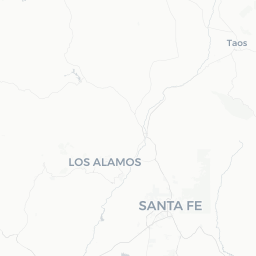
Spencerville is a small unincorporated community in San Juan County, northwestern New Mexico, with a recorded population of roughly 1,200 people. It sits in the high-desert terrain of the San Juan Basin at approximately 36.82°N, 108.06°W — a landscape defined by wide mesas, sage-covered flats, and the broader Colorado Plateau environment.
The community is not a conventional tourist destination, but it occupies a strategically interesting corner of the Four Corners region. Visitors typically pass through or base themselves here while exploring the surrounding public lands, the Navajo Nation, and the archaeological sites that make northwestern New Mexico one of the American Southwest's most historically layered areas.
Services in Spencerville itself are limited, so travelers should plan supplies, fuel, and accommodations before arrival. The nearest significant service hubs are Farmington and Aztec, both a short drive away.
Before You Go
Visas
Spencerville is in the United States. For visa requirements specific to your nationality, check TravelerPulse's Visas section and the official US Customs and Border Protection website.
What to Pack
- Sun protection is essential: high-desert UV exposure is intense year-round
- Layers for temperature swings — summer days can exceed 90°F (32°C) while nights cool sharply
- Sufficient water; dehydration is a genuine risk in arid terrain
- Paper maps or a downloaded offline map — cell coverage can be intermittent in rural San Juan County
- Cash, as rural communities and some nearby sites have limited card payment options
Health Considerations
Altitude across the region generally ranges from roughly 5,000–6,000 feet. Visitors coming from sea level may notice mild fatigue initially. Stay well hydrated. Verify any specific health advisories through the CDC or your personal physician before travel.
Getting There
By Air
The closest commercial airport with scheduled service is Four Corners Regional Airport (FMN) in Farmington, New Mexico, which handles regional flights. Albuquerque International Sunport (ABQ) is a larger hub offering more connections and is roughly a 3-hour drive southeast.
By Road
Spencerville is most practically reached by private vehicle. US-64 and US-550 are the primary regional arteries connecting the San Juan Basin communities. Roads in the immediate rural area may include unpaved sections; verify road conditions locally before traveling, especially after rain or winter storms.
By Bus
Limited regional bus service connects larger San Juan County communities such as Farmington and Aztec. Verify current schedules and routes locally, as rural service can change.
Getting Around
A personal vehicle is effectively essential in and around Spencerville. Public transportation does not serve the community in any meaningful way, and distances between points of interest in this part of New Mexico are significant.
Fuel up in Farmington or Aztec before venturing into more remote areas. Some roads leading to public lands and archaeological sites southwest and east of the San Juan Basin are unpaved and may require a high-clearance vehicle. Check current road conditions with the BLM Farmington Field Office or San Juan County before heading out.
Things to See & Do
Regional Archaeology and History
The broader San Juan Basin is one of the most archaeologically significant regions in North America. Chaco Culture National Historical Park, a UNESCO World Heritage Site, is roughly 60–70 miles to the southeast and contains extraordinary ancestral Puebloan great houses dating back over a thousand years. Aztec Ruins National Monument, another ancestral Puebloan site and UNESCO World Heritage component, is much closer — just a few miles east in the town of Aztec.
Public Lands and Outdoor Recreation
The Bureau of Land Management (BLM) administers extensive public land in San Juan County. Activities including hiking, wildlife watching, and photography are common. The area's mesa and canyon topography offers scenic rewards for those willing to explore on foot. Verify land access status and any permit requirements with the BLM Farmington Field Office before visiting specific parcels.
Navajo Nation Proximity
Spencerville is near the boundaries of the Navajo Nation, the largest tribal nation in the United States. Visitors interested in Diné culture, art, and landscape should note that travel within the Navajo Nation may require specific permits for certain recreational activities. Check with the Navajo Nation Parks and Recreation Department for current rules.
Stargazing
Low light pollution in rural San Juan County makes the night sky exceptionally clear on cloudless nights. The region is well regarded among amateur astronomers and astrophotographers.
Food & Drink
Spencerville itself has negligible dining infrastructure. Travelers should plan meals in Farmington or Aztec, both of which have a range of restaurants from local diners to chain options.
The broader Four Corners region has a food culture influenced by Indigenous, Hispanic, and Anglo-American traditions. New Mexican cuisine — featuring locally grown red and green chiles — is widely available in the region and worth seeking out. Ask for "Christmas" if you want both red and green chile on your plate, a local custom.
Practical Information
Emergency Services
For emergencies anywhere in the United States, dial 911. San Juan County Sheriff's Office provides law enforcement coverage for unincorporated areas including Spencerville.
Cell Coverage
Coverage is inconsistent in rural parts of San Juan County. Download offline maps before leaving a service area and inform someone of your itinerary if heading into remote public lands.
Time Zone
Spencerville observes Mountain Time. Note that the adjacent Navajo Nation observes Mountain Daylight Time year-round (it does not follow Arizona's no-daylight-saving practice), which can cause brief confusion at boundaries. Verify locally.
Fuel and Supplies
Stock up on fuel, water, and groceries in Farmington or Aztec. Do not assume you will find services in or immediately around Spencerville.
Safety
Spencerville and the surrounding rural area are generally quiet. Standard rural travel precautions apply: inform someone of your plans, carry sufficient water and food for longer outings, and do not rely solely on GPS or cellular navigation.
Weather can change rapidly in the high desert. Afternoon monsoon thunderstorms are common July through September and can make unpaved roads briefly impassable due to flash flooding. Wash crossings and low-water roads should be treated with respect — "turn around, don't drown" is sound advice throughout the Southwest.