Translate
Overview
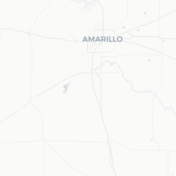
Dumas is a small city of roughly 15,000 people in Moore County, situated in the Texas Panhandle about 45 miles north of Amarillo. Sitting at an elevation of approximately 3,700 feet on the flat, windswept Llano Estacado, it is the commercial and administrative hub for one of the most productive agricultural counties in Texas — Moore County consistently ranks among the nation's top beef-producing counties.
The city has a straightforward, working-town character. Visitors here are typically road-trippers passing along US-287 or US-87, travelers with family ties to the region, or outdoor enthusiasts heading toward the Canadian River breaks. The surrounding landscape — enormous sky, grain elevators on the horizon, feedlots, and occasional wildflower bursts in spring — is quintessential High Plains Texas.
Dumas is not a major tourist destination, but it offers genuine small-town hospitality, practical amenities, and serves as a useful launch point for exploring the less-visited corners of the Texas Panhandle.
Before You Go
Visas & Entry
Dumas is located in the continental United States. For entry requirements, check TravelerPulse's Visas section and consult the official U.S. Customs and Border Protection website for guidance specific to your nationality.
Weather
The High Plains climate means hot summers (temperatures regularly exceeding 95°F / 35°C), cold winters with occasional snow and hard freezes, and persistent winds year-round. Dust storms can reduce visibility significantly in spring, particularly March through May. Pack layers if visiting outside summer, and always carry water when driving through the region.
What to Pack
- Sun protection: hat, sunscreen, sunglasses — UV exposure is intense at this elevation and latitude
- Wind-resistant outer layer, even in warmer months
- Comfortable walking shoes or boots suitable for ranch country
- Cash: some local businesses and rural spots may not accept cards reliably
Getting There
By Air
The nearest commercial airport with regular scheduled service is Rick Husband Amarillo International Airport (AMA) in Amarillo, approximately 45 miles south via US-87. Car rental is available at the airport and is strongly recommended, as there is no meaningful public transit connecting Amarillo to Dumas.
By Car
Dumas sits at the intersection of US-87 and US-287, making it straightforward to reach by road. From Amarillo the drive north takes roughly 45–50 minutes under normal conditions. From the Oklahoma Panhandle, US-287 runs west through Boise City into Dumas. Travelers from New Mexico can approach via US-54 to Clayton and then east, connecting through Dalhart.
By Bus
Verify locally or with regional bus providers whether scheduled intercity coach service currently connects Dumas to Amarillo or other Panhandle cities, as coverage in rural Texas can change.
Getting Around
A personal vehicle is essentially required in Dumas. The city is compact and most commercial services are arranged along or near US-87 (Dumas Avenue), but there is no local public transit system. Distances between points of interest in the broader region are significant — plan fuel and timing accordingly before heading out onto rural Panhandle roads.
Road conditions in winter can deteriorate quickly with ice and blowing snow. If you are traveling between November and February, check Texas DOT road conditions before long drives (verify the current official Texas DOT website).
Things to See & Do
Moore County Historical Museum
The local history museum provides context for the settlement of the Texas Panhandle, the development of the cattle and agriculture industries, and life on the High Plains. Verify current hours and admission locally before visiting.
Dogie Days
Dumas's signature annual community festival, held in summer, includes a parade, live music, carnival rides, and events celebrating the city's ranching heritage. Check locally for exact dates each year.
Lake Meredith National Recreation Area
While centered around Fritch (roughly 60 miles south near Borger), Lake Meredith offers boating, fishing, hiking, and camping in a dramatic Canadian River canyon landscape. It is the most significant outdoor recreation site within reasonable driving distance of Dumas. Operated by the National Park Service — verify current water levels and facility status before visiting, as conditions vary.
Canadian River Breaks
The terrain south and east of Dumas transitions into eroded Canadian River canyon country, offering scenic drives and a stark contrast to the flat plains. No developed visitor infrastructure exists for most of this area; treat it as a scenic driving route.
Palo Duro Canyon State Park
Located approximately 80 miles south (near Canyon, Texas), Palo Duro Canyon is often described as the 'Grand Canyon of Texas.' It is a full day trip from Dumas but one of the most rewarding natural attractions in the Panhandle.
Food & Drink
Dumas has a practical range of dining options typical of a small Texas county seat: Mexican and Tex-Mex restaurants reflect the significant Hispanic population and culture in Moore County, several local diner-style cafes, and familiar fast-food chains along the main commercial corridor.
Local Tex-Mex is generally a reliable and affordable option. Look for family-run establishments along or near Dumas Avenue. Hours can be limited on Sundays and holidays — verify locally.
Dumas is located in a county with specific alcohol sale regulations. Verify current local ordinances if purchasing alcohol is relevant to your plans, as rules can differ for restaurants, bars, and retail sales.
Practical Information
Emergency Services
For any emergency in the United States, dial 911. Dumas has a local police department and Moore County Sheriff's Office. The nearest Level I or II trauma center is in Amarillo — for serious medical emergencies, expect transport southward.
Medical Care
There is a local hospital serving Moore County; verify its current status and capabilities locally. For non-emergency care, urgent care clinics may be available — confirm addresses and hours before your trip.
Connectivity
Cell coverage from major US carriers is generally available within Dumas itself, but can become sparse or absent on rural roads and in canyon terrain outside the city. Download offline maps before venturing into less-traveled areas.
Fuel
Gas stations are available in Dumas. Fill up before driving into more remote Panhandle areas, as some rural routes have no services for 30–60 miles or more.
Safety
Dumas is generally considered a safe, low-key small city. Standard travel precautions apply: do not leave valuables visible in parked vehicles, be aware of your surroundings in unfamiliar areas after dark.
Weather is the primary safety consideration. Severe thunderstorms, tornadoes, and large hail occur in spring and early summer — the Texas Panhandle sits in a historically active tornado corridor. Monitor NOAA weather alerts if visiting between April and June. Dust storms (haboobs) can reduce highway visibility to near zero with little warning; if one approaches while driving, pull well off the road and wait it out.
In winter, 'blue norther' cold fronts can arrive rapidly, dropping temperatures dramatically within hours and creating icy road conditions.