Translate
Overview
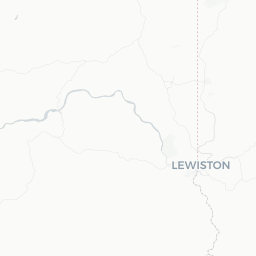
Clarkston sits at the southeastern corner of Washington State, directly across the Snake River from its Idaho twin city, Lewiston. Together the two form the Lewiston–Clarkston Valley, often called the "LC Valley." Despite a modest population of around 7,300, Clarkston punches above its weight as an outdoor recreation hub, primarily because it sits at the doorstep of Hells Canyon — North America's deepest river gorge.
The city takes its name from William Clark of the Lewis and Clark Expedition, which passed through this confluence of the Snake and Clearwater rivers in 1805 and again on the return journey in 1806. That history still resonates locally, and interpretive sites in the valley reflect it.
Clarkston sits at a low elevation for Washington (roughly 740 feet), which gives it one of the warmer and drier climates in the Pacific Northwest. Summers are hot and sunny, winters are mild by regional standards, and the surrounding hills turn golden through much of the year. The economy leans on agriculture (wheat, lentils, and barley dominate the Palouse region to the north), river transportation, and increasingly tourism tied to Hells Canyon.
Before You Go
Visas
Clarkston is in the United States. For visa and entry requirements, check the TravelerPulse Visas section and the official U.S. Customs and Border Protection website, as rules vary significantly by nationality.
Climate
Summers (June–August) are hot, frequently exceeding 90°F (32°C), and mostly dry. Spring and fall are pleasant and ideal for hiking and river trips. Winters are cool rather than harsh, with occasional snow that rarely lingers long at valley elevation. If you plan to go into Hells Canyon itself, temperatures can be extreme — verify conditions before any backcountry trip.
What to Pack
- Sun protection (hat, sunscreen, UV-rated clothing) is essential in summer
- Layers for early-morning river trips, which can start cool even in summer
- Sturdy footwear if you plan to hike canyon trails
- Sufficient cash — some local businesses and outdoor operators prefer it; verify locally
Connectivity
Mobile coverage is generally adequate in Clarkston itself but can drop significantly in the deeper sections of Hells Canyon. Download offline maps before venturing into the gorge.
Getting There
By Air
The nearest commercial airport is Lewiston-Nez Perce County Regional Airport (LWS), located just across the river in Lewiston, Idaho — roughly a 10-minute drive from central Clarkston. The airport offers regional connections; verify current routes and carriers on the airport's official site. For more flight options, Spokane International Airport (GEG) is approximately 100 miles north and connects to major hubs nationwide.
By Road
US-12 is the primary highway corridor linking Clarkston to Lewiston (immediately adjacent) and continuing west toward the Tri-Cities (Richland, Kennewick, Pasco) and east toward the Idaho Panhandle. From Spokane, US-195 south connects to the valley. Driving times vary — confirm current road conditions through the Washington State DOT site, particularly in winter when the Lewiston Hill grade can be affected by ice.
By Bus
Intercity bus service connects Clarkston and Lewiston to Spokane and other regional points. Verify current schedules and operators locally or online, as service frequency and providers can change.
By River
The Snake River is commercially navigable from the Pacific Ocean to Lewiston/Clarkston, making this the furthest-inland seaport on the U.S. West Coast. Barge traffic is commercial; passenger river access is primarily through jet boat tours and private watercraft.
Getting Around
Clarkston is a small city and most points of interest are reachable by car within a few minutes. Street parking is generally available. The city and Lewiston together operate a local public transit system (Valley Transit); verify current routes and hours on their official site.
For Hells Canyon excursions, most visitors join guided jet boat tours departing from marinas in Clarkston or Lewiston, as the canyon roads are limited and some areas are roadless. If you plan to drive into the canyon rim areas (accessible from the Oregon side or via Forest Service roads from Idaho), a high-clearance vehicle is advisable — verify road conditions before departure.
Riding a bicycle is feasible for getting around town and along the riverfront path. Rental options — verify locally for current availability.
Things to See & Do
Hells Canyon Jet Boat Tours
The signature experience from Clarkston is a jet boat excursion into Hells Canyon National Recreation Area. Tours range from half-day trips to multi-day adventures reaching the deepest sections of the gorge. Several operators are based in the Lewiston–Clarkston area; compare offerings, verify schedules, and book in advance during peak summer season.
Swallows Park and the Confluence
Swallows Park, near the confluence of the Snake and Clearwater rivers, provides a pleasant riverside setting with walking paths, picnic areas, and views of river traffic. It is a low-key spot that reflects the community character of Clarkston well.
Chief Timothy Park
Located a short drive west of Clarkston on an island in the Snake River (accessible by bridge), Chief Timothy State Park offers camping, swimming, boating, and a small museum with exhibits on the Nez Perce people and the Lewis and Clark Expedition. Verify current fees and facilities with Washington State Parks.
Hells Gate State Park (Idaho side)
Just across the river in Lewiston, Hells Gate State Park serves as a formal trailhead and marina for Hells Canyon access, with a visitor center covering canyon history and ecology. Given how closely Clarkston and Lewiston function as one community, this is effectively part of the local experience.
Golf
The valley has a mild enough climate to support year-round or near-year-round golf. Several courses operate in the LC Valley; verify locally for current conditions and access.
Palouse Scenic Byway
The rolling agricultural hills of the Palouse begin north of Clarkston and are particularly photogenic in late spring when winter wheat creates waves of green and gold. The Palouse Scenic Byway connects several small towns and viewpoints and can be driven as a day trip.
Food & Drink
The dining scene in Clarkston is modest and practical, reflecting the size of the community. Expect a mix of independent diners, family restaurants, and a handful of bars and breweries rather than a destination food culture. The proximity to Lewiston effectively doubles the options available to visitors.
Local agriculture contributes quality ingredients to the region — lentils grown on the Palouse are nationally significant, and wheat from the area feeds a range of local baked goods. Some local restaurants source regionally; ask staff about seasonal offerings.
The valley has craft brewing activity consistent with broader Pacific Northwest trends. Verify current establishments locally, as the small-business landscape shifts. A few spots along or near the riverfront offer views to complement a meal or drink.
Grocery stores in Clarkston make self-catering straightforward if you are staying in a vacation rental or preparing for a canyon trip.
Practical Information
Emergency Services
For emergencies in the United States, dial 911. This connects to police, fire, and medical services.
Medical
Clarkston has local medical facilities. For serious emergencies, the nearest hospital with full services is in Lewiston, Idaho, just across the bridge — verify current facilities and capabilities locally.
Money
ATMs are available in Clarkston. Major credit cards are accepted at most businesses. Some outdoor operators and smaller vendors prefer cash; confirm before your trip.
Utilities and Connectivity
Tap water is safe to drink. Standard US electrical outlets (120V, Type A/B). Phone and internet service is reliable in town.
Time Zone
Clarkston observes Pacific Time (PT): UTC−8 in winter, UTC−7 during daylight saving time. Note that Lewiston, Idaho — immediately across the river — observes Mountain Time, which means clocks differ by one hour depending on which side of the bridge you are on. Confirm times carefully when booking tours or services based in Lewiston.
Safety
Clarkston is a small, generally quiet community with a low crime profile. Standard urban precautions — securing valuables, being aware of your surroundings — apply as they would anywhere.
The primary safety considerations here are environmental. Hells Canyon presents genuine wilderness hazards: extreme summer heat, flash floods in side canyons, rapidly changing river conditions, and very limited cell service. Anyone venturing beyond guided tours into backcountry areas should have appropriate experience, gear, and trip plans filed with a contact.
The Snake River itself demands respect — currents can be deceptively strong, and water temperatures vary. If participating in water activities, wear appropriate flotation devices and follow operator safety briefings carefully.
In summer, heat-related illness is a real risk. Stay hydrated, limit strenuous activity during peak afternoon heat, and recognize the signs of heat exhaustion.