 Translate
58
Routes
6
Hubs
BHS
ICAO
UP
IATA
TravelerPulse profile
The national airline connecting the islands of the Bahamas.
Founded
1973
Headquarters
Nassau, Bahamas
Bahamasair is the flag carrier and national airline of the Commonwealth of the Bahamas, wholly owned by the Bahamian government. Founded in 1973, the same year the Bahamas gained independence from Britain, the airline has served as the primary inter-island connector for the archipelago nation as well as providing international services to nearby destinations.
The airline operates scheduled passenger services linking Nassau and Freeport with numerous Family Islands throughout the Bahamas, as well as international routes to cities in the United States such as Miami, Orlando, and Fort Lauderdale. Its operations are critical for connectivity in a nation composed of over 700 islands and cays.
As a state-owned enterprise, Bahamasair has faced periodic financial challenges over the decades and has undergone restructuring efforts aimed at improving efficiency and sustainability. Despite these challenges, it remains an essential lifeline for many Bahamian communities dependent on air travel.
Hubs & network
Bahamasair's primary hubs are Lynden Pindling International Airport in Nassau and Grand Bahama International Airport in Freeport.
Fleet
Bahamasair operates a fleet primarily composed of ATR 42 and ATR 72 turboprop aircraft for inter-island and short-haul regional routes.
Notable facts
- ›Bahamasair was established in 1973 to coincide with Bahamian independence from Britain.
- ›The airline is fully owned by the Government of the Commonwealth of the Bahamas.
- ›It serves numerous Family Islands that would otherwise have limited transportation access.
- ›Bahamasair operates international routes to several cities in Florida, USA.
- ›The airline has undergone multiple restructuring efforts to address financial and operational challenges.
This profile is provided for general information only. Contact details may be inaccurate or outdated — always verify with the airline's official website before acting on them.
Primary hubs
Route network map (58 legs)

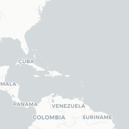



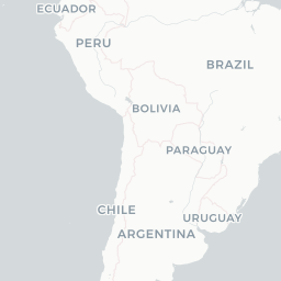

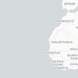




Leaflet © OpenStreetMap © CARTO
Route network
AXP → NASDH8
BWI → FPO734
CRI → AXPDH8
EWR → FPO734
FPO → BHM734
FPO → CMH734
FPO → EWR734
FPO → RIC734
GGT → NASDH8
GHB → NASDH8
IGA → NASDH8
MCO → NAS737 DH8
MIA → NAS737
NAS → FLL737 DH8
NAS → FPODH8
NAS → MCO737 DH8
NAS → MHHDH8
NAS → RSDDH8
NAS → SMLBE9
PBI → MHHDH8
RSD → NASDH8
AXP → CRIDH8
BHM → FPO734
FLL → NAS737 DH8
IGA → MYGDH8
MHH → NASDH8
MHH → PBIDH8
MYG → IGADH8
NAS → ELHDH8
NAS → GHBDH8
NAS → LGIDH8
NAS → MYGDH8
NAS → ZSADH8
PBI → NASDH8
SML → NASBE9
CMH → FPO734
FPO → FLLDH8
MIA → SKB737
NAS → IGADH8
NAS → MIA737
NAS → PLSDH8
RIC → FPO734
SKB → NAS737
ZSA → NASDH8
CRI → NASDH8
ELH → NASDH8
FLL → FPODH8
FPO → BWI734
FPO → NASDH8
HAV → NAS737
LGI → NASDH8
MYG → NASDH8
NAS → AXPDH8
NAS → CRIDH8
NAS → GGTDH8
NAS → HAV737
NAS → PBIDH8
PLS → NASDH8
Fleet (aircraft types operated)

Encyclopaedia
Bahamasair Holdings Limited, operating as Bahamasair, is the flag carrier of The Bahamas. Headquartered in Nassau, the capital of the Bahamas, the airline operates scheduled services to 32 domestic and regional destinations in the Caribbean and the United States from its base at Lynden Pindling International Airport.
Read full article on WikipediaLatest news
Upgraded Points· 6/8/2026
Bahamasair Resuming Flights Between RDU and the Bahamas
Read at Upgraded Points
Caribbean Journal· 6/27/2026
Bahamasair Is Flying Back to One of the Caribbean’s Most Underrated Islands After More Than 20 Years
Read at Caribbean Journal
Tribune 242· 8/17/2026
Bahamasair flight lands safely after gear failure
Read at Tribune 242
Eye Witness News – Bahamas Latest News· 9/18/2026
Bahamasair eyes Marsh Harbour-Fort Lauderdale route for 2027, expands AI use
Read at Eye Witness News – Bahamas Latest News
Upgraded Points· 6/8/2026
Bahamasair Adds New Route From FLL to North Eleuthera
Read at Upgraded Points
Breaking Travel News· 12/5/2025
Emirates activates interline partnership with Bahamasair
Read at Breaking Travel News

