Translate
Overview
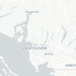
Arbutus Ridge is a residential neighbourhood on the west side of Vancouver, British Columbia, situated roughly between West 33rd and West 57th Avenues, and bounded loosely by Arbutus Street to the east and MacKenzie Heights to the north. Despite carrying a population figure that reflects a broader census aggregation, the area on the ground feels like a calm, tree-lined enclave rather than a standalone city.
The neighbourhood takes its name from the Pacific madrone (Arbutus menziesii), a native broadleaf evergreen tree with distinctive reddish-peeling bark that grows naturally on the area's west-facing slopes. These trees give streets a distinctive character that sets Arbutus Ridge apart from other Vancouver neighbourhoods.
For travellers, Arbutus Ridge functions primarily as a base within Vancouver rather than a destination in its own right. Its central west-side location puts it within easy reach of some of the city's most appreciated green corridors, beaches, and established commercial strips along West Broadway and South Granville.
Before You Go
Visas and Entry
Arbutus Ridge is part of the City of Vancouver, Canada. Entry requirements depend on your nationality. For accurate, current visa information, check TravelerPulse's Visas section and the official Immigration, Refugees and Citizenship Canada (IRCC) website.
Weather
Vancouver has a temperate oceanic climate. Summers (June–September) are mild to warm and relatively dry, with temperatures typically in the high teens to mid-twenties Celsius. Winters are cool and wet, with most precipitation falling as rain rather than snow. Layers and a waterproof jacket are useful year-round.
Practical Preparation
- Arbutus Ridge has no large hotels; accommodation seekers should search across broader Vancouver, particularly the Kitsilano, South Granville, or Cambie corridors nearby.
- The neighbourhood is residential, so most dining, shopping, and services are found on adjacent commercial streets rather than within the neighbourhood itself.
- Verify current transit schedules and service routes through TransLink before travel, as changes occur periodically.
Getting There
By Air
Vancouver International Airport (YVR) in Richmond is the primary airport serving this area. From YVR, the Canada Line SkyTrain connects to downtown Vancouver; from there, bus routes or a taxi/rideshare can reach Arbutus Ridge. Verify current transit options and journey times on the TransLink website.
By Road
Arbutus Ridge is accessible via several key Vancouver arterials, including West 41st Avenue and Arbutus Street. If arriving by vehicle from outside Vancouver, provincial highway connections feed into the city's street grid. Street parking exists in the neighbourhood but is regulated; check posted signs carefully.
By Public Transit
TransLink operates bus routes along Arbutus Street and along West 41st Avenue that serve the neighbourhood. The nearest SkyTrain stations are on the Canada Line (Oakridge–41st Avenue station is within reasonable distance). Verify current routes and schedules at translink.ca.
Getting Around
Within Arbutus Ridge and the surrounding west-side neighbourhoods, most day-to-day movement is manageable on foot or by bicycle. The Arbutus Greenway — a former CP Rail corridor converted into a multi-use path running roughly north–south through the neighbourhood — is a practical and pleasant route for cyclists and pedestrians connecting the waterfront near Burrard Inlet down toward the Fraser River.
TransLink buses provide connections to the broader city. Rideshare services (verify current availability locally) and taxis supplement public transit. The neighbourhood's hilly terrain in parts makes cycling effort variable; electric bike rentals are available in nearby commercial areas of Vancouver — confirm current providers locally.
A car is not necessary for most visits given the transit connectivity to the rest of Vancouver, though it may be convenient for day trips to regional parks or communities outside the city.
Things to See & Do
Arbutus Greenway
The Arbutus Greenway is the neighbourhood's defining public space — a linear park and active transportation corridor along the old rail line. Walking or cycling its length gives a ground-level view of several Vancouver neighbourhoods and passes community gardens, public art, and resting spots.
Natural Surroundings
The neighbourhood's west-facing slopes offer informal viewpoints toward the North Shore mountains and, on clear days, toward Vancouver Island. The native arbutus trees themselves are worth seeking out; they are relatively rare in urban settings.
Proximity to Broader Vancouver Attractions
- VanDusen Botanical Garden — a well-regarded botanical garden is located a short distance away on Oak Street; verify current hours and admission on their official website.
- Queen Elizabeth Park — Vancouver's highest point, with gardens and city views, is accessible from the neighbourhood.
- Kitsilano and Jericho Beaches — a short transit or cycling ride north gives access to Vancouver's west-side beaches.
- South Granville and West Broadway — nearby commercial strips with galleries, independent shops, and restaurants.
Arbutus Ridge itself is primarily residential; most activity and attractions lie in the adjacent neighbourhoods that border it.
Food & Drink
Arbutus Ridge has minimal commercial food and beverage presence within its immediate boundaries, as would be expected of a residential neighbourhood. The neighbouring commercial corridors are where dining and café culture is concentrated.
West 4th Avenue and Kitsilano (north) offer a wide range of cafés, casual restaurants, and independent eateries. South Granville (to the east along Granville Street) has a mix of independent restaurants and established dining options. West 41st Avenue passes through or near the neighbourhood and has local neighbourhood services including grocers and casual food options.
Visitors staying in the area should explore these adjacent strips for dining; online review platforms and neighbourhood guides for Vancouver's west side will have current, accurate listings, as specific establishments change regularly.
Practical Information
Emergency Services
In any emergency in Canada, dial 911 for police, fire, or ambulance.
Healthcare
Vancouver has multiple hospitals and walk-in clinics. Visitors from outside Canada should carry travel health insurance, as public healthcare is not automatically available to non-residents.
Connectivity
Mobile coverage in Arbutus Ridge is consistent with central Vancouver — generally strong across major Canadian carriers. Free public Wi-Fi is available in some parks and public spaces across the city; verify availability locally.
Money
ATMs and bank branches are found along West 41st Avenue and South Granville. Most businesses across Vancouver accept major credit and debit cards; contactless payment is widely used.
Tipping
Tipping is customary in Canada for restaurant service, taxis, and personal services. A common range for restaurant tips is 15–20% of the pre-tax bill, though this is at the visitor's discretion.
Safety
Arbutus Ridge is considered one of Vancouver's quieter and more settled residential neighbourhoods, and serious safety concerns specific to the area are not commonly reported. Standard urban awareness — keeping valuables out of sight in parked vehicles, being attentive at night in unfamiliar areas — applies as it would anywhere in a major city.
Vancouver as a whole has some neighbourhoods with higher rates of property crime; Arbutus Ridge is not among those areas. Visitors should nonetheless take ordinary precautions and use secure accommodation.
For the most current local safety context, consult Vancouver Police Department public communications or ask accommodation staff on arrival.