Overview
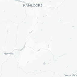
Dufferin is a small rural community situated in the Thompson River valley of British Columbia's Interior, positioned just outside the city of Kamloops at approximately 50.67°N. With a recorded population of under 3,000, it functions largely as a residential and agricultural area rather than a standalone urban destination.
The surrounding landscape is characteristic of the Thompson Okanagan region: semi-arid grasslands, sagebrush benchlands, and the broad braided channels of the Thompson River system. The terrain and climate differ noticeably from coastal BC, offering hot, dry summers and cold, clear winters.
Most visitors to the Dufferin area arrive in connection with Kamloops, which provides the full range of accommodation, dining, and services. Dufferin itself is best appreciated as part of a broader Thompson River corridor itinerary rather than a standalone destination.
Before You Go
Visas and Entry
Canada's entry requirements vary by nationality. For current visa and Electronic Travel Authorization (eTA) rules, check TravelerPulse's Visas section and the official Immigration, Refugees and Citizenship Canada (IRCC) website.
Climate
Dufferin shares Kamloops's semi-arid interior climate. Summers (June–August) are hot and dry, often exceeding 30 °C. Winters bring cold temperatures and some snow, though snowfall is generally lighter than in the mountain ranges nearby. Spring and fall are mild and pleasant. Bring sun protection in summer and layers year-round.
What to Pack
- Sun hat, sunscreen, and sunglasses for summer visits
- Sturdy walking or hiking footwear
- Layers for cool evenings even in July and August
- Winter tires or chains if driving between November and March (verify local road conditions at DriveBC before travel)
Getting There
By Air
The nearest commercial airport is Kamloops Airport (YKA), which receives scheduled service from several Canadian carriers. Verify current routes and schedules directly with airlines or the airport, as service levels change seasonally.
By Road
Dufferin sits close to the Trans-Canada Highway (Highway 1) corridor, making it easily accessible by car from Vancouver (approximately 350 km west) or from the Okanagan and points east. Driving is the most practical way to reach and explore this area.
By Rail
VIA Rail's The Canadian transcontinental train stops at Kamloops North station. This is a scenic option but schedules are infrequent; verify current timetables on the VIA Rail website.
By Bus
Intercity bus services connect Kamloops to major BC centres. Check current operators and schedules locally, as regional bus service in BC's interior has changed in recent years.
Getting Around
A personal vehicle is essentially required to get around Dufferin and the surrounding Thompson River area. The community is not served by a significant local transit network, and distances between points of interest are best covered by car.
Kamloops Regional Transit operates bus routes within the City of Kamloops; verify whether any routes extend to the Dufferin area on the BC Transit website. Ride-hailing and taxi services available in Kamloops may be able to serve the area — confirm availability locally.
Cycling is feasible on quieter rural roads in fair weather, though highway shoulders can be narrow in places. Always check road conditions, particularly in winter, at DriveBC (drivebc.ca).
Things to See & Do
Thompson River and Outdoor Recreation
The Thompson River corridor is the primary draw for outdoor visitors. Fishing for salmon and steelhead is a well-known activity in the broader region; access points and regulations are set by Fisheries and Oceans Canada — verify current licensing requirements before fishing.
Hiking and Nature
The grassland benchlands and river terraces in this part of BC offer walking and wildlife observation. The area is home to species including mule deer, coyotes, and numerous raptors. No formal trailheads are located in Dufferin itself, but Kamloops and the surrounding provincial parks provide established access points.
Kamloops Proximity
Kamloops, just a short drive away, offers Riverside Park, the Kamloops Museum and Archives, the Kamloops Art Gallery, and the BC Wildlife Park — a wildlife rehabilitation and display facility that is particularly well-suited for families. Verify admission fees and hours directly with each venue before visiting.
Scenic Drives
The Thompson Valley and Highway 1 corridor offer some of British Columbia's most striking interior scenery. The drive west toward Cache Creek or east toward Revelstoke provides excellent views of river canyons, dry grasslands, and mountain backdrops.
Food & Drink
Dufferin does not have a notable independent restaurant or café scene of its own. Visitors should plan to travel into Kamloops for dining, where a full range of options — from casual diners and fast food to locally focused restaurants — is available.
Kamloops has a growing food culture that reflects BC's agricultural interior, with access to locally produced beef, fruit from the nearby Okanagan, and fresh Thompson River fish in season. Verify restaurant hours locally, as hours can vary seasonally.
For self-catering, grocery stores are found in Kamloops. If you are staying in a rural rental property in the Dufferin area, stocking up in Kamloops before settling in is advisable.
Practical Information
Emergency Services
For all emergencies in Canada, dial 911. The nearest hospital with full emergency services is Royal Inland Hospital in Kamloops — verify its current address and services on the Interior Health website.
Money
ATMs and banking services are available in Kamloops. Credit and debit cards are widely accepted throughout BC; carry some cash for smaller rural transactions.
Connectivity
Cell coverage in the Dufferin and broader Thompson Valley area is generally reasonable along the highway corridor but can be patchy in more remote spots. Confirm coverage with your carrier before travel.
Fuel
Fill up in Kamloops before venturing into less-populated surrounding areas. Fuel prices in BC's interior vary; check current prices via GasBuddy or similar tools.
Time Zone
Pacific Time (PT): UTC−8 in winter, UTC−7 during daylight saving time (mid-March to early November).
Safety
Dufferin and the Thompson River area are generally safe rural environments. Standard rural travel precautions apply: inform someone of your plans if hiking or exploring remote areas, carry water and sun protection in summer, and check weather forecasts before outdoor activities.
Wildfire risk is elevated across BC's interior during summer months. Monitor the BC Wildfire Service website (bcwildfire.ca) and follow any evacuation or restriction orders. Highway closures due to wildfire smoke or active fires can affect travel in the Thompson Valley — always check DriveBC before driving.
Winter driving on highways in this region requires appropriate tires and caution. BC mandates winter tires on most provincial highways from October 1 to April 30; confirm current regulations on the CVSE (Commercial Vehicle Safety and Enforcement) website.