Overview
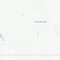
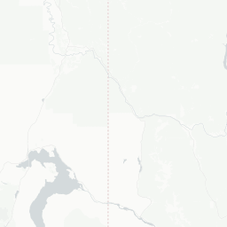
Grand Forks is a small city of roughly 4,000 people situated in the Boundary Country of southeastern British Columbia, near the border with Washington State. It sits at the confluence of the Kettle River and the Granby River, giving the town a gentle, river-valley character that draws cyclists, anglers, and those looking to slow down.
The city is perhaps best known outside the region for its Doukhobor heritage. Doukhobors — a pacifist Christian sect that emigrated from Russia in the late 19th and early 20th centuries — settled heavily in this valley and left a lasting imprint on local food traditions, architecture, and community identity. That cultural layer makes Grand Forks quietly distinctive in a way few small Canadian cities are.
The surrounding Boundary Country offers apple and cherry orchards, the Granby River corridor, and easy access to Christina Lake to the east and the Monashee Mountains to the north. The city itself is unhurried and practical — a working community rather than a polished tourist destination, which is part of its appeal.
Before You Go
Visas and Entry
Entry requirements depend on your citizenship. For general guidance, visit TravelerPulse's Visas section and check the official Immigration, Refugees and Citizenship Canada (IRCC) website before booking. U.S. citizens crossing by land should carry a valid passport or NEXUS card; the Cascade/Laurier border crossing is the nearest land crossing point.
Climate
Grand Forks sits in one of the warmest, driest interior valleys in British Columbia. Summers (July–August) are reliably warm and sunny, with temperatures that regularly exceed 30 °C (86 °F). Winters are cold but generally milder and less snowy than the surrounding mountains. Spring and fall are short but pleasant. Pack layers for cooler evenings even in summer.
What to Pack
- Sun protection (hat, sunscreen) for summer visits
- Comfortable walking or cycling shoes
- Layers for evenings and shoulder-season visits
- Insect repellent if you plan time near the rivers in early summer
Getting There
Grand Forks does not have a commercial airport. The nearest airports with regular scheduled service are in Kelowna (roughly 190 km northwest) and Castlegar (roughly 100 km east). Penticton Regional Airport is another option depending on your route. Verify current routes and schedules directly with airlines, as service to smaller BC airports changes seasonally.
By road, Grand Forks sits along Highway 3 (the Crowsnest Highway), which connects it westward through the Okanagan toward Vancouver and eastward through Castlegar toward the Kootenays. The drive from Kelowna takes approximately 2.5 hours; from Vancouver, allow around 5.5–6 hours depending on conditions. The route passes through mountainous terrain — check road conditions through DriveBC (drivebc.ca) before travelling, particularly outside summer.
If crossing from Washington State, the Cascade/Laurier port of entry on Highway 395 is the closest U.S. border crossing, roughly 20 km south of Grand Forks. Verify current hours of operation with the Canada Border Services Agency before planning a cross-border arrival.
Getting Around
A private vehicle is the most practical way to get around Grand Forks and to explore the surrounding region. The city centre is compact and walkable for those staying downtown, but reaching orchards, river access points, and nearby destinations requires a car.
Cycling is a genuine option within town and along the Kettle Valley Rail Trail corridor. The KVR trail network in this region offers relatively flat, scenic riding along former rail grades — confirm current trail conditions and access points locally or through the Trans Canada Trail website.
There is no local transit system. Taxis and rideshares are limited; verify availability locally before relying on them, especially for airport transfers.
Things to See & Do
Doukhobor Discovery Centre
The Boundary Museum complex includes exhibits on Doukhobor history, culture, and settlement in the region. It is the most substantive cultural attraction in the city. Verify current opening hours and admission fees directly with the museum before visiting.
Kettle River and Granby River
Both rivers offer fishing (primarily for rainbow trout and other species — check BC Freshwater Fishing Regulations for licensing requirements), swimming holes, and riverside walks. The rivers converge near the city centre, and informal access points are easy to find on foot.
Kettle Valley Rail Trail
A section of the historic Kettle Valley Railway corridor passes through the area, offering a flat, paved or packed-gravel trail suitable for walking and cycling. It is one of the more accessible multi-use trails in the region.
Christina Lake
Located about 25 km east along Highway 3, Christina Lake is one of the warmest lakes in Canada suitable for swimming. It is a popular summer destination for locals and a worthwhile half-day or full-day excursion.
Local Orchards
The Grand Forks area supports fruit growing, including apples, cherries, and other tree fruits. During harvest season (generally late summer to early fall), roadside stands and farm sales are worth seeking out. Ask locally for current availability.
Granby Provincial Park
North of the city, the Granby River corridor leads into more remote backcountry. Granby Provincial Park offers camping, fishing, and wildlife viewing in a quieter setting than better-known BC parks. Check BC Parks for current conditions and camping reservations.
Food & Drink
Grand Forks's most distinctive culinary contribution is Doukhobor cuisine — a tradition built around hearty vegetarian dishes, borscht, bread, and dairy. Several local establishments and community events draw on this heritage; asking locals or checking community boards for current options is the most reliable approach, as small-town restaurants open and close frequently.
The city has a modest range of casual dining options including cafés, pubs, and family restaurants along the main commercial strip. Do not expect a wide variety of international cuisines. For groceries and self-catering, there are supermarkets in town adequate for a short stay.
During summer, local fruit stands along Highway 3 offer fresh produce that is genuinely worth stopping for. The Okanagan wine region is a few hours west, but some Boundary Country producers also make wine and cider — verify locally what is currently available.
Practical Information
Health and Emergency Services
- Emergency services: 911
- Grand Forks has a hospital (Boundary Hospital) that provides emergency care. For serious medical emergencies, patients may be transferred to larger centres. Travel medical insurance is strongly recommended for all visitors to Canada.
Money
Canadian dollars are the only currency accepted locally. ATMs are available in town. Credit cards are widely accepted at most businesses, though some smaller vendors and farm stands may be cash-only.
Connectivity
Cellular coverage in Grand Forks itself is generally adequate, but gaps exist on mountain roads and in the backcountry north of the city. Download offline maps before venturing into rural areas.
Useful Resources
- Road conditions: drivebc.ca
- BC Parks reservations: bcparks.ca
- BC Freshwater Fishing Regulations: verify at the BC government website before fishing
Safety
Grand Forks is a low-key, low-crime community. Standard travel precautions apply — secure valuables in vehicles, be aware of your surroundings, and let someone know your plans if venturing into the backcountry.
Wildfire risk in the BC Interior is real and has increased in recent years. During summer visits, monitor the BC Wildfire Service (bcwildfire.ca) for current fire activity and any evacuation alerts or orders affecting the region. Highway 3 can close or be affected by fire activity.
If hiking or fishing along rivers, be aware of water levels. The Kettle and Granby rivers can run high and fast during spring snowmelt. River conditions can change; exercise appropriate caution near the water.