Overview
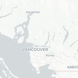
Mount Currie is a small community of roughly 1,200 people located in the South Chilcotin region of British Columbia, approximately 130 km north of Vancouver and about 30 km east of Whistler via Highway 99. It sits at the northern end of the Pemberton Valley, surrounded by glacier-capped peaks that give the area its striking visual character.
The community is home to the Lil'wat Nation, whose traditional territory spans a vast area of the southern Coast Mountains and Interior Plateau. The Lil'wat people have lived in this region for thousands of years and continue to maintain a strong cultural presence in Mount Currie. Visitors should be aware they are travelling through living Indigenous territory and approach accordingly.
For travelers, Mount Currie functions primarily as a gateway community — a quiet stop or overnight base for those heading into the backcountry, driving the scenic Duffey Lake Road (Highway 99) toward Lillooet, or visiting nearby Joffre Lakes Provincial Park. The village itself is unhurried and does not have extensive tourist infrastructure, which suits those seeking an alternative to the busier resort town of Whistler.
Before You Go
Visas and Entry
Mount Currie is located in Canada. Entry requirements vary by nationality. Check TravelerPulse's Visas section and the official Immigration, Refugees and Citizenship Canada (IRCC) website for current requirements before you travel.
What to Pack
- Layered clothing is essential; temperatures can shift significantly between valley floor and elevation, and conditions change quickly in mountain environments
- Bear spray is advisable if you plan to hike in the backcountry; check regulations on carrying it in provincial parks
- Cash is useful, as card payment options in very small communities can be limited — verify locally
- Download offline maps before arriving, as cell coverage can be patchy along Highway 99 and in the backcountry
Health and Prescriptions
The nearest hospitals and full medical facilities are in Whistler or Pemberton. If you require specific medications, ensure you bring an adequate supply. Travel health insurance covering mountain activities (hiking, backcountry skiing) is strongly recommended.
Getting There
By Road
Mount Currie is most commonly reached by car. From Vancouver, take Highway 99 north through Squamish and Whistler, then continue east through Pemberton — total driving time is roughly 2.5 to 3 hours depending on traffic and road conditions. Highway 99 through the Sea-to-Sky corridor is a well-maintained but winding mountain highway; drive attentively and allow extra time in winter.
From the east, Mount Currie can be approached via the Duffey Lake Road (Highway 99) from Lillooet. This route is scenic and less traveled but involves significant elevation change and may be closed or restricted seasonally due to snow or road conditions — check BC Ministry of Transportation road condition updates (DriveBC) before departure.
By Bus
BC Transit operates service connecting Pemberton and Whistler, and some regional bus options exist, but schedules and routes serving Mount Currie specifically should be verified locally or on the BC Transit website before travel. Having your own vehicle significantly expands your options in this area.
Nearest Airports
The closest commercial airport is Vancouver International Airport (YVR). Whistler also has a small airport; verify current scheduled service before planning around it.
Getting Around
A private vehicle is effectively essential for getting around Mount Currie and accessing the surrounding attractions. There is no local public transit within the village, and the distances between trailheads, parks, and points of interest make walking or cycling impractical for most visitors.
Roads in the area can be affected by seasonal conditions, particularly in winter and during spring snowmelt. Highway 99 over the Duffey Lake Road section is a mountain pass route and should be treated with appropriate caution. Check DriveBC (drivebc.ca) for current road conditions and closures before any drive along this corridor.
Where to Stay
Accommodation options within Mount Currie village are minimal. Travelers typically stay in Pemberton (approximately 10 km west) or Whistler (approximately 30–35 km west), both of which have established hotel, motel, and vacation rental markets.
For those wanting to stay closer to the backcountry, there are campgrounds in and around Joffre Lakes Provincial Park and along the Duffey Lake Road. Campsite availability can be competitive in summer — check the Discover Camping reservation system (BC Parks) well in advance. Glamping and farm-stay accommodation options exist in the broader Pemberton Valley; search current booking platforms and verify details directly with operators before booking.
Things to See & Do
Joffre Lakes Provincial Park
The most visited attraction in the immediate area is Joffre Lakes Provincial Park, located a short drive from Mount Currie on Highway 99. The park features a trail system leading past three glacier-fed turquoise lakes, with the upper lake situated directly beneath Matier Glacier. The route to the upper lake is moderately strenuous. The park has become very popular in recent years and BC Parks has at times implemented reservation or day-use permit systems — verify current access requirements on the BC Parks website before visiting.
Duffey Lake Road Scenic Drive
Highway 99 between Pemberton and Lillooet, known as the Duffey Lake Road, is considered one of British Columbia's most scenic drives. The route passes through old-growth forest, alongside glacier-carved lakes, and over mountain passes. It is worth traveling even if Lillooet is not your destination.
Cultural Engagement
Mount Currie is the home community of the Lil'wat Nation. The Lil'wat Nation has a cultural centre in the nearby town of Pemberton (verify current operations and visiting arrangements directly with the Lil'wat Nation). Approach any cultural sites or events with respect and follow any guidance provided by the community.
Outdoor Recreation
- Backcountry hiking and ski touring in the surrounding ranges attract experienced outdoor recreationists
- The Pemberton Valley, just west of Mount Currie, has farmland trails and cycling routes
- The area is known among climbers and mountaineers for access to demanding routes in the Cayoosh and Joffre ranges
Food & Drink
Food and dining options within Mount Currie itself are very limited. Travelers should not rely on finding a range of restaurants in the village. The nearby town of Pemberton, approximately 10 km to the west, has a more established selection of cafes, restaurants, and grocery stores — stock up there before venturing further.
If you are camping or staying in a self-contained accommodation, bringing supplies from Pemberton or Whistler is the most practical approach. Whistler has the largest selection of grocery and dining options in the corridor and is roughly 30–35 km from Mount Currie.
Practical Information
Money
Bring Canadian dollars in cash as a backup. Card acceptance may be limited at small local businesses. ATMs are available in Pemberton and Whistler.
Connectivity
Cell service is unreliable along much of Highway 99 east of Pemberton and in the backcountry. Download any maps, trail guides, or road information before leaving areas with reliable coverage.
Emergency Services
In an emergency, dial 911. For backcountry emergencies, RCMP and BC Emergency Health Services coordinate responses, but response times in remote mountain terrain can be lengthy. Consider carrying a personal locator beacon (PLB) or satellite communicator if heading into the backcountry.
Respect for the Land
Much of the surrounding land is within Lil'wat Nation traditional territory. Stay on designated trails, follow Leave No Trace principles, and observe any posted notices regarding access or cultural sensitivity.
Local Culture & Etiquette
Mount Currie is a Lil'wat Nation community. The Lil'wat are one of the St'át'imc peoples, whose culture, language, and governance are deeply rooted in this mountain landscape. Travelers visiting or passing through should approach the community as they would any Indigenous territory — with respect, without assumptions, and with awareness that this is not simply a scenic backdrop but a living homeland.
The Lil'wat Nation has its own governance structure and community institutions. Visitors should not wander into residential areas or onto private community land without invitation. If you are interested in learning about Lil'wat culture, the best approach is to seek out formally offered cultural programming or visit the Lil'wat Cultural Centre in Pemberton (verify current hours and programming directly).
Photography of community members or ceremonies without explicit permission is not appropriate. As with all Indigenous communities across Canada, the principle of self-determination means the community sets the terms of engagement with outsiders.