Overview
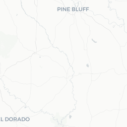
Wrightsville is a small incorporated city in Pulaski County, Arkansas, situated roughly 12 miles southeast of downtown Little Rock along US Highway 65. With a population of around 2,260, it functions largely as a residential community on the southern edge of the Little Rock metropolitan area.
The area is characterized by flat to gently rolling terrain typical of central Arkansas, with surrounding agricultural land and pine-mixed woodland. Visitors generally come through Wrightsville as part of a broader exploration of the Little Rock region rather than as a standalone destination.
Because of its small size, Wrightsville lacks the tourism infrastructure of larger cities. Travelers who choose to stop here will find a quiet, workaday Arkansas town that offers a genuine look at rural-edge community life in the South.
Before You Go
Visas & Entry
Wrightsville is located in the United States. For visa and entry requirements, visit TravelerPulse's Visas section and consult the official U.S. Customs and Border Protection website for current rules applicable to your nationality.
What to Pack
- Arkansas summers (June–August) are hot and humid; lightweight, breathable clothing and sunscreen are essential.
- Spring and fall bring pleasant temperatures but occasional rain — a light jacket and a compact umbrella are useful.
- Winter days can be cool to cold, occasionally dipping below freezing; layer accordingly.
Connectivity
Mobile coverage from major U.S. carriers is generally available in and around Wrightsville. Verify roaming terms with your carrier before travel if coming from outside the U.S.
Getting There
By Air
The nearest commercial airport is Bill and Hillary Clinton National Airport (LIT) in Little Rock, approximately 15–20 minutes by road depending on traffic. It serves a range of domestic routes via several major carriers. Verify current routes and schedules on the airport's official website.
By Car
Wrightsville sits directly on US Highway 65, making it straightforward to reach by personal vehicle or rental car from Little Rock. Interstate 530 is accessible nearby, connecting to Pine Bluff to the south.
By Bus
Verify locally whether Pulaski County or regional bus services extend to Wrightsville, as public transit options in small Arkansas communities can be limited or subject to change. The Central Arkansas Transit Authority (CATA) serves the broader Little Rock metro area — check their official site for current route coverage.
Getting Around
A personal vehicle is the most practical way to get around Wrightsville and the surrounding area. The community is small enough that most points within it are accessible in a short drive, but there is no local public transit or ride-share infrastructure within the town itself.
Ride-share apps (such as Uber and Lyft) may be available depending on driver availability in the area — verify the app in real time. Car rentals are best arranged at Little Rock's airport or in the city before heading south.
Things to See & Do
Wrightsville itself does not have established tourist attractions or landmarks. The town is most useful as a base for exploring the broader region rather than as a self-contained destination.
Nearby Natural Areas
Central Arkansas has numerous state parks, lakes, and trails within reasonable driving distance. Pinnacle Mountain State Park, Lake Maumelle, and the Arkansas River Trail system in Little Rock are all reachable within 30–45 minutes and offer hiking, cycling, and water recreation.
Agricultural Landscape
The fields and waterways surrounding Wrightsville reflect the farming heritage of central Arkansas. Driving the rural roads between Wrightsville and communities to the east provides an unfiltered view of Arkansas delta-edge landscape, particularly scenic during crop-growing seasons in late spring and early summer.
Food & Drink
Wrightsville has very limited dining options within the town limits. Travelers are advised to stock up or dine in Little Rock before arriving, or plan to make the short drive north for meals.
Local gas stations and convenience stores along US-65 may carry basic snacks and drinks. For sit-down dining, Southern comfort food, barbecue, and soul food restaurants are prevalent in the Little Rock area and reflect the broader culinary culture of Arkansas. Verify current operating businesses locally, as small-town establishments can open and close without wide notice.
Practical Information
Emergency Services
In any emergency in the United States, dial 911 for police, fire, or ambulance. For non-emergency local matters, contact the Pulaski County Sheriff's Office or verify contact details for Wrightsville's local government through Arkansas state or county directories.
Medical Care
The nearest hospitals and urgent care facilities are in Little Rock. Verify specific locations and hours before travel. Travel health insurance is advisable for international visitors, as U.S. healthcare costs can be significant without coverage.
Money
ATMs and banking services are limited within Wrightsville itself. Stock cash or ensure access to a card accepted widely before arriving. Credit and debit cards are standard at most U.S. businesses.
Fuel
Fuel stations are available along US-65 in and around Wrightsville. Prices vary — verify current local rates at the pump.
Safety
Wrightsville is a small residential community. As with any area adjacent to a larger city, standard urban-edge precautions apply: be aware of your surroundings, keep valuables out of sight in parked vehicles, and avoid unfamiliar areas after dark if you are unfamiliar with the neighborhood.
Arkansas occasionally experiences severe weather, including thunderstorms and, less commonly, tornadoes, particularly in spring and early summer. Monitor the National Weather Service (weather.gov) for alerts and follow local guidance if severe weather warnings are issued.