Translate
Overview
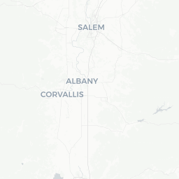
Turner is a small incorporated city in Marion County, Oregon, situated in the Willamette Valley roughly 8 miles southeast of Salem. With a population of around 2,000 residents, it functions largely as a quiet bedroom community and agricultural town rather than a major tourist destination.
The surrounding landscape is characteristic of the mid-Willamette Valley — flat to gently rolling farmland, with views toward the Cascade foothills to the east. The area supports agriculture including nursery crops and grass seed, industries common throughout Marion County.
Travelers typically encounter Turner while driving through the region or as a base for exploring the greater Salem area and nearby Willamette Valley attractions. It offers a glimpse of everyday small-town Oregon life without the crowds found in larger cities.
Getting There
By Car
Turner is the most practical way to reach Turner. It sits just off Oregon Route 22E (also known as the North Santiam Highway), which connects the town to Salem to the northwest and to the Cascade foothills and Detroit Lake to the east. From Salem, the drive is approximately 15–20 minutes.
By Bus
Salem's Cherriots regional transit system serves the greater Marion County area. Verify current routes and stops that include Turner directly with Cherriots, as service to smaller communities can change. The main Salem transit hub would be your likely connection point.
Nearest Airport
Salem's McNary Field (SLE) is the closest commercial airport, though it has limited scheduled service. Portland International Airport (PDX), approximately 60 miles north, is the primary regional hub with the broadest range of flights. Car rental from PDX is the most common way travelers reach Turner.
Getting Around
A personal vehicle is essentially required to get around Turner and the surrounding area. The town itself is small enough to walk across in minutes, but reaching nearby attractions, restaurants, or services in Salem makes a car necessary.
Ride-share services such as Uber and Lyft operate in the Salem metro area; availability in Turner specifically may be limited, particularly during off-peak hours. Verify availability before relying on these services.
Where to Stay
Turner itself has very limited lodging infrastructure given its size. Travelers should not expect a range of hotel options within the town limits.
Salem, just 8 miles away, offers the nearest practical range of accommodations — from national chain hotels near the interstate to smaller independent options closer to the city center. Booking in Salem and making day trips through Turner toward the Cascades or elsewhere in Marion County is the most practical approach for most visitors.
For those preferring a rural experience, the surrounding Marion County area occasionally has vacation rentals available through platforms such as Airbnb or Vrbo — verify listings and current availability directly.
Things to See & Do
Turner's primary appeal is its quiet, rural setting and convenient position along the North Santiam Highway corridor.
North Santiam Highway Corridor
Route 22 east of Turner leads toward the Cascade foothills, Detroit Lake State Recreation Area, and Santiam Pass. This makes Turner a natural stopping point for travelers heading into the mountains for fishing, camping, or scenic drives.
Proximity to Salem Attractions
The Oregon State Capitol, Willamette Heritage Center, and Bush's Pasture Park are all within a short drive in Salem. The broader Willamette Valley also offers winery visits, with several wine regions within easy reach.
Rural Exploration
The farmland and country roads around Turner suit cyclists and drivers interested in the pastoral Willamette Valley landscape. Marion County's agricultural scenery — particularly scenic in spring when fields are green — is a low-key draw for those who appreciate the unhurried pace of rural Oregon.
Food & Drink
Turner has limited dining options given its small population. Visitors should expect a handful of local establishments rather than a diverse restaurant scene. Verify current hours and operating status locally, as small-town businesses can change ownership or schedules.
For a broader selection of restaurants, cafes, and breweries, Salem is the practical option. Salem supports a growing food and beverage scene including farm-to-table dining, Pacific Northwest seafood, and several craft breweries and coffee roasters. The short drive makes Salem a convenient dining base when staying in the Turner area.
The Willamette Valley's wine country is also accessible, with tasting rooms in the broader region offering locally produced Pinot Noir, Pinot Gris, and Chardonnay.
Practical Information
Visas and Entry
Turner is in the United States. For visa and entry requirements, check TravelerPulse's Visas section and the official U.S. Customs and Border Protection website, as requirements vary significantly by nationality.
Connectivity
Cell service from major U.S. carriers (Verizon, AT&T, T-Mobile) is generally available in Turner and along the Route 22 corridor, though signal can weaken in the Cascade Mountain areas further east.
Services
Basic services — a post office, some local businesses — exist in Turner. For banking, medical services, grocery stores, and fuel, Salem provides more comprehensive options. It is advisable to fill up on fuel before heading east into the mountains on Route 22, as services thin out considerably past the foothills.
Emergency
Dial 911 for all emergencies in the United States. Marion County Sheriff's Office and Salem Fire/EMS serve the broader area. The nearest hospital with emergency services is in Salem — verify the specific facility with local sources.
Safety
Turner is a low-key rural community and does not present unusual safety concerns for travelers. Standard travel sensibilities apply: secure valuables in vehicles, be aware of surroundings in unfamiliar areas, and let someone know your plans if heading into the Cascade backcountry east of town.
Drivers on Route 22 heading toward the mountains should be aware that road conditions can change significantly in winter. Snow, ice, and chain requirements are common on mountain passes. Check ODOT TripCheck (Oregon Department of Transportation's road conditions site) before driving toward Santiam Pass, especially October through April.