Translate

Overview
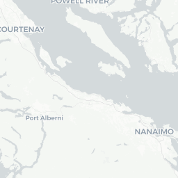
Bowser is a small unincorporated community on Vancouver Island's east coast, situated in the Regional District of Nanaimo between Qualicum Beach to the south and Courtenay/Comox to the north. With a population of roughly 1,700, it sits along the historic Highway 19A — the older coastal route that predates the inland Inland Island Highway — offering travelers a slower, more scenic alternative through this stretch of mid-Island.
The community fronts the Strait of Georgia, where low tides expose broad, sandy-to-gravel flats popular for walking, clam digging, and watching wildlife including herons, eagles, and migratory shorebirds. Bowser is not a destination with a dense attraction list; its appeal is largely about pace — campgrounds, ocean air, and proximity to better-known Oceanside communities.
For most visitors, Bowser functions as a comfortable overnight stop or a quiet base for exploring the broader Parksville–Qualicum Beach corridor. Services are limited but adequate for basic needs, and the surrounding area rewards travelers who enjoy nature over nightlife.
Before You Go
Entry and Visas
Bowser is in Canada. Entry requirements depend on your nationality. Check TravelerPulse's Visas section and the official Immigration, Refugees and Citizenship Canada (IRCC) website for current requirements before you travel.
When to Go
- Summer (June–September): Warmest and driest; beach activities, camping, and cycling are all at their best. Campgrounds book up quickly — reserve well in advance.
- Spring (April–May): Mild and quieter; good for birdwatching as shorebirds move through the Strait of Georgia.
- Fall (October–November): Cooler and rainier; storm-watching from the beach can be atmospheric. Most campgrounds reduce capacity or close.
- Winter: Quiet. Some local services may have reduced hours. Verify locally before visiting.
What to Pack
Layering is essential year-round on Vancouver Island. Rain gear is advisable even in summer. If you plan to dig for clams or mussels, bring rubber boots and check current shellfish harvest notices with the BC government (closures due to biotoxins occur periodically).
Getting There
By Road
Bowser straddles Highway 19A on Vancouver Island, approximately 15 km north of Qualicum Beach and roughly 35 km south of Courtenay. Driving is the most practical way to arrive. From Nanaimo (the major ferry terminal city), the drive is approximately 45–55 minutes north via Highway 19 or the slower, scenic Highway 19A.
By Ferry
Vancouver Island is accessible by BC Ferries from the BC mainland. The closest major terminal to Bowser is Departure Bay in Nanaimo (from Horseshoe Bay, West Vancouver) or Duke Point in Nanaimo (from Tsawwassen). From either Nanaimo terminal, Bowser is a straightforward drive north. Check BC Ferries (bcferries.com) for current schedules and reservations, which are strongly recommended in summer.
By Air
The nearest commercial airport with scheduled service is Comox Valley Airport (YQQ), approximately 35 km to the north, with connections to Vancouver and Calgary among other destinations. Nanaimo Airport (YCD) is farther south but also an option. Verify current routes and carriers directly with the airports.
By Bus
BC Transit and some intercity coach services operate along the Island Highway corridor. Verify current routes and stops locally, as service to small communities like Bowser can be limited.
Getting Around
A private vehicle is strongly recommended for getting around Bowser and exploring the surrounding area. The community is spread along Highway 19A and its side roads, and there is no local transit to speak of. Cycling is feasible along the quieter stretches of 19A, though highway shoulders vary in width — exercise caution.
Parking is generally easy and informal at beach access points and local businesses. Nearby Qualicum Beach and Parksville offer more services and are a short drive away.
Things to See & Do
Beaches and Shoreline
Bowser's most distinctive feature is its coastline on the Strait of Georgia. At low tide, the flats extend considerably, making for long walks and opportunities to spot crabs, clams, and shorebirds. Access points are available along Beach Road and surrounding lanes — verify public access points locally.
Birdwatching
The coastal wetlands and estuary areas around Bowser attract a variety of waterfowl and shorebirds, particularly during spring and fall migration. Great blue herons are common year-round. The broader Qualicum Beach area is recognized for its birdwatching and the Milner Gardens & Woodland (in Qualicum Beach) is worth a short drive.
Cycling Highway 19A
The historic 19A corridor through this stretch of Vancouver Island is a popular cycling route, passing through small communities with ocean views. It is less trafficked than the main inland highway, though riders should still be alert to vehicle traffic.
Day Trips
Bowser's location makes it a good base for day trips to Qualicum Beach, Parksville (with Rathtrevor Beach Provincial Park), and the Comox Valley to the north. Hornby Island and Denman Island, accessible by small ferry from nearby Buckley Bay, are a popular excursion and worth planning a separate day around.
Camping and Outdoors
Several campgrounds operate in and near Bowser. Demand is high in summer; book ahead. Confirm current availability and amenities directly with individual operators.
Food & Drink
Bowser's dining options are limited given its size. There are a small number of local establishments along Highway 19A — expect casual, unfussy food rather than destination dining. A general store and small local businesses handle basic grocery and convenience needs.
For a broader selection of restaurants and cafés, Qualicum Beach (approximately 15 km south) offers a well-regarded dining scene by small-town Vancouver Island standards, with several well-reviewed independent restaurants. Parksville, a short drive further south, has supermarkets and a wide range of food options. Verify current opening hours locally, as small-town establishments on Vancouver Island often have seasonal or limited schedules.
Practical Information
Money
Canadian dollars are the currency. There may be limited ATM access in Bowser itself — carry cash if needed, or use ATMs in Qualicum Beach or Parksville before arriving.
Connectivity
Cell coverage along Highway 19A is generally adequate with major Canadian carriers, but can be patchy in some rural side roads and on nearby islands. Check with your carrier.
Shellfish Harvesting
If you plan to harvest clams or other bivalves from the beach, check current Fisheries and Oceans Canada (DFO) shellfish closure notices before doing so. Biotoxin closures are common and change regularly.
Emergency Services
Dial 911 for emergencies. The nearest hospital services are in Qualicum Beach and Courtenay/Comox. Verify the location of the nearest medical clinic or hospital upon arrival.
Fuel
Fuel is available in Bowser and along Highway 19A. Prices on Vancouver Island are generally higher than mainland Canada averages.
Safety
Bowser is a quiet, low-crime community. Standard rural travel precautions apply: lock vehicles, don't leave valuables visible, and be aware of your surroundings near waterways and forested areas.
Ocean safety: the Strait of Georgia is calm compared to the open Pacific, but tides can be strong and waters are cold year-round. Supervise children near the water and be aware of how quickly tides can come in across the flat beach areas.
Wildlife: black bears are present in the broader region. Follow BC's WildSafeBC guidelines if you encounter wildlife, particularly around campgrounds and forested trails.