Overview
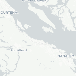
Port Alberni sits at the head of the Alberni Inlet, the longest inlet on Vancouver Island at roughly 40 kilometres, and is home to about 20,000 people. The city occupies a narrow valley flanked by the mountains of central Vancouver Island, giving it a distinct feel compared to the island's coastal resort towns. It is a working city with roots in the forestry and fishing industries, and that practical character shapes the experience for visitors.
The city is perhaps best known among anglers as one of British Columbia's premier salmon-fishing destinations, particularly for Chinook salmon. Beyond fishing, it serves as the main inland gateway to the Pacific Rim National Park Reserve, Tofino, and Ucluelet — making it a logical overnight stop or base for those travelling across Vancouver Island. The Alberni Inlet also provides access by boat to the remote Broken Group Islands and Barkley Sound.
Port Alberni has invested in heritage tourism around its forestry past, with working steam locomotives, a historic railway, and the McLean Mill National Historic Site adding texture to a visit. Visitors who look only at it as a transit point often miss a genuinely interesting stop.
Before You Go
Visas and Entry
Canada's entry requirements vary by nationality. Check TravelerPulse's Visas section and the official Immigration, Refugees and Citizenship Canada (IRCC) website for current requirements before booking.
Weather
Port Alberni sits in a rain shadow that makes it noticeably drier and warmer in summer than the outer coast. Summers (June–August) are warm and mostly sunny, with daytime temperatures commonly reaching the mid-20s°C. Winters are mild but wet, with occasional snow. The inlet geography can also concentrate heat in July and August, making Port Alberni one of the warmer spots on Vancouver Island. Pack layers regardless of season.
What to Bring
- Fishing licence if you plan to fish — required for saltwater and freshwater; purchase through the federal or provincial government portal (verify current process online)
- Rain gear for shoulder seasons
- Bear spray if hiking in backcountry areas
- Cash and cards; most businesses accept major cards, but smaller operators or remote sites may prefer cash
Getting There
By Road
Port Alberni is reached via Highway 4, which connects it to Parksville on the east coast of Vancouver Island (approximately 50 km) and continues west to Ucluelet and Tofino. The mountain section of Highway 4 between Parksville and Port Alberni includes steep grades and curves — drive cautiously, particularly in wet conditions or when RV towing. The highway is paved throughout.
By Bus
BC Transit and inter-regional coach services connect Port Alberni to other Vancouver Island communities. Verify current schedules and operators locally or through BC Transit's website, as service patterns change.
By Boat — MV Frances Barkley
One of the more distinctive ways to arrive or depart is aboard the MV Frances Barkley, a working freight and passenger vessel operated by Lady Rose Marine Services. The ship travels the Alberni Inlet between Port Alberni and communities including Bamfield and Ucluelet, with stops at the Broken Group Islands. Schedules are seasonal; verify current sailing days and booking procedures directly with the operator before planning around this option.
Nearest Airports
The closest major airport is Nanaimo Airport (YCD), roughly 90 km to the east. Vancouver International Airport (YVR) is accessed via BC Ferries and then road, or via float plane services to the island. There is a small local airport (Alberni Valley Regional Airport) serving private and charter traffic.
Getting Around
Port Alberni is a driving city. Most attractions, the waterfront, and the McLean Mill are spread across an area that is not easily walkable in a single trip. A rental car or your own vehicle is the most practical way to get around.
BC Transit operates local bus routes within the city. Coverage is functional for core routes but limited for outlying sites such as McLean Mill — verify schedules at bctransit.com before relying on public transit for specific attractions.
The downtown core and the waterfront Harbour Quay area are walkable from each other and pleasant on foot in good weather. Cycling infrastructure exists but is limited; the Inlet and surrounding trails are better suited to mountain biking than urban cycling.
Where to Stay
Accommodation in Port Alberni ranges from motels and independent hotels along the main highway corridors to bed-and-breakfasts and vacation rentals in residential areas. There is no large resort property in the city itself.
For those arriving in summer during peak fishing season, booking ahead is advisable, as accommodation can fill quickly when Chinook runs are active and guided fishing parties are in town.
Camping is available at Sproat Lake Provincial Park, a short drive west of the city, which has both serviced and unserviced sites. Reserve through BC Parks' reservation system (reserve.bcparks.ca) well in advance for summer weekends. Additional campgrounds exist along Highway 4 toward Tofino.
Things to See & Do
Salmon Fishing
Port Alberni is widely regarded as the "Salmon Capital of the World" — a claim tied to its historically significant Chinook runs in the Somass River and Alberni Inlet. Guided charters operate out of Harbour Quay and the inlet. A valid saltwater or freshwater fishing licence is required and must be purchased before fishing; check Fisheries and Oceans Canada for current regulations and licence information, as fishing seasons and quotas change annually.
McLean Mill National Historic Site
This former steam-powered sawmill, designated a National Historic Site, offers a rare look at early-20th-century logging operations. The Alberni Pacific Railway runs a steam train between the mill and the city's railway station on operating days. Hours and operating season vary — check with the Alberni Valley Museum or the City of Port Alberni for current schedule information before visiting.
Harbour Quay
The waterfront area at the foot of Argyle Street has been redeveloped as a public gathering space with shops, restaurants, a marina, and the departure point for the MV Frances Barkley. The Alberni Valley Museum and the Paper Mill Dam fish ladder are also accessible from the broader waterfront area.
Outdoor Activities
- Hiking: The surrounding mountains offer trails ranging from short walks to multi-day backcountry routes. The Mount Arrowsmith Massif and Della Falls (one of Canada's tallest waterfalls, accessed via Great Central Lake) are notable destinations for experienced hikers.
- Kayaking and Paddling: Great Central Lake and the Sproat Lake Provincial Park are popular flat-water paddling areas. Sproat Lake is also home to the Martin Mars water bombers, large heritage aircraft occasionally on display.
- Wildlife Watching: Black bears, Roosevelt elk, and a range of bird species inhabit the valley. The Somass River sees significant salmon runs in season that attract eagles and other wildlife.
Food & Drink
Port Alberni's dining scene is modest in scale and unpretentious in character. The city has a range of local restaurants, pubs, and cafés concentrated around downtown and along Johnston Road, the main commercial strip.
Fresh seafood is a reasonable expectation given the fishing culture, though menu quality varies by establishment. Local pubs are generally reliable for casual meals. The Saturday Farmers Market (verify current schedule locally) offers seasonal produce and local products during summer months.
Visitors looking for fine dining or a wide range of international cuisine should set expectations appropriately for a city of this size. Tofino, roughly 90 minutes west, has a more developed restaurant scene if that is a priority.
Practical Information
Emergency Services
Dial 911 for police, fire, or ambulance emergencies anywhere in Canada.
Health
West Coast General Hospital is located in Port Alberni and provides emergency services. For non-emergency medical needs, walk-in clinics operate in the city — verify current hours locally.
Money
ATMs are available at major banks downtown and at larger grocery stores. Credit cards are widely accepted in shops and restaurants. Some charter fishing operators, farmers market vendors, and remote recreation operators may prefer or require cash.
Connectivity
Major Canadian carriers (Rogers, Telus, Bell) provide coverage in Port Alberni itself, but signal can be unreliable or absent on Highway 4 through the mountains and in backcountry areas. Download offline maps before heading out.
Useful Contacts
- Tourism Alberni Valley: verify current contact details at albernivalley.com
- BC Parks (Sproat Lake, camping): bcparks.ca
- Fisheries and Oceans Canada (fishing licences and regulations): dfo-mpo.gc.ca
Safety
Port Alberni is a safe city for travellers by most measures. Standard urban precautions apply downtown, particularly around the main commercial strip at night.
The primary safety considerations are outdoor-related. Highway 4 through the mountains can be hazardous in poor weather, after heavy rain (rockfall risk), or in winter conditions — check DriveBC (drivebc.ca) for road conditions before travelling. Wildlife encounters, particularly with black bears, are possible on trails and even in suburban areas near the forest edge; carry bear spray and know how to use it.
Della Falls and other backcountry destinations require proper trip planning, navigation skills, and informing someone of your itinerary. Water levels on rivers can change rapidly in wet weather.