Overview
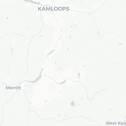
Cache Creek is a small village of roughly 1,000 people situated at the confluence of Cache Creek and the Thompson River, about 340 km northeast of Vancouver. It sits at the junction of Highway 1 (Trans-Canada) and Highway 97, making it one of the most strategically placed stopping points in BC's southern interior.
The landscape here is semi-arid — sagebrush, bunch grass, and eroded hills rather than coastal rainforest. The area receives far less rainfall than the Lower Mainland, and summer temperatures can climb well above 30°C. That desert character gives Cache Creek a distinct identity within British Columbia.
Historically, the village was a waypoint on the old Cariboo Wagon Road, which carried gold seekers north to the Bcariboo goldfields in the 1860s. Traces of that history still shape the town's character and some of its heritage sites. Today Cache Creek functions primarily as a service hub for travellers and the surrounding ranching and farming community.
Before You Go
Visas and Entry
Entry requirements for Canada vary by nationality. Check TravelerPulse's Visas section and the official Immigration, Refugees and Citizenship Canada (IRCC) website for current requirements before booking.
What to Pack
- Sun protection is essential year-round but especially May–September; UV exposure is high in the semi-arid interior.
- Evenings can be surprisingly cool even in summer — bring a light layer.
- If travelling in winter, be prepared for road closures or chain requirements on mountain passes leading into the area.
Health
Cache Creek is a small community with limited medical facilities. The nearest hospital with full services is in Kamloops (approximately 80 km east). Travel insurance that covers medical evacuation is recommended for visitors unfamiliar with rural BC.
Getting There
By Road
Cache Creek sits directly on Highway 1 and Highway 97, making it easily accessible by car from Vancouver (roughly 3.5–4 hours under normal conditions), Kamloops (under 1 hour), and Kelowna (via Highway 97, approximately 2.5 hours). The Trans-Canada through the Fraser Canyon can be subject to seasonal closures or delays — check DriveBC (drivebc.ca) for current road conditions before departing.
By Bus
Scheduled intercity bus services connecting Vancouver, Kamloops, and Prince George historically stopped in Cache Creek, but service levels and operators change. Verify current options and schedules through BC regional transit providers or national carriers before travel.
By Air
There is no commercial airport in Cache Creek. The nearest airports with regular service are Kamloops Airport (YKA) to the east and Vancouver International Airport (YVR) to the west.
Getting Around
Cache Creek is a small, walkable village for its core services. A private vehicle is strongly recommended for exploring the surrounding region, including the Bonaparte Plateau, the Thompson River area, and nearby heritage sites. There is no local public transit system. Fuel, basic vehicle services, and supplies are available in the village — a practical consideration if you are continuing north on Highway 97 toward the Cariboo, where services become more widely spaced.
Where to Stay
Accommodation in Cache Creek is geared toward highway travellers — expect motels, RV parks, and campgrounds rather than boutique hotels. Several properties along the highway corridor offer basic but functional rooms. Campgrounds in the area can be popular in summer, so booking ahead is advisable during peak travel months (July and August).
For a broader choice of accommodation styles and price points, Kamloops is the practical alternative for those who don't mind a short daily drive. Verify current availability and pricing directly with properties or through booking platforms before your trip.
Things to See & Do
Historic Cariboo Wagon Road
Cache Creek was a key stop on the historic Cariboo Wagon Road built in the 1860s during the gold rush era. Interpretive signage and remnants of that era are found in the broader region, and the BC Interior's gold rush heritage is well documented at several nearby communities.
Scenic Drives and Desert Landscapes
The Bonaparte Valley north of Cache Creek along Highway 97 offers striking semi-arid scenery, small lakes, and ranchland. The drive toward Ashcroft (approximately 18 km west) passes through dramatic eroded terrain and the Thompson River canyon.
Fishing
The Thompson River and nearby Bonaparte River and lakes in the region are known for fishing. Regulations and licensing requirements apply — verify current rules with the BC Ministry of Forests and that region's Freshwater Fisheries Society before fishing.
Rockhounding
The semi-arid interior around Cache Creek has a modest reputation among rockhounds for jade and other minerals found in the broader region. Verify land access and any permit requirements locally before collecting.
Passing Through vs. Staying
Many visitors treat Cache Creek as a rest stop. If you have time, the surrounding landscape rewards a slower pace — even a few hours exploring the Bonaparte Plateau or driving down to the Thompson River is worthwhile.
Food & Drink
Cache Creek has a modest selection of diners, fast-food outlets, and highway-oriented restaurants that cater primarily to travellers. Expect practical, no-frills options rather than fine dining. A handful of independent spots serve hearty road-food staples. Grocery supplies are available in the village for those self-catering in the region.
For a wider restaurant selection, Kamloops (approximately 80 km east) offers a full range of dining options. Ashcroft, just west, is smaller still, but the short drive to Kamloops is the practical choice for a full evening out.
Practical Information
Money
ATMs and basic banking services are available in Cache Creek, though options are limited for a village of this size. Carry some cash when exploring remote areas of the surrounding region.
Connectivity
Mobile coverage is generally available in the village itself but can be patchy or absent on rural roads in the Bonaparte Valley and surrounding backcountry. Download offline maps before heading out.
Fuel
Fuel is available in Cache Creek. If heading north on Highway 97 toward 100 Mile House or south through the Fraser Canyon, note that service intervals can be long — fill up before leaving.
Emergency Services
Dial 911 for police, fire, and ambulance in Canada. The RCMP serves the Cache Creek area. For serious medical emergencies, the nearest full hospital is in Kamloops — confirm current services locally.
Safety
Cache Creek is a quiet, low-crime community. Standard travel precautions apply. The primary safety considerations are environmental and road-related: summer heat can be intense, winter driving on BC interior highways requires appropriate tires and preparation, and wildfire smoke can affect air quality during dry summer months. Check BC Wildfire Service advisories (bcwildfire.ca) if travelling between June and September. Wildlife — including deer, coyotes, and occasionally black bears — may be encountered on rural roads; drive cautiously at dawn and dusk.