Translate
Overview
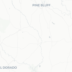
Sherwood is a mid-sized suburban city in Pulaski County, Arkansas, situated just north of Little Rock along the Arkansas River corridor. With a population of roughly 30,000, it functions primarily as a residential community that offers travelers a quieter, more affordable alternative to staying in the state capital itself.
The city sits on flat to gently rolling terrain typical of central Arkansas's lowlands. While Sherwood lacks a dense tourist infrastructure of its own, its location makes it a practical staging point for day trips into Little Rock, the Arkansas River Trail system, and the natural and cultural attractions scattered across the region.
Visitors who end up in Sherwood are often here for family, business, or as part of a broader Arkansas road trip. The city has the everyday amenities — chain restaurants, grocery stores, gas stations, and accommodations — that make it a functional stop, even if the destination itself is understated.
Before You Go
Visas and Entry
Sherwood is in the United States. For visa and entry requirements, check TravelerPulse's Visas section and the official U.S. Customs and Border Protection website, as rules vary significantly by nationality.
Climate
Central Arkansas has a humid subtropical climate. Summers (June–August) are hot and humid, with temperatures frequently exceeding 90°F (32°C). Winters are mild but can bring occasional ice storms, which are more disruptive in Arkansas than snow. Spring and autumn offer the most comfortable conditions for outdoor activity. Tornado season is broadly March through May; monitor weather alerts.
What to Pack
- Lightweight, breathable clothing for summer visits
- A rain layer year-round; spring storms can be intense
- Comfortable walking or hiking shoes if you plan to use regional trails
- Insect repellent, especially near waterways in warmer months
Getting There
By Air
The nearest major airport is Bill and Hillary Clinton National Airport (LIT) in Little Rock, approximately 10–15 miles south of Sherwood, depending on your exact destination within the city. Verify current airline routes and ground transportation options directly with the airport or your carrier.
By Car
Sherwood is easily reached via Interstate 40 (east–west) and Arkansas Highway 107 (north–south). If you are driving through Arkansas, the city is a convenient off-highway stop. A car is effectively essential for getting around once you arrive.
By Bus
Greyhound and other intercity bus services operate through Little Rock. Check current schedules and stops at the carrier's website, then plan local transportation from Little Rock into Sherwood.
Getting Around
Sherwood is a car-dependent community. Most businesses, parks, and points of interest are spread along arterial roads and are not easily walkable between. Having your own vehicle or a rental car is strongly recommended.
Rideshare services (Uber and Lyft) are available in the Little Rock metro area and generally extend to Sherwood, though availability may be more limited than in the urban core — verify locally. Public transit connections between Sherwood and Little Rock exist through Central Arkansas Transit (CAT); check their current routes and schedules on the CAT website before your trip, as service patterns change.
Things to See & Do
Sherwood itself is primarily residential, so travelers typically combine local green space with attractions in adjacent Little Rock.
Local Parks and Outdoor Space
- Sherwood Forest Park and other municipal green spaces offer walking paths, sports facilities, and picnic areas suitable for a relaxed afternoon. Verify current park hours and amenities with the City of Sherwood Parks Department.
- The Arkansas River Trail network is accessible within a short drive; this multi-use trail extends for miles along both banks of the Arkansas River and connects to Little Rock and North Little Rock trail systems.
Day Trips from Sherwood
- Little Rock Central High School National Historic Site — a significant civil rights landmark, roughly 15–20 minutes south
- Arkansas State Capitol — worth a visit for architecture and history
- Pinnacle Mountain State Park — a popular hiking destination west of Little Rock
- MacArthur Museum of Arkansas Military History in downtown Little Rock
Most of the region's cultural and recreational draw is centered in Little Rock and North Little Rock, both easily reached within 15–20 minutes.
Food & Drink
Sherwood's dining scene is dominated by national chains and casual American fare, which you will find clustered along Sherwood's main commercial corridors. For a wider selection of independent and regional restaurants, the short drive into Little Rock or North Little Rock opens up considerably more options, including Arkansas-style barbecue, Southern comfort food, and an emerging farm-to-table scene.
What to Look For Locally
- Casual American diners and family-style restaurants are the norm
- Fast food and chain options are plentiful along Highway 107 and the main commercial strips
- Grocery stores and convenience stores are easy to find for self-catering
If you are specifically seeking Arkansas culinary experiences — catfish, barbecue, fried pies — plan a meal in Little Rock or ask locals for current neighborhood favorites, as independent restaurants open and close frequently.
Practical Information
Emergency Services
For emergencies in the United States, dial 911. This connects to police, fire, and emergency medical services.
Connectivity
Cell coverage from major U.S. carriers (AT&T, Verizon, T-Mobile) is reliable in Sherwood. Free Wi-Fi is available at the local public library; verify hours locally.
Banking and ATMs
Major U.S. banks and ATMs are present in Sherwood's commercial areas. Credit and debit cards are widely accepted at businesses.
Medical
There are medical clinics and pharmacies within Sherwood. For hospital-level care, facilities in Little Rock are a short drive away. Verify current locations and hours before your trip, as healthcare infrastructure changes.
Safety
Sherwood is a generally safe suburban community. Standard urban-area precautions apply: do not leave valuables visible in parked cars, be aware of your surroundings after dark in unfamiliar areas, and keep copies of important documents separate from the originals.
Central Arkansas is within Tornado Alley's broader risk zone. Download a weather alert app (the National Weather Service app is free) and familiarize yourself with shelter-in-place procedures at your accommodation if you are visiting during spring storm season (roughly March–May). Ice storms in winter can make roads hazardous; check road conditions through the Arkansas Department of Transportation before driving.