Translate

Overview
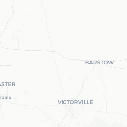
Lake Hughes is a small, unincorporated community in the northwestern corner of Los Angeles County, California, sitting at roughly 3,000 feet elevation in the mountains north of the Santa Clarita Valley. With a population of under 700 people, it functions primarily as a quiet residential enclave and a low-key recreational stop for visitors seeking an escape from the urban sprawl of greater Los Angeles.
The community takes its name from the nearby Lake Hughes reservoir, a small man-made lake that has historically drawn anglers, picnickers, and campers. The surrounding terrain — high chaparral, oak woodland, and scrubby hillsides — is characteristic of the Transverse Ranges and offers hiking, wildlife watching, and a genuine sense of rural remoteness that is rare given the area's proximity to a major metropolitan region.
Because of its size, Lake Hughes offers minimal commercial infrastructure. Visitors should approach it as a nature-oriented retreat rather than a destination with conventional tourism amenities. The region was also significantly affected by wildfires in 2020 (the Lake Fire), so landscapes along certain corridors show ongoing recovery — a reminder of the fire ecology that shapes Southern California's mountains.
Before You Go
Visas
Lake Hughes is in the United States. For visa requirements, check the TravelerPulse Visas section and the official U.S. Citizenship and Immigration Services (USCIS) website, as rules vary by nationality.
Fire and Weather Awareness
The area sits within a high fire-hazard severity zone. Before visiting, check current fire restrictions and any closures with the Angeles National Forest (verify current contact details and resources on the USDA Forest Service website). During hot, dry summer months, fire danger can restrict campfires and certain activities.
What to Bring
- Sufficient water — services are extremely limited locally
- A paper or offline map; cell coverage is unreliable in the mountains
- Sun protection and layers, as temperatures can swing significantly between day and night at elevation
- A full tank of gas before leaving the highway; there is no guarantee of fuel availability in the community itself
Getting There
By Car
The most practical way to reach Lake Hughes is by private vehicle. From the Los Angeles area, the typical route runs north on Interstate 5, then northeast on Lake Hughes Road from Castaic, climbing into the mountains. The drive from central Los Angeles is roughly 60–75 miles, depending on your starting point, but allow extra time for mountain road conditions.
Nearest Airports
The closest major airport is Hollywood Burbank Airport (BUR), followed by Los Angeles International Airport (LAX). Neither has direct public transit connections to Lake Hughes; a rental car is effectively essential.
Public Transit
Regular public transit service to Lake Hughes does not exist in a meaningful form for visitors. The community's remote location makes a personal vehicle or ride-share (coverage may be limited) the only realistic options.
Getting Around
Lake Hughes is small enough that the community itself is walkable, but accessing nearby natural areas, trailheads, and the reservoir requires a vehicle. Roads in the surrounding mountains can be narrow and winding; drive cautiously, particularly after rain when surfaces may be slick or debris may be present.
Cell coverage is intermittent throughout the area. Download offline maps (Google Maps, Maps.me, or similar) before leaving reliable service. There are no local taxi or rideshare services operating predictably in this community.
Where to Stay
Traditional hotel accommodations do not exist in Lake Hughes. Lodging options are primarily camping — both within Angeles National Forest (check permit requirements on the Forest Service website) and potentially through private campgrounds or RV parks in the vicinity. Verify current availability and reservation requirements before your trip, as fire damage and seasonal closures can affect access.
Short-term rental platforms (such as Airbnb or VRBO) may list properties in the surrounding rural area; search the Lake Hughes and Elizabeth Lake zip codes for cabin or home rentals. For a wider range of hotels, Castaic and Santa Clarita to the south are the nearest towns with conventional accommodation options.
Things to See & Do
Lake Hughes Reservoir
The reservoir is the community's namesake and primary attraction. It has historically been used for fishing and lakeside relaxation. Access and permitted activities can vary by season and water conditions — verify current access status locally or through Los Angeles County resources before visiting.
Angeles National Forest
The national forest surrounds the area and offers hiking, dispersed camping (with permits where required), mountain biking, and wildlife observation. Trails range from easy walks to more strenuous ridge routes with views across the Antelope Valley and back toward the San Fernando Valley. Check the USDA Forest Service website for current trail conditions and permit requirements.
Scenic Driving
Lake Hughes Road and connecting routes through the mountains provide scenic drives through recovering and intact chaparral landscapes. The route connecting toward Elizabeth Lake and then down to Palmdale offers a pleasant loop through varied high-desert and mountain terrain.
Stargazing
Due to its distance from dense urban development and low local light pollution, Lake Hughes and the surrounding hills offer notably good conditions for amateur stargazing on clear nights.
Food & Drink
Commercial dining options in Lake Hughes are extremely limited and cannot be guaranteed to be operating at any given time for a community of this size. Visitors should plan to bring their own food and beverages or stop in Castaic, Santa Clarita, or Lancaster before making the mountain drive.
There is no supermarket in Lake Hughes itself. Stocking up on groceries, snacks, and water in a larger nearby town before arrival is strongly recommended, especially for multi-day camping or hiking trips.
Practical Information
Emergency Services
For emergencies in the United States, dial 911. The nearest hospitals are in Santa Clarita or the broader Los Angeles County system. Response times in remote mountain communities can be longer than in urban areas — factor this into trip planning, especially for strenuous outdoor activities.
Connectivity
Mobile coverage is patchy. Major carriers have partial coverage along main roads, but dead zones exist throughout the mountains. Do not rely on real-time navigation or communication without a backup plan.
Fuel and Supplies
Fuel is not reliably available in Lake Hughes. Fill up in Castaic (on Interstate 5) or another nearby town before ascending.
Seasonal Road Conditions
Winter storms can bring snow, ice, and road closures to the mountains above Lake Hughes. Check Caltrans road condition resources (quickmap.dot.ca.gov) before traveling in winter months.
Safety
Lake Hughes is a quiet rural community with no particular safety concerns related to crime. The primary risks are environmental: wildfire, flash flooding in drainage areas after heavy rain, rattlesnakes and other wildlife on trails, and the general hazards of remote outdoor recreation.
Always tell someone your plans when hiking or camping in this area. Carry more water than you think you need — dehydration is a genuine risk in Southern California's dry climate, even at elevation. If you encounter smoke or signs of fire, leave the area immediately by the most direct paved route and contact emergency services.