
268
Routes
6
Hubs
BEE
ICAO
BE
IATA
TravelerPulse profile
Connecting regional UK and European destinations.
Founded
1979
Headquarters
Birmingham, United Kingdom
Flybe is a British regional airline that has operated as one of Europe's largest regional carriers, specializing in connecting smaller UK cities and towns with each other and with major European destinations. Originally founded as Jersey European Airways, the airline rebranded to British European in 2000 and then to Flybe in 2002, growing to serve dozens of routes across the United Kingdom and Europe.
Flybe entered administration in March 2020, ceasing operations at the onset of the COVID-19 pandemic. The airline was subsequently relaunched in April 2022 under new ownership, resuming flights from its base at Birmingham Airport with a focus on underserved regional UK routes.
The revived Flybe again entered administration in January 2023, grounding its fleet and ending operations for a second time. Despite repeated efforts to sustain a regional air network in the UK, the airline faced persistent financial challenges in a difficult post-pandemic market.
Hubs & network
Flybe primarily operated from Birmingham Airport, with additional focus on Belfast City, Aberdeen, and other regional UK airports.
Fleet
Flybe operated a fleet primarily composed of Bombardier Dash 8 Q400 turboprop aircraft, with some Embraer regional jets used in earlier configurations.
Notable facts
- ›Originally founded as Jersey European Airways in 1979 before rebranding to Flybe in 2002.
- ›At its peak, Flybe was considered one of Europe's largest regional airlines by number of routes.
- ›The airline collapsed into administration in March 2020, coinciding with the COVID-19 pandemic.
- ›Flybe was relaunched in April 2022 under new ownership but collapsed again in January 2023.
- ›The airline focused heavily on connecting UK regions not well served by major hub-and-spoke carriers.
This profile is provided for general information only. Contact details may be inaccurate or outdated — always verify with the airline's official website before acting on them.
Primary hubs
Route network map (266 legs)

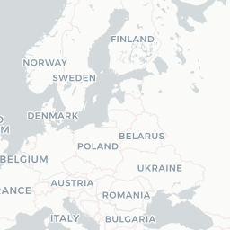





Leaflet © OpenStreetMap © CARTO
Route network
ALC → BHXE75
ALC → SOUE95
AMS → EXTDH4
BEB → SYYSF3
BHD → MANE75 DH4
BHX → AMSE75 DH4
BHX → CDGE95
BHX → DBVE75
BHX → GLADH4 E75
BHX → INVDH4 E75
CDG → ABZEMJ
CDG → NCLARJ
CGN → BHXDH4 E75
DUB → SOUDH4 E95
EDI → MANDH4 E75
EDI → SOUDH4
EDI → WICD38
EXT → ALCE95
EXT → AMSDH4
EXT → CDGDH4
EXT → DUBE95
EXT → DUSDH4
EXT → FAOE95
EXT → JERDH4
EXT → PMIE95
GCI → SOUDH4
GLA → BEBSF3
GLA → KOISF3
GLA → LSISF3
GLA → MANDH4
GLA → SOUDH4
GLA → SYYSF3
GLA → TRESF3 DHT
HAJ → BHXE75
HEL → JYVAT7
ILY → GLASF3
INV → BHDDH4
INV → BHXDH4 E75
INV → SYYSF3 D38
IOM → MANDH4 E75
JER → DSAE75
JER → HUYE75
JER → NWIDH4
KOI → ABZSF3 S20
KOK → HELAT7
LBA → BHDDH4
LGW → NQYDH4
MAN → HAJE75
MAN → INVDH4
MAN → MXPE75
MRS → ORY32S
NWI → EDID38
NWI → GCID38
OPO → BHXE75
ORY → SOUDH4
PMI → SOUE95
SOU → BHDDH4
SOU → NCLDH4
ABZ → BHDDH4
ABZ → CDGEMJ
ABZ → LSISF3 S20
AGP → EXTE95
ALC → EXTE95
AMS → INVDH4
AMS → SOUDH4 E75
BHD → GLADH4
BHD → INVDH4
BHX → BHDDH4 E75
BHX → HAJE75
BHX → IOMDH4
BHX → LYSE75
BHX → OPOE75
BHX → WATDH4
BRR → GLADHT
CDG → BHXE95
CDG → EDIARJ
CFN → DUBSF3
DND → STND38
DUS → BHXE75 DH4 E95
EDI → JERDH4
Fleet (aircraft types operated)
Encyclopaedia
Flybe may refer to:Flybe (1979–2020), a defunct regional British airline based in Exeter Flybe (2022–2023), a defunct regional British airline based in Birmingham
Read full article on WikipediaLatest news
The Global Legal Post· 10/28/2026
Former Fiji Airways and Flybe CEO joins Clyde & Co
Read at The Global Legal Post
Euronews· 3/5/2020
Thousands stranded as Europe's largest regional airline collapses
Read at Euronews
Reuters· 1/28/2023
UK regional airline Flybe ceases trading, cancels all flights
Read at Reuters
BBC· 1/15/2020
Flybe: Airline and rail rivals attack government rescue
Read at BBC
The New York Times· 1/28/2023
British Airline, Flybe, Collapses a Second Time (Published 2023)
Read at The New York Times
Business Insider· 3/5/2020
What it was like to travel on Flybe, the budget airline used by the royals that just declared bankruptcy
Read at Business Insider
