Overview
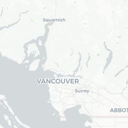
Powell River sits at the northern end of the Sunshine Coast in British Columbia, accessible by ferry from Metro Vancouver or from Vancouver Island. With a population of roughly 13,000, it has a small-city feel while offering an outsized range of outdoor activities — long-distance hiking, kayaking, freshwater and saltwater diving, and cycling among them.
The city is built around a pulp mill that has operated since 1912, and the adjacent Townsite neighbourhood is a designated National Historic District, one of the best-preserved examples of a company-planned town in Canada. That industrial heritage sits alongside arts communities, independent businesses, and a regional hospital that makes it a genuine year-round hub for the northern Sunshine Coast.
Powell Lake and dozens of smaller lakes feed into surrounding forest, while Desolation Sound — one of British Columbia's most celebrated marine areas — lies within easy boating distance to the north. For travelers who want wilderness access without leaving behind basic amenities, Powell River offers a workable balance.
Before You Go
Visas and Entry
Powell River is in Canada. Entry requirements depend on your nationality and travel document. Check TravelerPulse's Visas section and the official Immigration, Refugees and Citizenship Canada (IRCC) website for current requirements before booking.
When to Visit
July and August bring the warmest and driest weather, making them peak season for hiking the Sunshine Coast Trail and paddling the Powell Forest Canoe Route. Shoulder months (May–June and September–October) see fewer visitors, cooler temperatures, and good conditions for diving and cycling. Winter is mild by Canadian standards but rainy; the town remains open and functional year-round.
What to Pack
- Waterproof outer layers regardless of season
- Broken-in hiking boots if you plan trail time
- Dry bags or drysacks for any paddling or ferry travel
- Insect repellent for summer forest travel
- Reusable water bottle — tap water is safe
Health and Insurance
Travel health insurance is strongly recommended for all visitors to Canada. The nearest large hospitals are in the Lower Mainland; Powell River has a regional hospital for emergencies, but complex cases may require evacuation.
Getting There
By Ferry
BC Ferries operates the primary connections to Powell River. One route runs from Horseshoe Bay (West Vancouver) to Langdale, continuing by road to Earls Cove, then ferry to Saltery Bay, and finally by road into Powell River. A second route connects Comox/Little River on Vancouver Island to Powell River (Westview terminal). Schedules, fares, and reservation options change seasonally — check the BC Ferries website directly before traveling.
By Air
Powell River Airport (YPW) is served by scheduled floatplane and small aircraft services from Vancouver. Carriers and schedules vary; verify current options with Pacific Coastal Airlines or Harbour Air, which have historically served the route. The airport is a short drive from the town centre.
By Road
There is no continuous road connection from the Lower Mainland; ferries are integral to any driving route. Drivers coming from the south pass through Gibsons and Sechelt on the Sunshine Coast Highway (Highway 101) before reaching the Earls Cove–Saltery Bay ferry. Total travel time from Vancouver, including ferry crossings, is typically four to five hours under normal conditions.
Getting Around
Powell River is spread across several distinct neighbourhoods — Townsite, Westview, and Cranberry among them — separated by a few kilometres. Having a vehicle or bicycle makes independent exploration significantly easier.
BC Transit operates local bus service within Powell River. Routes and schedules are modest given the city's size; verify current service on the BC Transit website before relying on it for time-sensitive travel.
Taxi and ride-hailing options are limited compared to urban centres. Visitors planning to access trailheads, lakes, or Lund (the northern terminus of Highway 101) should plan on renting a car, bringing their own vehicle via ferry, or arranging shuttles through local outfitters. Several outdoor operators offer water taxis and shuttle services for canoe route drop-offs and pickups — inquire locally.
Where to Stay
Accommodation in Powell River ranges from hotels and motels in the Westview commercial area to B&Bs, vacation rentals, and cabin rentals on Powell Lake. Campgrounds include both provincial park sites (Saltery Bay Provincial Park and others nearby) and privately operated facilities — reservations through Discover Camping BC are advisable in summer.
For the canoe route, lakeside Forest Service recreation sites provide basic camping, often at no charge, though facilities are minimal (pit toilets, no running water). Sunshine Coast Trail hikers can use the trail's backcountry huts, which are free and first-come, first-served — do not count on availability in peak season without an early start.
Visitors seeking a quieter base sometimes stay in Lund, which has a small hotel and limited other options; this suits those prioritizing Desolation Sound access. Verify availability and book ahead for any accommodation during July and August.
Things to See & Do
Sunshine Coast Trail
At roughly 180 km, the Sunshine Coast Trail is one of the longest hut-to-hut hiking trails in Canada. It runs from Sarah Point near Lund in the north to Saltery Bay in the south, passing through old-growth forest, ridge lines with coastal views, and several backcountry huts available on a first-come basis. Day hikes on sections near Powell River are accessible without committing to the full route.
Powell Forest Canoe Route
This multi-day paddling circuit links eight lakes via portages and connects to Powell River by canoe. The full loop takes approximately five to seven days for most paddlers. Campsites are spaced along the route, and local outfitters rent equipment and provide shuttles. Conditions on exposed sections of Powell Lake can change quickly; paddlers should have appropriate experience.
Diving
Powell River has a strong reputation in the diving community, particularly for its wreck dives. The HMCS Saskatchewan and HMCS Breaking are intentionally sunk vessels that form an artificial reef in Mermaid Cove, accessible from Saltery Bay Provincial Park. Visibility in these waters is frequently good by Pacific Northwest standards. A local dive shop can advise on conditions, rentals, and guided dives — verify current operators locally.
Townsite Historic District
The Townsite neighbourhood retains its original Craftsman-style homes, community buildings, and street layout from the early twentieth century. It is recognized as a National Historic District. Walking through is free; interpretive signage explains the mill-town history. The Patricia Theatre, opened in 1913 and still operating, is among the oldest continuously operating cinemas in Canada.
Lund and Desolation Sound
Highway 101 ends at Lund, about 28 km north of Powell River — the northern terminus of the longest highway in the Americas. From Lund, water taxis and kayak operators offer access to Desolation Sound Marine Provincial Park, known for warm anchorages, wildlife, and remote camping. Day trips and multi-day kayak expeditions both depart from this area.
Food & Drink
Powell River's dining scene is modest in scale but covers everyday needs. The Westview area has the highest concentration of restaurants, cafés, and a grocery store. Expect a range of casual options — pubs, pizza, casual seafood, and café-style breakfast spots — rather than fine dining.
Local seafood does appear on menus when in season; spot prawns, salmon, and Dungeness crab are caught in regional waters. The Sunshine Coast generally has a small but genuine farm-and-sea-to-table culture, and Powell River participates to some degree.
The Saturday farmers market (seasonal — verify dates and location locally) is a reliable source of produce, baked goods, and artisan products. For self-catering, the main grocery stores are in the Westview area. Visitors staying at remote lakeside or trail accommodations should stock up before heading out, as resupply options along routes are very limited.
Practical Information
Money
Canadian dollars are the currency. ATMs are available in the Westview area. Card payment is widely accepted at businesses in town, but carry some cash if visiting remote parks, markets, or smaller operators.
Connectivity
Cell coverage is reasonable in the town centre but drops significantly on trails, lakes, and along Highway 101 north of town. Download offline maps before heading into the backcountry. Some accommodations offer Wi-Fi; verify when booking.
Emergency Services
Dial 911 for police, fire, and ambulance within Canada. Powell River General Hospital provides regional emergency care. For backcountry emergencies, RCMP or BC Search and Rescue may respond — always leave a trip plan with someone before entering the wilderness.
Useful Contacts (verify current details locally or online)
- BC Ferries: bcferries.com
- BC Parks / Discover Camping: bcparks.ca
- Tourism Powell River: verify current tourism office contact locally
- Sunshine Coast Trail: sunshinecoasttrail.com (verify)
Safety
Powell River is a low-crime small city. Standard urban precautions apply but the overall environment is relaxed and safe for visitors.
The primary safety considerations are wilderness-related. Bears (black bears) are present in forests around Powell River; carry bear spray on hikes, store food properly, and follow BC Parks guidelines. Cougar sightings are less common but do occur. Water conditions on Powell Lake and in Desolation Sound can deteriorate rapidly — inexperienced paddlers should go with a guide or obtain a thorough local briefing before heading out.
The Sunshine Coast Trail has remote sections where rescue response times are long. Inform someone of your itinerary, carry a personal locator beacon (PLB) or satellite communicator on multi-day trips, and do not underestimate the physical demands of portages on the canoe route.