Overview
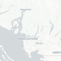
South Lynnmour is a small residential neighbourhood in the District of North Vancouver, British Columbia, with a population of roughly 1,400 people. It sits on the lower slopes of the North Shore mountains, bordered by the Seymour River corridor to the east and the larger Lynn Valley community to the west. Its coordinates place it just inland from the Second Narrows (Ironworkers Memorial) Bridge, giving it relatively quick road access to both downtown Vancouver and the forested recreation areas to the north.
For travellers, South Lynnmour functions less as a standalone destination and more as a quiet, well-located base. The neighbourhood is predominantly low-rise residential and does not have a commercial high street of its own, but it sits within easy reach of Lynn Valley's shops, cafés, and the trailheads that lead into the Mount Seymour and Lynn Headwaters regional park systems. Visitors who prefer a calmer, non-tourist environment while still being close to nature and the city often find the North Shore neighbourhoods like this one appealing.
Before You Go
Visas and Entry
Canada has specific entry requirements that vary by nationality and travel document. For accurate and current visa or Electronic Travel Authorization (eTA) information, consult TravelerPulse's Visas section and the official Immigration, Refugees and Citizenship Canada (IRCC) website before booking.
What to Pack
- Layered, waterproof clothing is advisable year-round; North Vancouver receives significant rainfall, particularly October through March.
- Sturdy hiking footwear is worthwhile if you plan to use the nearby trail networks.
- A transit card (Compass Card) loaded with credit makes getting around Metro Vancouver considerably easier — verify current pricing and availability at TransLink's official site.
Health and Insurance
British Columbia's public health system does not cover non-residents. Comprehensive travel health insurance is strongly recommended. Verify coverage details with your insurer before departure.
Getting There
By Air
The primary arrival point is Vancouver International Airport (YVR) in Richmond, approximately 25–35 minutes by car from South Lynnmour under normal traffic conditions. The Canada Line SkyTrain connects YVR to downtown Vancouver; from there, TransLink buses serve the North Shore via the Second Narrows or Lions Gate crossings. Verify current routes and schedules on the TransLink website.
By Car
From downtown Vancouver, Highway 1 eastbound leads across the Second Narrows Bridge into North Vancouver. South Lynnmour is accessible from Main Street (North Vancouver) and from the Lynn Valley Road corridor. Street parking is generally available in the neighbourhood. Be aware that rush-hour congestion on the bridge approaches can be significant.
By Transit
TransLink operates bus routes through the Lynn Valley and Seymour areas. The exact routes serving South Lynnmour should be confirmed using the TransLink trip planner (translink.ca), as schedules and route numbers change periodically.
Getting Around
South Lynnmour itself is compact enough to walk across in under twenty minutes. For reaching surrounding attractions — Lynn Canyon, Lower Seymour Conservation Reserve, or Lynn Valley Centre — a car or bicycle is the most practical option, though bus routes do connect the broader area.
Cycling infrastructure on the North Shore has expanded in recent years, and many residents commute by bike. Rideshare services (verify current availability in Metro Vancouver) and taxis supplement transit. If you are renting a car, note that parking in downtown North Vancouver and at popular trailheads can be limited on weekends and holidays.
Things to See & Do
Lynn Canyon Park
A short drive or cycle north, Lynn Canyon Park offers suspension bridge crossings, canyon swimming holes (seasonal, with safety advisories posted on-site), and a network of hiking trails through old-growth forest. The Ecology Centre provides interpretive displays about the local ecosystem. Entry to the park itself is free; verify any current fees for specific facilities locally or through the District of North Vancouver.
Lower Seymour Conservation Reserve (LSCR)
The LSCR, managed by Metro Vancouver Regional Parks, is accessible from Lillooet Road just east of South Lynnmour. It offers cycling, walking, and limited vehicle access along a paved road corridor into the Seymour Valley. The area is particularly popular for family cycling. Check Metro Vancouver's parks website for current access conditions and seasonal restrictions.
Lynn Headwaters Regional Park
For more serious hikers, Lynn Headwaters to the northwest offers multi-hour trail routes including access to Hanes Valley and connections toward Grouse Mountain. Trail conditions vary significantly by season; check Metro Vancouver Regional Parks for current advisories before heading out.
Nearby Urban Amenities
Lynn Valley Centre (a short drive west) has grocery stores, cafés, a library branch, and everyday services. The Shipyards District in Lower Lonsdale, roughly 10–15 minutes by car, has waterfront restaurants, the North Vancouver Museum and Archives, and a Friday night market in summer season (verify dates and hours locally).
Food & Drink
South Lynnmour does not have restaurants or cafés within the immediate neighbourhood. The nearest concentration of dining options is in Lynn Valley along Mountain Highway and Lynn Valley Road, where you will find independent cafés, casual dining, and grocery options.
For a wider selection — including the waterfront dining scene, craft breweries, and diverse cuisines — Lower Lonsdale (Lonsdale Avenue toward the water) is the North Shore's most active food and drink corridor. The Quay area also has a SeaBus terminal for easy access to downtown Vancouver's many dining neighbourhoods. All specific establishment hours and prices should be verified locally, as the hospitality industry in the region sees regular turnover.
Practical Information
Emergency Services
In any emergency in Canada, dial 911 for police, fire, or ambulance.
Hospitals
Lions Gate Hospital in North Vancouver is the primary acute care facility for the North Shore. Its address and contact information are available through the Vancouver Coastal Health website.
Money
ATMs are available at Lynn Valley Centre and along Lonsdale Avenue. Credit and debit cards are accepted almost universally at retail and food businesses in Metro Vancouver.
Connectivity
Mobile coverage is reliable throughout North Vancouver. Free Wi-Fi is available at public library branches. Coverage can thin out on backcountry trails — download offline maps before heading into the conservation reserves.
Time Zone
Pacific Standard Time (UTC−8) in winter; Pacific Daylight Time (UTC−7) in summer, generally from the second Sunday in March to the first Sunday in November.
Safety
South Lynnmour is a quiet residential neighbourhood and is generally considered safe. Standard urban precautions — securing valuables, being aware of your surroundings — apply as they would anywhere.
The primary safety considerations for visitors relate to the outdoor environment. Trail hazards include unpredictable weather, creek crossings that rise rapidly after rain, and wildlife including black bears and coyotes. Always inform someone of your hiking plans, carry sufficient water and food, and check current trail conditions through Metro Vancouver Regional Parks before departing. Swimming in Lynn Canyon's pools carries real risk; follow all posted safety signs and local advisories.
Wildfire smoke can affect air quality in summer months across British Columbia. Check Environment and Climate Change Canada's Air Quality Health Index (AQHI) if you have respiratory sensitivities.