Overview
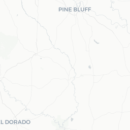
Caddo Valley is a small unincorporated community in Clark County, Arkansas, situated just east of Arkadelphia along the Caddo River and US Highway 67. With a population of roughly 600 people, it functions less as a standalone destination and more as a quiet residential community and convenient stop for travelers moving through south-central Arkansas.
The community sits at a geographic crossroads that gives it outsized access to outdoor recreation. Lake DeGray State Park, one of Arkansas's flagship state parks, lies a short drive to the north. The Ouachita Mountains begin to rise to the west, and the Caddo River itself offers paddling and fishing opportunities nearby.
Most visitors to the area use Caddo Valley as a base while exploring Arkadelphia — the nearest full-service city — or while en route between Hot Springs and Texarkana on US-67/US-70. Travelers looking for a low-key, nature-oriented stop in the Ouachita region will find this corner of Arkansas quietly rewarding.
Before You Go
Caddo Valley has very limited commercial infrastructure of its own. Visitors should plan to stock up on supplies, fill up on fuel, and make dining and lodging arrangements in nearby Arkadelphia (roughly 3–5 miles away) before settling in.
Visas: Caddo Valley is in the United States. For entry requirements, check TravelerPulse's Visas section and the official US Customs and Border Protection website, as rules vary by nationality.
Weather: South-central Arkansas has a humid subtropical climate. Summers (June–August) are hot and humid, with temperatures regularly exceeding 90 °F (32 °C). Winters are mild but can include occasional ice storms. Spring and fall are the most comfortable seasons for outdoor activities. Tornado risk is present in spring; monitor local weather advisories.
- Bring insect repellent in warmer months — mosquitoes and ticks are common near waterways and wooded areas.
- Cell coverage can be spotty in rural stretches; download offline maps before arriving.
- If you plan to fish or kayak, Arkansas fishing licenses are required and can be obtained online through the Arkansas Game and Fish Commission.
Getting There
By Car
Caddo Valley is the most practical way to arrive. The community sits directly on US Highway 67/70 and is accessible from Interstate 30, which passes through Arkadelphia just to the west. From Little Rock, the drive is approximately 65 miles southwest. From Hot Springs, it is roughly 30 miles south via US-270 connecting to US-67.
By Air
The nearest commercial airport is Bill and Hillary Clinton National Airport (LIT) in Little Rock, approximately 65–70 miles northeast. Hot Springs Memorial Field (HOT) is closer at roughly 35 miles, though it has limited commercial service — verify current routes before booking. Renting a car at the airport is strongly recommended, as no meaningful public transit connects these airports to Caddo Valley.
By Bus
Intercity bus service (Greyhound and similar carriers) stops in Arkadelphia, not in Caddo Valley itself. Verify current schedules and stop locations directly with the carrier before travel.
Getting Around
A personal vehicle is essentially required to get around Caddo Valley and the surrounding area. There is no local public transportation serving the community.
US Highway 67/70 is the main corridor through Caddo Valley, connecting it to Arkadelphia to the west and to Gurdon and other communities to the east. State roads branching north lead toward Lake DeGray and Bismarck. Roads toward Lake DeGray State Park are generally well-maintained but become more rural as you go north.
Bicycle travel is possible on quieter back roads, but US-67/70 is a busy highway without dedicated cycling infrastructure and is not recommended for casual cyclists. If exploring the Caddo River or surrounding trails, some routes are accessible only via unpaved forest roads — a vehicle with moderate ground clearance is useful.
Where to Stay
There are no major hotels located within Caddo Valley proper. Lodging options are found in Arkadelphia, which has a modest selection of national chain motels and budget hotels along the highway corridors near I-30. Verify current availability and rates directly with properties or through a booking platform.
Lake DeGray State Park offers a lodge (DeGray Lake Resort State Park), cabins, and campground sites managed by Arkansas State Parks — this is one of the more atmospheric lodging options in the area. Reservations are advisable, especially on summer weekends and holidays. Check the Arkansas State Parks website for current availability and pricing.
Camping is also available at Ouachita National Forest sites in the broader region. Dispersed camping rules and designated campground details are available on the US Forest Service website.
Things to See & Do
Lake DeGray State Park
The most significant attraction near Caddo Valley, Lake DeGray is a 13,800-acre reservoir about 10 miles north via Highway 7. The state park offers boating, fishing, swimming, hiking, golf, and camping. It is one of Arkansas's most visited state parks. Verify current park hours, fees, and marina services at the Arkansas State Parks official website.
Caddo River
The Caddo River flows through the region and is popular for float trips, fishing (bass, bream, and catfish are commonly caught), and kayaking. Several outfitters in the broader Clark County area offer canoe and kayak rentals — verify current operators locally or through the Arkadelphia Regional Chamber of Commerce.
Arkadelphia
The neighboring city of Arkadelphia offers Henderson State University and Ouachita Baptist University campuses, the Ouachita River, local dining, and small-town commerce. The Clark County Museum (verify current hours locally) provides regional history context.
Ouachita National Forest
The western edges of the Ouachita National Forest are accessible within a reasonable drive, offering hiking, wildlife watching, and dispersed camping. The forest spans millions of acres across Arkansas and Oklahoma — the US Forest Service website has maps and current conditions.
Food & Drink
Caddo Valley itself has minimal dining options. Travelers should plan meals in Arkadelphia, where a range of locally owned restaurants, fast-food chains, and casual diners can be found along Valley Street and nearby commercial corridors.
South-central Arkansas food culture leans toward Southern comfort food: barbecue, fried catfish, biscuits and gravy, and homestyle plate lunches are common. Arkadelphia has options for various budgets, though fine dining options are limited — this is genuinely small-town Arkansas.
Alcohol availability varies. Arkansas has historically had a patchwork of wet and dry jurisdictions at the county and city level. Verify current regulations locally, as this can affect what is available at restaurants and retailers in the area.
Practical Information
- Emergency services: Dial 911 for police, fire, or medical emergencies throughout the United States.
- Nearest hospital: Verify the location and services of the nearest full-service hospital in Arkadelphia before your trip, as rural medical facilities can have limited capabilities.
- Fuel and supplies: Gas stations and convenience stores are present along US-67 in and around Caddo Valley, but stock up on any specialized supplies (camping gear, medications, etc.) before leaving a larger city.
- Connectivity: Mobile coverage from major US carriers (AT&T, Verizon, T-Mobile) is generally available in Caddo Valley and Arkadelphia, but can drop in more remote forest and river areas. Download offline maps.
- Tipping: Standard US tipping norms apply — 15–20% at sit-down restaurants is customary.
- Fishing and hunting licenses: Required for respective activities in Arkansas. Purchase through the Arkansas Game and Fish Commission website or licensed retailers.
Safety
Caddo Valley is a quiet, low-crime rural community. Visitors should exercise standard common-sense precautions: secure valuables in vehicles, be aware of your surroundings in unfamiliar areas, and let someone know your itinerary if venturing into remote outdoor areas.
Outdoor safety is a more relevant concern than urban crime here. Flash flooding can occur along the Caddo River and other waterways, particularly after heavy rain — never attempt to drive through flooded roads. Tornado season is primarily spring; monitor the National Weather Service (weather.gov) for alerts. In warmer months, watch for venomous snakes (copperheads and cottonmouths are present in the region) when hiking near water or in rocky terrain.