Overview
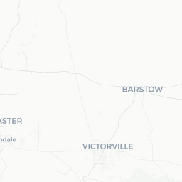
Arvin is a small city of roughly 21,000 people situated at the southeastern edge of the San Joaquin Valley in Kern County, California, about 15 miles southeast of Bakersfield. It sits at an elevation of approximately 400 feet and is flanked to the east and south by the Tehachapi Mountains, which form a visible backdrop on clear days.
The city's economy has historically been tied to agriculture — table grapes, citrus, and vegetables are grown in the surrounding fields — and to oil and gas extraction, industries that define much of Kern County. Arvin is also known for its significant Latino population and community, reflected in its local food scene and cultural character.
For most travelers, Arvin is a waypoint rather than a primary destination: it lies along Highway 223 and is close to the junction of several routes connecting the Central Valley to Southern California. That said, the surrounding countryside and the proximity to the Tehachapi Mountains offer low-key outdoor opportunities for those who look for them.
Before You Go
Visas and Entry
Arvin is in the United States. For visa and entry requirements, check TravelerPulse's Visas section and the official U.S. Customs and Border Protection website for the most current information relevant to your nationality.
Air Quality Awareness
Arvin and the southern San Joaquin Valley are among the most affected areas in the country for particulate matter and ozone pollution, due to geography (air trapped by surrounding mountains), agricultural dust, and vehicle and industrial emissions. Travelers with respiratory conditions such as asthma should check the local Air Quality Index (AQI) before and during their visit. The AirNow.gov website provides real-time AQI data.
Summer Heat
Summers in Arvin are hot, with daytime temperatures regularly exceeding 100°F (38°C) from June through August. Pack sun protection, carry water, and plan any outdoor activity for early morning or evening during these months.
What to Bring
- Sun protection (sunscreen, hat, sunglasses)
- Ample drinking water if venturing outdoors
- Cash for smaller local businesses
- A full tank of gas, as options thin out quickly east of town toward the mountains
Getting There
By Car
Arvin is the most practical way to reach Arvin. The city is accessed primarily via Highway 223 (Bear Mountain Boulevard), which connects west to Bakersfield and east into the Tehachapi Mountains. From Interstate 5 or Highway 99 in Bakersfield, follow Highway 58 east or Highway 223 southeast into town. From Los Angeles, the drive is approximately 90–100 miles via I-5 north and Highway 99, or via Highway 14 north through the Antelope Valley and over Tehachapi Pass.
Nearest Airport
Méhacafé-style regional access is via Meadows Field Airport (BFL) in Bakersfield, roughly 20 miles northwest. Los Angeles International Airport (LAX) is approximately 100 miles to the southwest and serves many more routes; a rental car from LAX is the most flexible option for visiting Arvin.
By Bus
Limited regional bus service connects Bakersfield to surrounding communities in Kern County. Check Golden Empire Transit (GET) and Kern Transit for current routes and schedules, as service to and within Arvin is infrequent and subject to change.
Getting Around
A personal vehicle is essentially required to get around Arvin and its surroundings. The city is compact but spread out in the typical Central Valley fashion, with services distributed along Bear Mountain Boulevard and a few cross streets.
Rideshare apps such as Uber and Lyft operate in the area with variable availability — response times may be longer than in larger cities. Verify availability before relying on them, especially for early morning or late evening travel.
Cycling is physically possible within the flat parts of town, though the heat, road conditions, and lack of dedicated infrastructure make it less practical for most visitors.
Things to See & Do
Explore the Tehachapi Mountains
The mountain passes and foothills immediately east and south of Arvin offer hiking, scenic drives, and birdwatching. Bear Mountain Road leads into increasingly rugged terrain. The area is lightly visited and requires self-sufficiency — carry water, let someone know your plans, and verify road conditions before heading out, particularly after winter storms.
Wind Turbines of Tehachapi Pass
A short drive east of Arvin brings you to one of the largest concentrations of wind turbines in North America, spread across the ridges of Tehachapi Pass. There is no formal visitor center, but the visual scale of the wind farms is striking from roadside pullouts on Highway 58.
Local Agricultural Landscape
The vineyards and farm fields surrounding Arvin reflect the working landscape of the San Joaquin Valley. Roadside farm stands appear seasonally — table grapes are a local specialty and can be purchased directly from stands during harvest season (generally late summer). Verify availability locally.
Day Trips
Arvin's greatest asset for visitors may be its proximity to other destinations. Bakersfield's Basque restaurants, country music history, and California Living Museum (CALM) are 20–25 minutes away. The Sequoia National Forest and Lake Isabella are accessible to the northeast via Highway 178 through Bakersfield.
Food & Drink
Arvin's food scene is small and practical, oriented toward local residents rather than visitors. Mexican and Mexican-American cuisine dominates, with taquerias and family restaurants serving as the backbone of the dining landscape. Dishes such as tacos, burritos, tamales, and menudo are reliably available and tend to be inexpensive and freshly made.
A handful of fast-food chain locations operate in town along Bear Mountain Boulevard, as do small convenience stores and a supermarket. For a wider variety of restaurants — including Basque cuisine, a Bakersfield specialty dating back to Basque sheep-herding immigrants — plan a short drive into Bakersfield.
Alcohol is available at local markets and some restaurants. Arvin is not a wine-tasting destination, despite being in a grape-growing region; the nearest established wine tasting rooms are in the Paso Robles area, roughly 90 miles west, or in isolated spots around the valley. Verify locally for any tasting options that may have opened recently.
Practical Information
Emergency Services
For emergencies in the United States, dial 911. The Kern County Sheriff's Office serves the Arvin area. The nearest hospital with full emergency services is in Bakersfield; verify the nearest facility and its current status before travel.
Connectivity
Cell service from major U.S. carriers (Verizon, AT&T, T-Mobile) is generally available in town. Coverage can become patchy in the mountain areas east and south of Arvin.
Banking and Cash
ATMs are available at local banks and the supermarket. Smaller taquerias and farm stands may be cash-only — carry some cash.
Fuel
Gas stations are available in Arvin. If heading into the Tehachapi Mountains or rural areas, fill up before departing; stations are sparse beyond town.
Useful Contacts
- Air quality: AirNow.gov (real-time AQI)
- Road conditions: Caltrans Quickmap (quickmap.dot.ca.gov)
- Kern County Sheriff: verify the non-emergency number locally
Safety
Arvin is a working-class agricultural community. Visitors should exercise the same general awareness they would in any small city. Keep valuables out of sight in parked vehicles.
The primary safety considerations for visitors are environmental rather than crime-related: heat exhaustion in summer, poor air quality on high-AQI days, and the risks of venturing into remote mountain terrain unprepared. Check the AQI before outdoor activities and carry significantly more water than you think you'll need in the backcountry.
Highway 223 and surrounding rural roads can have fast-moving truck traffic related to agricultural operations. Drive attentively, especially on two-lane roads outside of town.