Overview
Golden Hills is a small unincorporated community in Kern County, California, situated at roughly 3,000 feet elevation in the foothills south of the Tehachapi Mountains. With a population of around 8,600 residents, it functions primarily as a residential area adjacent to the city of Tehachapi, sharing many of its services and amenities.
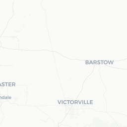
The community sits at the transition zone between the southern Sierra Nevada, the Tehachapi Mountains, and the northern Mojave Desert, giving it a high-desert character with scrubby vegetation, open skies, and notable wind. Its location along California State Route 58 makes it a natural stopping point for travelers moving between Bakersfield to the west and Barstow or Las Vegas to the east.
Most visitors who spend time in Golden Hills do so in conjunction with the broader Tehachapi area, using the community as a quiet base for exploring nearby natural landscapes, the historic downtown Tehachapi, and the wind energy infrastructure that defines the regional skyline.
Before You Go
Visas and Entry
Golden Hills is in the United States. Entry requirements depend on your nationality. Check the TravelerPulse Visas section and the official U.S. Customs and Border Protection website for current requirements before booking.
Weather and Seasons
Golden Hills experiences a high-desert climate with four distinct seasons. Summers are warm and dry, with daytime temperatures frequently exceeding 90°F (32°C). Winters are cool and can bring frost and occasional snow at this elevation. Spring and fall offer the most comfortable conditions for outdoor activity. Wind is common throughout the year, especially in spring, owing to the mountain passes surrounding the area.
What to Pack
- Layered clothing year-round — temperatures can swing significantly between day and night
- Sun protection (sunscreen, hat, sunglasses) for desert-adjacent conditions
- Water and snacks if planning drives into surrounding rural or undeveloped areas
- A full tank of gas before leaving major highway corridors
Getting There
By Road
Golden Hills is directly accessible via California State Route 58, which connects Bakersfield (roughly 35 miles to the west) with Barstow and I-15 to the east. The drive from Bakersfield takes approximately 45 minutes under normal conditions. From Los Angeles, most drivers take I-5 north to SR-99 then SR-58, or alternatively travel via the Antelope Valley on CA-14 north to SR-58 west — a journey of roughly 100 to 120 miles depending on route.
By Air
The nearest commercial airport with regular service is Meadows Field Airport (BFL) in Bakersfield. Los Angeles International Airport (LAX) is a longer option but offers far more flight connections; verify travel times and ground transportation options before booking.
By Bus
Limited intercity bus service operates through the Tehachapi area. Verify current schedules with Kern Transit or relevant regional operators, as service levels in small communities can change.
Getting Around
Golden Hills and the adjacent Tehachapi area are best explored by private vehicle. The community is spread out, and there is no local transit network that serves visitors in a practical way. Roads in and around the area are generally well-maintained, but some routes into surrounding mountains or toward recreational areas may become unpaved or require higher clearance — check conditions locally before venturing off main roads.
Ride-share availability (Uber, Lyft) may be limited compared to urban areas. Confirm availability through the respective apps before relying on these services, particularly for early morning or late evening travel.
Things to See & Do
Outdoor Recreation
The Tehachapi Mountains surrounding Golden Hills provide opportunities for hiking, mountain biking, and wildlife observation. Bear Valley Springs, a private gated community nearby, has its own lake and recreational amenities for residents; public access is restricted, but the surrounding landscape is worth exploring on public lands.
Wind Farm Viewing
The Tehachapi Pass Wind Farm, one of the earliest and largest wind energy installations in the United States, is visible throughout the area. Rows of turbines across the ridgelines are a distinctive sight and offer a sense of California's renewable energy history. There is no formal visitor center, but the turbines are visible from public roads.
Tehachapi Loop
A short drive from Golden Hills, the Tehachapi Loop is a famous railroad engineering landmark built in 1876. The loop allows trains to gain elevation by circling over themselves — a feat of 19th-century civil engineering still in active use by freight trains today. Train enthusiasts gather at a viewpoint off Woodford-Tehachapi Road to watch trains pass. Verify access conditions locally.
Downtown Tehachapi
The adjacent city of Tehachapi has a small historic downtown with local restaurants, shops, and the Tehachapi Museum. It is easily reachable from Golden Hills in under 10 minutes by car.
Food & Drink
Golden Hills itself has limited independent dining; most food and drink options are found in the neighboring city of Tehachapi. The area supports a modest range of casual dining — from diners and fast-food chains to local Mexican and American restaurants. A small number of independently owned establishments in downtown Tehachapi serve the community.
Grocery options, including at least one major supermarket chain, are available in Tehachapi for visitors who prefer to self-cater. If you are traveling through on SR-58 and plan an extended drive into more remote areas, stock up on water and provisions before leaving the Tehachapi area, as services along the highway can be sparse.
Practical Information
Emergency Services
For emergencies in the United States, dial 911. Kern County Sheriff's Office provides law enforcement to unincorporated communities including Golden Hills. Verify the location of the nearest hospital or urgent care facility before your visit, as medical facilities in small mountain communities may have limited hours or capabilities.
Connectivity
Cell coverage in Golden Hills is generally available from major U.S. carriers, but can become intermittent in the surrounding mountains and rural roads. Download offline maps before venturing outside the immediate community.
Fuel and Supplies
Fuel stations are available in the Tehachapi area. If planning drives toward Edwards Air Force Base, the Mojave Desert, or backcountry routes, fill up locally — the next services may be farther than expected.
Altitude
At roughly 3,000 feet elevation, most visitors will not notice significant altitude effects, but those coming from sea level should stay hydrated, especially in summer heat.
Safety
Golden Hills is a quiet residential community with a generally low crime profile typical of small California towns. Standard travel precautions apply: do not leave valuables visible in parked vehicles, and be aware of your surroundings in unfamiliar areas.
Outdoor safety is a more relevant consideration here. Rattlesnakes are present in the region, particularly in warmer months — watch where you step on trails and around rocky outcrops. Wildfire risk is elevated in summer and fall across Kern County; check the California Department of Forestry and Fire Protection (CAL FIRE) website for current fire conditions and any active alerts before outdoor activities. Flash flooding, while less common than in lower desert areas, can occur on mountain roads during heavy rain events.