Overview
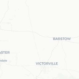
Stallion Springs is a small, gated community of roughly 2,500 residents tucked into the Tehachapi Mountains of Kern County, California, at an elevation of approximately 4,000 feet. It sits just southwest of the city of Tehachapi and is surrounded by oak-studded hills, rolling grasslands, and the open sky of Southern California's high desert transition zone.
The community has a distinctly rural, residential character. It is not a tourist destination in the conventional sense — there are no major attractions, resorts, or commercial districts — but it appeals to travelers who are drawn to solitude, equestrian culture, and the unhurried pace of mountain living. Many visitors come as guests of residents or pass through while exploring the broader Tehachapi Valley.
The setting offers genuine scenic value. The Tehachapi Mountains mark the junction of the Sierra Nevada, the Transverse Ranges, and the Coast Ranges, creating a landscape that feels remote despite being roughly 40 miles from Bakersfield and about 100 miles north of Los Angeles.
Before You Go
Entry and Gated Access
Stallion Springs is a private, gated community. Public access to the interior roads and amenities is generally restricted to residents and their guests. If you are visiting a resident, confirm gate access arrangements before you arrive.
Visas
Stallion Springs is in the United States. For visa requirements, check TravelerPulse's Visas section and the official US Customs and Border Protection website for guidance relevant to your nationality.
What to Pack
- Layers are essential year-round. Summers are warm but evenings cool quickly at elevation; winters can bring frost and occasional snow.
- Sun protection (sunscreen, hat, sunglasses) is important, especially in spring and summer.
- If you plan to hike nearby trails, sturdy footwear is advisable.
- Cell coverage can be limited; download offline maps before arriving.
Getting There
By Car
The most practical way to reach Stallion Springs is by private vehicle. From Bakersfield, take Highway 58 east toward Tehachapi (approximately 40 miles), then follow local roads south and west toward Stallion Springs. From Los Angeles, the drive is roughly 100–110 miles via Interstate 5 north and Highway 99 north to Highway 58 east, or via the Antelope Valley on Highway 14 north connecting to Highway 58 west near Mojave.
By Air
The nearest commercial airports are Meadows Field Airport (BFL) in Bakersfield and, for more flight options, Los Angeles International Airport (LAX). Verify current airline service at both airports before booking. A rental car from either airport is effectively required.
By Bus
Limited regional bus service connects Tehachapi to Bakersfield via Kern Transit. Stallion Springs itself has no dedicated transit stop. Verify current schedules and routes with Kern Transit before planning travel by bus.
Getting Around
A personal vehicle is essential for getting around Stallion Springs and the surrounding Tehachapi area. There is no local public transit within the community, and distances between points of interest in the valley — grocery stores, restaurants, trailheads — require driving.
The roads within the community are generally well-maintained paved roads, though some access routes on the surrounding hills can become slippery after rain or snow in winter. Rideshare availability is very limited in this area; verify locally before relying on it.
Things to See & Do
Equestrian Activities
Stallion Springs has a long association with the horse community, and equestrian trails and facilities are a core feature of life here. Guests of residents may have access to riding trails within and around the community. Check with your host for current access.
Tehachapi Valley Exploration
The broader Tehachapi area offers more structured recreational options a short drive away:
- Tehachapi Pass Wind Farm: One of the oldest and largest wind energy installations in the United States, visible from Highway 58 and surrounding hilltops. A striking feature of the landscape.
- Tehachapi Loop: A famous railroad engineering landmark where Union Pacific trains spiral through a loop tunnel. A popular spot for rail enthusiasts; the viewing area is located near Keene, a short drive from Stallion Springs.
- Bear Valley Springs and Lake of the Woods: Neighboring private communities with lakes and recreational amenities — access for non-residents may be restricted; verify locally.
- Hiking: The hills around Tehachapi offer informal trails and open space, though formal trail infrastructure is limited. The Tejon Ranch Conservancy manages land in the broader area; check their site for any public access programs.
Stargazing
At 4,000 feet elevation with low light pollution, the night sky above Stallion Springs can be exceptional on clear, moonless nights. Spring and autumn provide stable atmospheric conditions and mild temperatures for viewing.
Food & Drink
There are no restaurants or cafes within Stallion Springs itself. For dining, residents and visitors travel to nearby Tehachapi, which has a small but functional selection of independent restaurants, cafes, and fast-food options serving the local population.
For groceries and supplies, Tehachapi has supermarket options that serve the surrounding mountain communities. It is advisable to stock up before arriving at your accommodation in Stallion Springs, particularly if arriving late in the day.
The Tehachapi area has a small but growing community of local food producers — farmstands and seasonal markets occasionally operate in the valley. Verify locally for current schedules.
Practical Information
Emergency Services
In an emergency, dial 911. The nearest hospital with emergency services is in Tehachapi or Bakersfield. Confirm the location and capabilities of the nearest medical facility with your host upon arrival, as response times in rural mountain areas can be longer than in urban settings.
Connectivity
Cell service within Stallion Springs can be spotty depending on your carrier. Wi-Fi availability depends on your accommodation. Download offline maps (Google Maps or Maps.me) of the Tehachapi Valley area before you arrive.
Weather Awareness
Winter weather can bring ice and snow on mountain roads, including the approaches to Stallion Springs. Check road conditions via Caltrans (verify current URL on the official Caltrans site) before traveling in December through February. Chains or all-wheel drive may be advisable after storms.
Supplies
Bring any specialty items you need from Bakersfield or a larger city. Stallion Springs has no commercial retail; Tehachapi's selection, while adequate for basics, is limited.
Safety
Stallion Springs is a quiet residential community with a generally low crime profile, consistent with rural Kern County. Standard precautions apply: lock your vehicle, secure valuables, and be aware of your surroundings on unfamiliar roads.
Wildfire is a genuine seasonal hazard in the Tehachapi Mountains, particularly in summer and fall. Monitor Cal Fire alerts and have an awareness of evacuation routes. Ask your host about local emergency protocols. Rattlesnakes and other wildlife are present in the surrounding hills; watch where you step on trails and in brushy areas, particularly in warmer months.