Overview
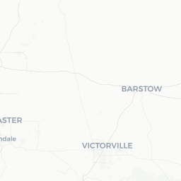
Mojave is a small desert town of roughly 4,000 people situated in Kern County, California, at the western edge of the Mojave Desert at an elevation of about 2,762 feet. It sits at the junction of US-58 and State Route 14, making it a natural crossroads between the Los Angeles Basin, the Central Valley, and the high desert communities to the east.
The town is best known to the wider world for the Mojave Air and Space Port, a facility with genuine significance in aviation and commercial spaceflight history. Scaled Composites and other aerospace firms have used the airfield for experimental work, and SpaceShipOne — the first privately built craft to reach space — was developed and tested here. The airfield also functions as a storage and retirement facility for commercial aircraft, drawing aviation enthusiasts who come to photograph the rows of parked jets.
Beyond aerospace, Mojave is flanked by some of California's largest wind energy installations, and the surrounding landscape of creosote flats, joshua trees, and rugged mountain ranges gives the area a stark, open-sky character. For travelers, it is most often a purposeful stop — a fueling and resting point en route to Death Valley, Las Vegas, or the Eastern Sierra — but it rewards those who take a few hours to look around.
Before You Go
Climate
Mojave has a hot desert climate with significant seasonal swings. Summers (June–August) regularly bring daytime highs above 100°F (38°C), with low humidity and intense sun. Winters are cool to cold, with overnight temperatures occasionally dropping below freezing and rare light snowfall. Spring and autumn are the most comfortable seasons for visiting.
Packing Essentials
- Sunscreen, sunglasses, and a wide-brim hat are important year-round
- Carry extra water whenever you plan to spend time outdoors — the desert air is very dry
- Layers are useful in autumn and winter, as temperature swings between day and night can exceed 30°F
- Fuel up before venturing into the surrounding desert; service stations become sparse east of town
Visas
Mojave is in the United States. For entry requirements specific to your nationality, check TravelerPulse's Visas section and the official US Customs and Border Protection website.
Getting There
By Road
Mojave is most easily reached by car. US Highway 58 connects it westward to Bakersfield and eastward toward Barstow and the I-15. State Route 14 runs south toward the Antelope Valley and eventually merges with I-14 into the Los Angeles area, and north toward Ridgecrest and the Eastern Sierra. Driving time from central Los Angeles is roughly 1.5 to 2 hours depending on traffic.
By Bus
Intermodal ground transportation does serve Mojave, including Kern Regional Transit routes. Schedules and stops should be verified directly with the relevant transit provider before travel, as rural service can change.
Nearest Major Airports
The closest large commercial airports are Bakersfield's Meadows Field Airport to the west and Los Angeles International Airport (LAX) to the south. The Mojave Air and Space Port has a runway open to general aviation; it does not offer scheduled commercial passenger service. Verify current operations before planning any aviation-related visit.
Getting Around
Mojave is a small, grid-like town and its main commercial corridor along State Route 14 (Sierra Highway) is navigable on foot in fair weather, though the distances between points of interest — particularly the air and space port — make a car essentially necessary for most visitors.
There is no local taxi or rideshare infrastructure reliably available in a town of this size. Travelers should plan on having a personal or rental vehicle. If you arrive by bus, confirm in advance whether your intended destinations are walkable from the stop.
Things to See & Do
Mojave Air and Space Port
The airfield is a working facility, and public access to the flight line and aircraft storage areas is restricted. However, the perimeter roads — particularly along Airport Road — offer legal vantage points where aviation photographers regularly shoot the stored commercial aircraft. The airport's visitor and operations status should be confirmed locally before any planned visit, as access policies can change.
Wind Farm Viewing
The Tehachapi Pass Wind Farm, one of the earliest and largest in the United States, begins just west of Mojave and extends into the hills toward Tehachapi. Driving along State Route 58 through this area gives a striking view of hundreds of turbines across the ridgelines. There is no dedicated visitor center, but the visual experience from the road is notable.
Desert Landscape
The open desert around Mojave features creosote bush scrub, occasional joshua trees, and wide sky views. Early morning and late afternoon light can be particularly photogenic. If you plan to leave paved roads, a high-clearance vehicle and careful preparation are advised.
Tehachapi
The town of Tehachapi, about 18 miles west, offers the Tehachapi Loop — a famous railroad engineering landmark — as well as a more developed downtown with shops and dining. It makes a natural paired stop with Mojave.
Food & Drink
Mojave's dining options are limited and reflect its character as a working desert town and truck stop. You will find fast food chains, a few diners, and convenience stores along the main highway corridor. Options oriented toward sit-down meals are sparse, and hours can be irregular — it is worth checking that a restaurant is open before making it part of your plan.
Travelers with specific dietary requirements or preferences for sit-down dining may find it more practical to bring supplies from a larger nearby town such as Tehachapi or Rosamond, or to plan meals around stops in those communities. There are no notable craft breweries, wine bars, or upscale restaurants in the immediate Mojave townsite as of this writing — verify locally for any recent additions.
Practical Information
Connectivity and Services
Mojave has basic services including a post office, a few gas stations, and a small number of retail shops along the main corridor. Mobile phone coverage is generally available in town but can drop off quickly once you head into the surrounding desert.
Fuel
Fill your tank in Mojave before heading east toward Barstow or north toward Ridgecrest, as the stretches of highway in between have very limited services.
Emergency Services
Kern County Sheriff and local emergency services cover Mojave. For any emergency in the United States, dial 911.
Accommodation
Mojave has a small number of motel properties along the highway, suited to overnight rest stops. Amenities are basic. For a broader range of lodging, Tehachapi (18 miles) or the Antelope Valley communities to the south offer more options. Verify availability and current operating status of any property before arrival.
Safety
Mojave is a generally quiet and low-key town. The principal safety considerations here are environmental rather than social.
Heat is the primary hazard in summer months. Temperatures exceeding 100°F combined with low humidity can lead to heat exhaustion or heatstroke rapidly, especially if you are active outdoors or your vehicle breaks down on a remote road. Always carry significantly more water than you think you need, and let someone know your itinerary if traveling off main highways.
If you venture onto unpaved desert roads, be aware that these roads can become impassable in wet conditions and that cell service is unreliable outside of town. A paper map or downloaded offline map is a sensible backup.