 Translate
The Essence of Bachigualato Federal International Airport
A closer look
Living guide content for Bachigualato Federal International Airport — read or listen in 46+ languages.
Sinaloa's main gateway serving northwestern Mexico.
- ›The airport is located roughly 8 km north of downtown Culiacán.
- ›It handles significant cargo traffic related to Sinaloa's major agricultural exports.
- ›The airport offers international flights primarily to cities in the western United States.
- ›Sinaloa's large expatriate community contributes notably to passenger volumes.
- ›The facility is administered by Grupo Aeroportuario del Pacífico (GAP).
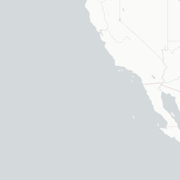
Route map (7 destinations)




Airlines serving this airport
Routes
Pick what matters for your layover or early flight, then compare on your favorite booking site.
TravelerPulse may receive compensation when you book or purchase through some of the links on this page, at no additional cost to you. Prices and availability are set by the booking provider and may change. We never share your private trip details with partners — only the destination, dates and party size you searched.
City & Place Guide
No guide exists for this place yet — Click to generate a Traveler Pulse guide.
Passport, Visa & Immigration
Flying internationally via CUL? Check entry, transit and customs requirements for Mexico from official government sources.

Culiacán International Airport, (Spanish: Aeropuerto Internacional de Culiacán); officially Aeropuerto Internacional Federal de Bachigualato (Bachigualato Federal International Airport) (IATA: CUL, ICAO: MMCL), is an international airport located in Culiacán, Sinaloa, Mexico. It serves as the primary air traffic gateway to the Culiacán metropolitan area, offering nonstop flights to many cities in Mexico and serving as a gateway in a heavily traveled air corridor connecting mainland Mexico to the Baja California peninsula. It is also a focus city for Volaris.
Read full article on WikipediaCuliacán International Airport
Culiacán International Airport, (Spanish: Aeropuerto Internacional de Culiacán); officially Aeropuerto Internacional Federal de Bachigualato (Bachigualato Federal International Airport) (IATA: CUL, ICAO: MMCL), is an international airport located in Culiacán, Sinaloa, Mexico. It serves as the…
Read on WikipediaText from Wikipedia, licensed under CC BY-SA. May be out of date — verify important details.

