Translate
Overview
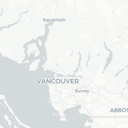
Big Bend is a small, low-key community in British Columbia situated near the Fraser River, with coordinates placing it in the south Burnaby/Richmond corridor of Metro Vancouver. With a population of roughly 1,650, it is not a tourist destination in the conventional sense — there are no major landmarks, theme parks, or heritage districts — but it sits within easy reach of one of Canada's most liveable and scenically varied metropolitan regions.
The area takes its name from the pronounced curve the Fraser River makes as it sweeps through the lower mainland. That geographic feature shapes the local landscape: expect flat river floodplain, industrial and light-commercial land uses, and quiet residential pockets rather than a bustling town centre.
Visitors most commonly encounter Big Bend as a pass-through point or as a base for exploring south Burnaby and the broader Metro Vancouver area. If you are staying nearby for work or visiting family in the area, the surrounding region offers far more to see and do than the neighbourhood itself.
Before You Go
Entry Requirements
Canada's entry requirements vary depending on your nationality, travel history, and whether you arrive by air or land. Do not rely on general summaries — check TravelerPulse's Visas section and the official Immigration, Refugees and Citizenship Canada (IRCC) website for current requirements before booking.
What to Pack
- Layered clothing is advisable year-round; Metro Vancouver weather is mild but frequently wet, especially October through March.
- A compact umbrella or waterproof jacket is more useful than a heavy coat for most of the year.
- If you plan river-area walks, wear sturdy footwear that can handle muddy paths.
Health & Insurance
British Columbia has a public health system, but visitors from outside Canada are not covered. Arrange comprehensive travel health insurance before departure. Verify coverage details with your provider.
Getting There
By Air
The nearest major airport is Vancouver International Airport (YVR) in Richmond, roughly 10–15 km away depending on exact route. YVR is one of Canada's busiest airports with extensive international and domestic connections. Verify current routes and schedules directly with airlines or on the YVR website.
By Road
Big Bend is accessible via the Metro Vancouver road network. Highway 99, Marine Way, and Marine Drive are the primary arterials in this part of the region. If driving from downtown Vancouver, allow extra time during peak commuter hours — traffic on key Fraser River crossings can be significant.
By Transit
TransLink, Metro Vancouver's public transit authority, operates bus routes throughout south Burnaby and the surrounding area. Check the Translink website (translink.ca) for current route maps, schedules, and fare information, as these change periodically.
Getting Around
Within the Big Bend area itself, most movement is by private vehicle. The street layout is oriented around industrial and residential blocks with limited pedestrian infrastructure in some sections.
For broader Metro Vancouver exploration, TransLink's bus and SkyTrain network is the most practical car-free option. The nearest SkyTrain stations are in Burnaby; verify the closest stop to your specific address via the TransLink trip planner. Cycling is feasible on designated routes but the area's proximity to industrial roads means some stretches are less cycle-friendly. Ride-hailing services (such as Uber and Lyft) operate throughout Metro Vancouver and are a convenient option.
Things to See & Do
Big Bend itself has limited dedicated visitor attractions, but the surrounding area offers genuine outdoor and urban appeal.
Fraser River Access
The Fraser River foreshore near this part of south Burnaby offers walking and cycling paths with views of the river's wide, working waterway. Bald eagles are a common sight, particularly in cooler months when salmon runs attract them.
Byrne Creek Ravine Park
A short distance from the Big Bend area, Byrne Creek Ravine Park offers forested creek-side trails that feel surprisingly wild given the urban surroundings. Verify current trail conditions and access locally before visiting.
Proximity to Burnaby and Richmond
Burnaby's major parks — including Burnaby Lake Regional Park and Deer Lake Park — are within a short drive. Richmond's dyke trails along the Fraser and Middle Arms offer flat, scenic cycling and walking. Both cities have community centres, cultural venues, and shopping that Big Bend itself lacks.
Food & Drink
Big Bend does not have a notable restaurant district of its own. The immediate area is primarily residential and light-industrial, with convenience-oriented food options rather than destination dining.
For a wider choice, Marine Way and nearby commercial corridors in south Burnaby and north Richmond offer a range of casual restaurants, fast food, and ethnic eateries reflecting Metro Vancouver's diverse population. For more considered dining — including the city's celebrated Asian food scene — central Burnaby, Richmond's No. 3 Road corridor, and Vancouver's various neighbourhoods are all accessible within 20–30 minutes by car or transit. Verify hours and current operations locally, as the hospitality industry sees regular turnover.
Practical Information
Emergency Services
In any emergency in Canada, dial 911 for police, fire, or ambulance.
Money
Most businesses throughout Metro Vancouver accept major credit and debit cards. ATMs are widely available. Some smaller or casual food outlets may still prefer cash; it is worth carrying a small amount.
Connectivity
Mobile coverage from Canada's major carriers (Rogers, Telus, Bell) is reliable throughout Metro Vancouver. Check with your home carrier about roaming costs or consider a local SIM. Wi-Fi is available at most accommodation and many cafés.
Postal Code Area
The Big Bend area falls within Metro Vancouver's postal system. Verify specific postal codes with Canada Post if needed for deliveries or bookings.
Safety
Big Bend and the surrounding south Burnaby area are generally considered safe for residents and visitors. Standard urban precautions apply: keep valuables out of sight in parked vehicles, be aware of your surroundings at night in industrial areas, and stick to established trails when walking near the river.
The Fraser River itself carries strong currents and can be deceptively dangerous — do not swim in it and supervise children closely near the water's edge. Weather-related risks are low but winter rain can make unpaved paths slippery.