Overview
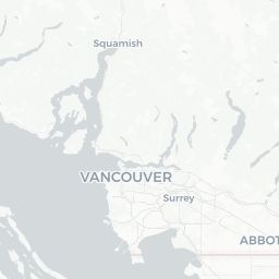
Oakalla is a small residential community within the City of Burnaby in Metro Vancouver, British Columbia. With a population of roughly 1,500 people, it functions more as a neighbourhood than an independent destination in the traditional sense. It sits in the southwestern part of Burnaby, close to the boundary with New Westminster and within easy reach of the broader Metro Vancouver transit and road network.
The area is best known historically as the site of the Oakalla Prison Farm, a provincial correctional facility that operated from 1912 until its closure in 1991. The prison buildings have since been demolished, and the land redeveloped into the residential community visitors see today. A handful of historical references and local memory keep that chapter of the area's past alive, and it occasionally draws people with an interest in British Columbia's social and criminal justice history.
For most travelers, Oakalla serves as a convenient base for exploring Burnaby and the greater Metro Vancouver region rather than a stand-alone destination. It is close to parks, transit connections, and the amenities of surrounding municipalities. Those who do find themselves here will encounter a calm, predominantly residential environment with easy access to the urban energy of nearby communities.
Before You Go
Visas and Entry
Entry requirements for Canada vary depending on your nationality, intended length of stay, and mode of arrival. Do not rely on generalised summaries. Check TravelerPulse's Visas section for an overview, and always verify current requirements directly with Immigration, Refugees and Citizenship Canada (IRCC) before booking travel.
What to Pack
Burnaby and the greater Vancouver area experience a temperate oceanic climate. Summers (June–August) are warm and relatively dry; winters are mild but wet and grey. A waterproof jacket is useful year-round. Comfortable walking shoes are practical given the neighbourhood's hilly terrain and access to nearby parks.
Connectivity
Mobile coverage in Oakalla and across Metro Vancouver is generally strong, with service from Canada's main national carriers. Prepaid SIM cards and data plans are available at airports and electronics retailers throughout the region. Verify locally for current options and pricing.
Getting There
By Air
The closest major airport is Vancouver International Airport (YVR) in Richmond, approximately 15–20 kilometres from Oakalla depending on the route taken. From YVR, visitors can reach Burnaby by Canada Line SkyTrain to Waterfront or Commercial–Broadway stations, then transfer to the Millennium Line. Verify current TransLink routes and fares at translink.ca before travel.
By Rail and SkyTrain
TransLink's SkyTrain Millennium Line serves Burnaby with several stations that place riders within reasonable distance of the Oakalla area. The system connects directly to Downtown Vancouver and New Westminster. Check current station access and routing on the TransLink website.
By Road
Oakalla is accessible via Highway 1 (Trans-Canada) and the Kingsway corridor, major arterial roads that run through Burnaby. Driving from Downtown Vancouver typically takes 20–40 minutes depending on traffic. Street parking exists within the residential neighbourhood; verify any local restrictions on-site.
By Bus
TransLink bus routes serve the broader Burnaby area extensively. Specific routes serving the Oakalla neighbourhood and their current schedules should be confirmed at translink.ca or via the Transit app.
Getting Around
Oakalla itself is compact and walkable for those staying within the neighbourhood. The surrounding Burnaby area is well served by TransLink's integrated bus and SkyTrain network, making car-free travel practical for reaching attractions, parks, and retail areas.
Rideshare services (Uber and Lyft both operate in Metro Vancouver) and taxis are available for point-to-point trips. Cycling is feasible on quieter residential streets, and Burnaby maintains a network of designated cycling routes; verify current maps through the City of Burnaby's website. For longer journeys across the region, the SkyTrain remains the most reliable and traffic-independent option.
Things to See & Do
Deer Lake Park
One of Burnaby's most popular green spaces, Deer Lake Park is a short drive or bus ride from Oakalla. The park features a lake with canoe and paddle boat rentals (verify seasonal availability locally), walking trails, and the Burnaby Village Museum—an outdoor living history museum depicting life in the Lower Mainland during the early 20th century. Admission details and hours should be confirmed at the City of Burnaby's official website.
Burnaby Lake Regional Park
Burnaby Lake, managed by Metro Vancouver Regional Parks, offers walking and cycling trails around a significant wetland habitat. Wildlife viewing—particularly birds—is a draw throughout the year. Access points and current trail conditions can be confirmed through Metro Vancouver Parks.
Historical Context of the Oakalla Site
While no preserved prison structures remain, visitors with an interest in British Columbia's penal and social history may find it worthwhile to read about the Oakalla Prison Farm before arriving. Local libraries and the Burnaby Historical Society hold archival records and resources on the subject.
Proximity to New Westminster
The Royal City of New Westminster, one of British Columbia's oldest cities and its former provincial capital, borders Burnaby just south of Oakalla. Its historic downtown, riverside Quay, and cultural sites make for an easy half-day excursion.
Food & Drink
Oakalla is a residential neighbourhood with limited dining options within its immediate boundaries. However, Burnaby as a whole offers a broad and diverse food scene reflecting Metro Vancouver's multicultural population. Metrotown—Burnaby's main commercial hub—hosts a wide range of restaurants, cafés, and food courts within Metropolis at Metrotown mall and along surrounding streets, accessible by SkyTrain.
Kingsway, running through Burnaby, is a well-known corridor for Vietnamese, Korean, Chinese, and other Asian cuisines, along with neighbourhood diners and independent cafés. Visitors should explore current listings via Google Maps or a local dining app, as restaurant turnover in Metro Vancouver can be high and specific recommendations go stale quickly.
Grocery options for self-catering are available at several major supermarket chains operating in Burnaby; verify the nearest locations to your accommodation locally.
Practical Information
Emergency Services
In any life-threatening emergency in Canada, dial 911 for police, fire, or ambulance. For non-emergency police matters in Burnaby, contact the RCMP Burnaby detachment; verify the current non-emergency number locally or via the RCMP website.
Healthcare
Burnaby Hospital is the main acute-care facility serving the area. Walk-in medical clinics are available across Burnaby; verify current locations and hours locally, as these change frequently.
Currency and Banking
ATMs are widely available across Burnaby, particularly near SkyTrain stations and in commercial areas. Major credit and debit cards are accepted at virtually all retailers and restaurants in Metro Vancouver.
Time Zone
Oakalla observes Pacific Time (PT). British Columbia observes Daylight Saving Time; clocks move forward in spring and back in fall. Verify current offset before scheduling time-sensitive connections.
Safety
Oakalla and Burnaby are generally considered safe residential environments. As with any urban area, standard travel precautions apply: be aware of your surroundings, secure valuables, and avoid leaving items visible in parked vehicles.
Metro Vancouver, like many North American cities, has areas with higher rates of property crime; Oakalla's residential character means it sees less of this than denser commercial zones. Check current travel advisories from your home government before departure, and consult the Government of Canada's travel advisory pages for any updated guidance on travel within Canada.