Translate
Overview
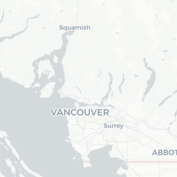
Brentwood Park is a residential neighbourhood in the City of Burnaby, British Columbia, situated in the northeastern part of Metro Vancouver. With a population of roughly 10,500, it occupies a compact area centred loosely around the Brentwood Town Centre commercial district and the eponymous SkyTrain station on the Millennium Line.
The area has undergone significant redevelopment since the late 2010s, with a wave of high-rise residential towers reshaping what was once a low-rise suburban strip. Despite the construction activity, the neighbourhood retains quiet, tree-lined residential streets and has good access to parks, transit, and the broader amenities of Burnaby.
Brentwood Park functions primarily as a liveable urban neighbourhood rather than a conventional tourist destination. Visitors typically pass through on the way to Simon Fraser University on Burnaby Mountain, or use it as an affordable accommodation base when exploring Vancouver, New Westminster, or Coquitlam.
Before You Go
Entry and Visas
Canada has specific entry requirements that vary by nationality, including the Electronic Travel Authorization (eTA) for visa-exempt travellers arriving by air. Do not rely on general summaries — check the TravelerPulse Visas section and the official Immigration, Refugees and Citizenship Canada (IRCC) website for current requirements before booking.
Climate
Brentwood Park shares Metro Vancouver's temperate oceanic climate. Winters (November–March) are mild but wet and grey, with temperatures rarely dropping below −5 °C. Summers (June–September) are warm and relatively dry, with daytime highs commonly in the low-to-mid 20s °C. Pack layers and a waterproof jacket for any season.
Health and Insurance
BC's public healthcare system does not cover foreign visitors. Comprehensive travel insurance including medical coverage is strongly advised. Verify your coverage details before departure.
Getting There
By Air
The nearest international gateway is Vancouver International Airport (YVR) in Richmond. From YVR, the Canada Line SkyTrain connects to downtown Vancouver, where travellers can transfer to the Millennium Line and reach Brentwood Town Centre Station in roughly 45–55 minutes total, depending on connections. Verify current schedules and fares on the TransLink website.
By SkyTrain
Brentwood Town Centre Station on the Millennium Line is the neighbourhood's primary transit hub. It sits within Burnaby and connects directly to downtown Vancouver to the west and to Coquitlam and the Evergreen Extension to the east.
By Road
Brentwood Park is accessible via Lougheed Highway (Highway 7) and is close to Highway 1 (Trans-Canada). Street parking and paid lots are available near the commercial centre, though transit is generally more practical for accessing central Vancouver.
Getting Around
Brentwood Park is well-served by TransLink, Metro Vancouver's integrated transit authority. In addition to the Millennium Line SkyTrain, multiple bus routes connect the neighbourhood to Burnaby, North Vancouver, and beyond. A reloadable Compass Card is the most convenient way to pay for TransLink services; single-use tickets are also available at station vending machines.
The area is walkable at its commercial core around Brentwood Town Centre. Cycling is feasible on local streets, and bike-share options may be available — verify current availability through the city or regional bike-share operators. Rideshare apps (Uber, Lyft) and taxis operate throughout Metro Vancouver and can be hailed in the neighbourhood.
Things to See & Do
Burnaby Mountain Conservation Area
A short bus or drive from Brentwood Park, Burnaby Mountain offers forested trails, sweeping views of Metro Vancouver, Burrard Inlet, and the North Shore mountains, and the Kamui Mintara (Playground of the Gods) totem sculptures. The summit is also home to Simon Fraser University.
Burnaby Lake Regional Park
Located south of Brentwood Park, Burnaby Lake Regional Park has walking and cycling trails encircling a wildlife-rich lake. Bird watching — herons, eagles, and migratory waterfowl — is popular year-round. The park is managed by Metro Vancouver; verify current trail access before visiting.
Brentwood Town Centre
The redeveloped shopping and dining precinct at the neighbourhood's core has a range of retail stores, restaurants, and a cinema. It is primarily a practical amenity for residents but serves visitors needing everyday supplies or a meal.
Proximity to Burnaby Art Gallery and Deer Lake Park
Deer Lake Park, a short transit or car trip south, includes Burnaby Art Gallery (housed in a historic villa), the Shadbolt Centre for the Arts, and a pleasant lakeside environment popular for picnics and paddle-boating in summer. Verify hours and admission on the City of Burnaby website.
Food & Drink
The dining scene around Brentwood Town Centre reflects Burnaby's multicultural population. You will find a solid range of Chinese, Korean, Japanese, Vietnamese, South Asian, and Western casual dining options within walking distance of the SkyTrain station. Several bubble tea shops, bakeries, and quick-service chains are also present.
For a broader range of dining, the Commercial Drive neighbourhood in Vancouver (accessible by SkyTrain and bus) is known for its independent cafés and restaurants and is within 15–20 minutes by transit. Lougheed Highway also has a long commercial strip with diverse eating options accessible by bus.
Note that specific restaurant names and hours change frequently — check current reviews and hours on Google Maps or Yelp before visiting, particularly for smaller independent establishments.
Practical Information
Emergency Services
Dial 911 for police, fire, or medical emergencies anywhere in Canada. For non-emergency police matters in Burnaby, contact the RCMP Burnaby detachment — verify the current non-emergency number through the RCMP website or locally.
Money
Most businesses accept major credit and debit cards. ATMs are available at Brentwood Town Centre and SkyTrain stations. Inform your bank of travel plans to avoid card blocks.
Connectivity
Free Wi-Fi is available at many cafés and at Brentwood Town Centre. Canadian SIM cards and prepaid data plans are available from major carriers (Rogers, Telus, Bell, Fido, Koodo, and others) — outlets can be found in the shopping centre. Check current plan pricing directly with providers.
Useful Apps
- TransLink Trip Planner or Google Maps for transit navigation
- Compass Card app to manage your transit card
- Weather Network or Environment Canada for local forecasts
Safety
Brentwood Park is a generally safe residential and commercial neighbourhood. As with any urban area, travellers should be aware of their surroundings, particularly around transit stations after dark, and secure valuables when leaving vehicles.
Traffic along Lougheed Highway and Willingdon Avenue can be heavy at peak times — exercise standard pedestrian caution. There are no specific safety concerns beyond what applies to Metro Vancouver generally. For the most current local advisories, check the City of Burnaby or TransLink websites.