Translate

Overview
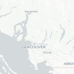
Willingdon Heights is a low-key residential neighbourhood in the northeast quadrant of Burnaby, British Columbia, situated between the commercial corridor of Hastings Street to the south and the green buffer of Burnaby Lake Regional Park to the north. With a population of roughly 12,000, it functions primarily as a suburb within the City of Burnaby rather than a stand-alone tourist destination.
Despite its modest profile, the neighbourhood sits in an exceptionally convenient location. SkyTrain stations, regional parks, and the amenities of greater Metro Vancouver — including the City of Vancouver to the west, Coquitlam to the east, and North Vancouver across Burrard Inlet — are all within easy reach. Visitors typically use Willingdon Heights as a quiet, affordable base rather than a marquee stop.
The area reflects Burnaby's broader demographic diversity, with a mix of long-established residents and newer immigrant communities. Local shopping, cafés, and everyday services are clustered along Hastings Street and around the Holdom and Brentwood SkyTrain stations nearby.
Before You Go
Visas & Entry
Canada's entry requirements vary by nationality and travel document. For accurate, up-to-date visa and eTA (Electronic Travel Authorization) information, visit TravelerPulse's Visas section and cross-reference with Immigration, Refugees and Citizenship Canada (IRCC) at the official Government of Canada website.
Climate
Willingdon Heights shares Burnaby's temperate oceanic climate. Summers (June–August) are mild and relatively dry, with daytime highs typically in the low-to-mid 20s °C. Winters are cool and rainy rather than bitterly cold, with snow rare at low elevations. Pack a waterproof layer for any shoulder-season visit.
Practical Prep
- The Canadian dollar is the only currency you will need; credit and debit cards are accepted almost universally.
- Tipping is customary in restaurants and taxis (15–20% is standard).
- Canada operates on 120V/60Hz electricity with Type A/B outlets.
- Cell coverage is strong throughout Burnaby; confirm your carrier's roaming plan before arrival.
Getting There
By Air
The closest major airport is Vancouver International Airport (YVR) in Richmond, roughly 30–40 minutes by car from Willingdon Heights depending on traffic, or reachable via Canada Line SkyTrain to Waterfront Station and then the Millennium Line eastbound. Abbotsford International Airport (YXX) is an alternative for budget carriers but requires a longer ground transfer.
By SkyTrain
TransLink's Millennium Line is the most practical rapid-transit option, with stations at Holdom and Brentwood Town Centre providing walkable or short-bus access to much of Willingdon Heights. The SkyTrain connects directly into downtown Vancouver and onward to Coquitlam. Verify current schedules and fares on the TransLink website.
By Bus
Multiple TransLink bus routes serve the Hastings Street corridor and adjacent streets. Check the TransLink trip planner for up-to-date routing.
By Car
Highway 1 (Trans-Canada) runs along Burnaby's southern edge; Willingdon Avenue is a key north–south arterial connecting the neighbourhood to the highway. Street parking is generally available, though verify local signage.
Getting Around
Willingdon Heights is walkable for everyday errands within the immediate neighbourhood, and cycling infrastructure has improved throughout Burnaby in recent years — verify current bike routes with the City of Burnaby.
For wider exploration, TransLink's integrated bus and SkyTrain network is reliable and cost-effective. A reloadable Compass Card (available at SkyTrain stations) is the most convenient way to pay across all TransLink modes.
Rideshare services (Uber, Lyft) and traditional taxis operate throughout Metro Vancouver and are readily available via app. Car rental agencies are clustered near YVR and in central Burnaby; verify local pickup options before booking.
Things to See & Do
Burnaby Lake Regional Park
A short distance north of Willingdon Heights, Burnaby Lake Regional Park offers walking and cycling trails around a substantial freshwater lake. Birdwatching is popular — the lake and surrounding marshes host herons, grebes, and waterfowl year-round. The park is accessible by trail or by car; check Metro Vancouver Regional Parks for current trail conditions.
Hastings Street Exploration
The Hastings Street corridor running along the neighbourhood's southern edge provides day-to-day local colour: independent cafés, ethnic grocery stores, and small restaurants that reflect the area's diverse communities.
Nearby Brentwood Town Centre
The rebuilt Brentwood Town Centre mall, a short SkyTrain ride away, is a regional shopping and dining hub if you need a broader retail experience. Verify current tenant listings on the centre's own website.
Day Trips from Willingdon Heights
The neighbourhood's central position in Metro Vancouver makes it an excellent base for day trips: downtown Vancouver, Stanley Park, the North Shore mountains (Grouse Mountain, Lynn Canyon), Coquitlam's Town Centre Park, and the Fraser River communities of New Westminster and Surrey are all within 30–60 minutes.
Food & Drink
Willingdon Heights itself does not have a concentrated restaurant district, but its position between Hastings Street and the broader Burnaby dining scene means options are accessible without a lengthy commute.
The Hastings Street corridor has Chinese, South Asian, and general Canadian casual dining options. The Brentwood and Lougheed areas nearby have a denser concentration of restaurants, from quick-service chains to independent sit-down spots.
For craft beer and a broader bar scene, East Vancouver — accessible via SkyTrain or bus — offers numerous breweries and neighbourhood pubs. Burnaby also has its own craft establishments; verify current options locally or on review platforms, as the hospitality landscape shifts frequently.
Practical Information
Emergency Services
In any emergency across Canada, dial 911 for police, fire, or ambulance.
Healthcare
The nearest hospitals with emergency departments include Burnaby Hospital and Royal Columbian Hospital in New Westminster. Walk-in clinics operate throughout Burnaby; verify current hours and locations on the College of Physicians and Surgeons of BC's physician directory or through a local search.
Money
ATMs are available at SkyTrain stations, banks, and grocery stores throughout the area. Most businesses accept major credit cards; some smaller vendors may be cash-preferred.
Internet & Connectivity
Free public Wi-Fi is available at TransLink SkyTrain stations and many cafés. Mobile data coverage from major Canadian carriers (Rogers, Telus, Bell) is strong throughout Burnaby.
Safety
Willingdon Heights is a generally quiet residential neighbourhood with no particular safety concerns beyond those common to any urban Canadian suburb. Standard urban precautions apply: be aware of your surroundings, secure valuables in your accommodation or vehicle, and avoid leaving bags unattended.
The Hastings Street corridor in some sections closer to East Vancouver has historically had elevated social challenges; exercise the same awareness you would in any busy urban commercial street. The neighbourhood itself is calm by comparison.
For non-emergency police matters in Burnaby, contact the RCMP Burnaby detachment. Verify current contact information on the RCMP's official website.