Overview
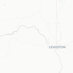
Orofino is a small city of roughly 3,000 people situated along the Clearwater River in Clearwater County, north-central Idaho. Its name is derived from the Spanish phrase for 'fine gold,' a nod to the area's Gold Rush-era past, though today the town is better known for its rivers, reservoirs, and forests than for any precious metals.
The city serves as the county seat of Clearwater County and functions as a practical hub for the surrounding wilderness. U.S. Highway 12 runs through town, making it a natural stopping point on the scenic Lewis and Clark Highway corridor that follows the Lochsa and Clearwater rivers west from the Montana border.
The surrounding landscape—heavily forested hills, the Clearwater River canyon, and the enormous Dworshak Reservoir to the north—draws anglers, boaters, hikers, and hunters throughout the year. Visitors who appreciate small-town, working-landscape travel over resort-style tourism tend to find Orofino a rewarding destination.
Before You Go
Visas and Entry
Orofino is located within the continental United States. Entry requirements depend on your country of citizenship. Check TravelerPulse's Visas section and the official U.S. Customs and Border Protection website for current requirements.
What to Pack
- Layered clothing is advisable year-round; temperatures in the canyon can shift significantly between morning and afternoon.
- Sun protection, sturdy footwear, and insect repellent are useful from late spring through summer.
- If you plan to fish or hunt, Idaho fishing and hunting licenses are required and can be obtained through the Idaho Department of Fish and Game (verify current process and fees on their official site).
- Cell coverage can be limited or absent in the surrounding canyons and forest roads; download offline maps before heading out.
When to Visit
Summer (June–August) brings warm, dry weather ideal for boating on Dworshak Reservoir and hiking. Fall attracts steelhead anglers and hunters. Winters are generally mild by Idaho standards given the low canyon elevation, but mountain roads can close due to snow. Spring brings high river flows and wildflower blooms.
Getting There
Orofino has no commercial air service. The nearest airports with scheduled commercial flights are Lewiston–Nez Perce County Regional Airport (LWS) in Lewiston, Idaho, approximately 45 miles to the west, and Pullman–Moscow Regional Airport (PUW) across the border in Washington state. Spokane International Airport (GEG) in Spokane, Washington, is a larger hub roughly two hours away and offers more flight options.
By road, U.S. Highway 12 is the primary route into Orofino from both the east and west. From Lewiston, the drive follows the Clearwater River canyon and takes under an hour in normal conditions. From Missoula, Montana, the full Lewis and Clark Highway route is a scenic multi-hour drive through mountainous terrain.
There is no scheduled intercity bus or rail service directly to Orofino. Visitors should plan on having a personal vehicle or a rental car obtained at one of the regional airports, as a car is essential for exploring the area.
Getting Around
A personal vehicle is effectively required in and around Orofino. The town itself is small enough to walk in the downtown core, but access to Dworshak Dam, the reservoir, trailheads, and surrounding recreation areas requires driving.
Many roads leading to recreation sites are paved U.S. Forest Service or county roads, but some access roads to boat ramps, campgrounds, or trailheads may be unpaved or require higher clearance. Verify road conditions with the Clearwater National Forest ranger district or Dworshak State Park before heading out, particularly in spring or after heavy rain.
Fuel is available in Orofino, but options become sparse quickly once you travel into the forest. Fill up before extended drives into the backcountry.
Things to See & Do
Dworshak Dam and Reservoir
Dworshak Dam is one of the tallest straight-axis concrete dams in North America. The U.S. Army Corps of Engineers offers public tours of the dam structure (verify current tour availability and schedules directly with the Corps of Engineers office in Orofino). Dworshak Reservoir stretches roughly 54 miles to the northeast and is used for boating, fishing, swimming, and camping. Dworshak State Park, located at the reservoir's south end near Orofino, provides managed access with boat ramps, camping, and day-use areas.
Fishing
The Clearwater River system is nationally recognized for steelhead trout fishing, particularly in fall. Chinook salmon also run through the drainage. A valid Idaho fishing license and the appropriate tags are required; check current regulations with the Idaho Department of Fish and Game before your trip.
Lewis and Clark Highway (U.S. 12)
The highway corridor itself is a scenic drive following the route of the Lewis and Clark Expedition. Interpretive signs and pullouts along the way connect the landscape to historical and cultural context.
Nez Perce National Historical Park
The broader Nez Perce National Historical Park encompasses dozens of sites across north-central Idaho, eastern Oregon, and southeastern Washington. Several park sites are within reasonable driving distance of Orofino. The park's main visitor center is located in Spalding, Idaho, about 40 miles west of Orofino on U.S. 12.
Hiking and Wildlife Viewing
The Clearwater National Forest surrounds the area and provides access to hiking, wildlife viewing, and dispersed camping. Black bear, white-tailed deer, elk, and various raptors are present in the region.
Food & Drink
Orofino's dining options reflect its size—expect a small selection of local diners, casual restaurants, and taverns rather than a diverse restaurant scene. Basic American comfort food, burgers, and bar food are the norm. A few local establishments serve as community gathering spots and are worth visiting for an authentic small-town experience.
Grocery options exist in town for those self-catering, particularly useful for campers and anglers. If you have specific dietary requirements or preferences, consider stocking up in Lewiston before arriving, as selection in Orofino is limited.
Alcohol is available at licensed establishments and through local retailers. Verify current hours locally, as smaller towns often have limited evening service outside of peak seasons.
Practical Information
Emergency Services
For emergencies, dial 911. Orofino has local police, fire, and medical services. Clearwater Valley Hospital is located in Orofino and provides emergency care. For serious medical emergencies, transfer to larger facilities in Lewiston may be necessary.
Connectivity
Wi-Fi is available at some accommodations and the public library. Cell service (all major carriers) is generally available within the city but can drop off on forest roads and in canyons.
Banking and ATMs
Basic banking services and ATMs are available in Orofino. Verify specific bank locations locally.
Useful Contacts (verify current details locally)
- Clearwater National Forest, Orofino Ranger District: for trail and road conditions
- U.S. Army Corps of Engineers, Dworshak Project: for dam tours and reservoir information
- Dworshak State Park: for camping reservations (Idaho State Parks reservation system)
- Idaho Department of Fish and Game: for fishing and hunting licenses and regulations
Safety
Orofino is a low-key small town with no particular safety concerns for visitors. Standard travel common sense applies.
Outdoor safety is the more relevant consideration. River currents in the Clearwater can be strong, especially during spring runoff; heed posted warnings at boat ramps and swimming areas. Rattlesnakes are present in the canyon country, particularly on south-facing rocky slopes in warm months—watch where you step and place your hands.
If hunting or hiking in the national forest, wear blaze orange during hunting seasons to remain visible. Always tell someone your plans and expected return time when going into remote areas where cell service is unavailable.
Wildfire is a seasonal reality in north-central Idaho. Check current fire restrictions before lighting campfires, and monitor the InciWeb or AirNow sites for smoke and closure information during summer and early fall.