Overview
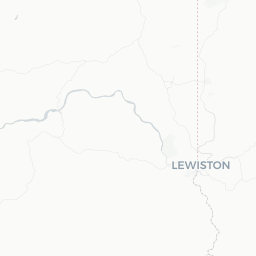
Lewiston Orchards is a residential community situated on the benchlands southeast of Lewiston, Idaho, at roughly 46.38°N. It sits above the Snake and Clearwater River valleys in north-central Idaho, sharing the broader Lewiston metropolitan area with its neighbor Clarkston, Washington, just across the Snake River.
The area takes its name from the fruit orchards that once dominated the fertile benchlands here. The mild climate — unusually warm by Idaho standards due to low elevation and the shelter of surrounding hills — historically made this an ideal spot for growing peaches, cherries, and apples. While large-scale commercial orcharding has declined, the agricultural identity remains part of local character.
For travelers, Lewiston Orchards functions primarily as a quiet residential extension of Lewiston proper. Visitors typically use the wider Lewiston area as a gateway to Hells Canyon, the Clearwater River corridor, and the Nez Perce National Historical Park sites scattered across the region. The community itself offers a glimpse of everyday Pacific Northwest borderlands life without the crowds of larger destinations.
Before You Go
Visas and Entry
Lewiston Orchards is located in the United States. For visa and entry requirements, check TravelerPulse's Visas section and the official U.S. Customs and Border Protection website for the most current information relevant to your nationality.
Climate
The Lewiston area sits at a relatively low elevation (around 700–900 feet / 210–275 m) for Idaho, which keeps winters milder than much of the state. Summers are hot and dry, with temperatures regularly reaching the upper 90s°F (35–37°C) in July and August. Spring and early fall are pleasant for outdoor activities. Pack layers for evenings even in summer, and bring sun protection and water for any outdoor excursions.
What to Know Before Arriving
- State border: Clarkston, Washington is directly across the Snake River. You will likely cross between Idaho and Washington multiple times if exploring the region — no checkpoint, just a bridge.
- Rural character: Lewiston Orchards itself has limited tourist infrastructure; most hotels, restaurants, and services are in Lewiston proper or Clarkston.
- Wildfire smoke: Late summer can bring smoke from regional wildfires; check air quality forecasts if you have respiratory sensitivities.
Getting There
By Air
Lewiston Nez Perce County Regional Airport (LWS) is the nearest commercial airport, located in Lewiston a short drive from Lewiston Orchards. It receives scheduled regional flights; verify current routes and carriers directly with the airport or booking platforms, as service on small regional airports changes frequently.
By Road
US-12 and US-95 are the primary highway corridors serving the Lewiston area. Driving from Boise takes roughly four to four-and-a-half hours via US-95 north. From Spokane, Washington, the drive is approximately 100 miles southeast via US-195 and US-12, typically under two hours. A personal vehicle is strongly recommended — it is the most practical way to reach and explore the area.
By Bus
Intercity bus service to Lewiston exists but is limited. Verify current schedules and operators locally or through regional transit resources before planning travel this way.
Getting Around
Lewiston Orchards blends into the broader Lewiston urban area without a distinct downtown core, so a personal vehicle is effectively essential for getting around. The road network in the benchlands is a grid of residential streets connecting to Lewiston's main commercial corridors.
Lewiston Transit operates local bus routes within the city of Lewiston; verify whether routes serve the Orchards area and current schedules at the official Lewiston Transit resource. Rideshare apps operate in the region but availability can be inconsistent compared to larger cities — verify locally.
For regional exploration — Hells Canyon, the Clearwater River, Nez Perce historical sites — you will need your own vehicle. Roads into Hells Canyon in particular require awareness of seasonal conditions and road type (some sections are unpaved).
Things to See & Do
Hells Canyon National Recreation Area
The deepest river gorge in North America is roughly an hour's drive or less from Lewiston. Hells Canyon offers hiking, jet boat tours on the Snake River, and dramatic scenery. The Hells Canyon National Recreation Area is managed by the U.S. Forest Service; check their official site for current access, road conditions, and permit requirements before visiting.
Nez Perce National Historical Park
The park is not a single site but a network of 38 sites across Idaho, Oregon, Washington, and Montana commemorating the history and culture of the Nimíipuu (Nez Perce people). Several sites are within easy driving distance of Lewiston. The main visitor center at Spalding, Idaho, is approximately 11 miles east of Lewiston on US-12 — verify hours before visiting.
Snake and Clearwater Rivers
The confluence of the Snake and Clearwater rivers at Lewiston is a notable geographical landmark. Confluence Point State Park in Clarkston, Washington offers a viewpoint and waterfront access. Fishing, kayaking, and jet boating are popular along both rivers; local outfitters in Lewiston and Clarkston can provide guided trips — verify operators and current availability locally.
Lewiston Levee Parkway
A paved trail runs along the Snake River waterfront in Lewiston, suitable for walking and cycling. It connects several parks and offers river views without requiring a vehicle once you reach the waterfront.
Chief Timothy Park
Located west of Clarkston on the Washington side, this state park sits on an island in Lake Bryan (the reservoir behind Lower Granite Dam) and offers camping, swimming, and boating. Verify current facilities and fees with Washington State Parks.
Food & Drink
Lewiston Orchards itself is a residential neighborhood and has limited standalone dining options. The main restaurant concentration for the area is along Lewiston's primary commercial corridors (particularly 21st Street and Thain Road areas) and across the river in Clarkston.
The region's agricultural background means locally grown produce — stone fruits, apples, wheat — appears at the Lewiston Farmers Market during the growing season. Verify current market days and location locally.
Dining options in greater Lewiston range from regional chain restaurants to locally owned diners and Mexican restaurants reflecting the area's agricultural workforce demographics. For specific current restaurant recommendations, consult recent reviews on platforms like Google Maps or Yelp, as independent establishments open and close regularly in smaller cities.
Practical Information
Emergency Services
In the United States, dial 911 for police, fire, or medical emergencies.
Health
The nearest hospital serving the area is St. Joseph Regional Medical Center in Lewiston. Verify its current address and services before travel.
Money
ATMs and banks are available in Lewiston proper. Credit cards are widely accepted at most businesses in the area. Smaller farms, markets, or rural vendors may prefer cash.
Connectivity
Mobile coverage from major U.S. carriers (Verizon, AT&T, T-Mobile) is generally available in the Lewiston/Lewiston Orchards area, though it can be spotty in more remote parts of Hells Canyon and surrounding canyonlands. Download offline maps before venturing into rural areas.
Fuel
If you plan to drive into Hells Canyon or other remote areas, fill up in Lewiston or Clarkston before departing — fuel stations become sparse quickly outside the urban area.
Safety
The Lewiston Orchards area is a quiet residential community and is generally considered safe for visitors. Standard urban travel precautions apply: be aware of your surroundings, secure valuables in your vehicle, and avoid leaving gear visible in parked cars, especially at trailheads.
For outdoor activities in the region, heat is the primary hazard in summer — carry adequate water, wear sun protection, and inform someone of your plans if hiking into Hells Canyon or remote trails. Rattlesnakes are present in the region's rocky, shrub-steppe terrain; watch your step on trails and around rock formations. River currents on the Snake and Clearwater can be strong; heed any posted warnings and wear a life jacket for water activities.
Local Culture & Etiquette
The Lewiston area sits within the traditional homeland of the Nimíipuu (Nez Perce) people, whose presence and history are deeply interwoven with the landscape. The Nez Perce Tribe is a federally recognized sovereign nation with its headquarters at Lapwai, Idaho, approximately 13 miles east of Lewiston. Visitors are encouraged to engage with Nez Perce history thoughtfully — the Nez Perce National Historical Park sites and visitor center at Spalding provide well-interpreted context.
The broader community reflects a working-class, agricultural and light-industrial economy. The twin-cities character of Lewiston-Clarkston means locals move fluidly between Idaho and Washington for work and commerce. The area hosts the Lewiston Roundup, a rodeo event with a long history in the community; verify current dates and details locally.