Overview
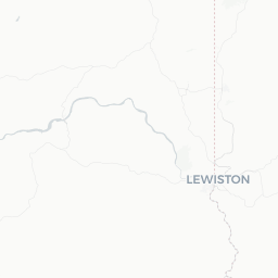
Clarkston Heights-Vineland is a small census-designated place and residential community situated on the bluffs above Clarkston, Washington, in Asotin County. With a population of roughly 6,300, it occupies elevated terrain overlooking the confluence of the Snake and Clearwater rivers and the Idaho border city of Lewiston directly across the water.
The community is effectively the uphill, suburban extension of Clarkston proper. It is not a traditional tourist destination in its own right, but travelers passing through or basing themselves in the greater Clarkston–Lewiston metro area often find the hillside vantage points here among the most scenic in the region. The sweeping views down into the river valleys and across to the Idaho hills give a clear sense of the dramatic geography that defines this corner of the Pacific Northwest.
The area sits at the head of Hells Canyon National Recreation Area, one of the deepest river gorges in North America, making the broader Clarkston region a legitimate hub for river recreation, jet-boat tours, hiking, and wildlife watching. Clarkston Heights-Vineland itself is quiet and residential; visitors will rely on Clarkston and Lewiston for hotels, restaurants, and most services.
Getting There
By Air
The nearest commercial airport is Lewiston-Nez Perce County Regional Airport (LWS) in Lewiston, Idaho, just across the Snake River. It is a small regional airport with connecting service; verify current routes and carriers directly with the airport or your preferred booking platform before travel.
By Road
Clarkston Heights-Vineland is accessible by US-12, which connects the area westward through Washington State (toward Walla Walla and eventually I-82/I-84) and eastward into Lewiston, Idaho. From Spokane, Washington, the drive is roughly 100 miles southeast via US-195 and US-12 — verify current road conditions, especially in winter, through the Washington State Department of Transportation.
By Bus
Intercity bus service to Clarkston is limited. Check with regional carriers and verify schedules locally, as service frequency and stops can change.
By River
Historically, commercial barge traffic used the Snake River system. Jet-boat tours operate seasonally from the Clarkston waterfront into Hells Canyon; these are excursions rather than transportation, but they represent a memorable way to arrive at or depart from the river corridor.
Getting Around
A personal vehicle is the most practical way to move around Clarkston Heights-Vineland and the wider Clarkston–Lewiston metro area. The community sits on elevated terrain and the road network connecting it to lower Clarkston involves grades and curves that can be challenging on foot or by bicycle.
Clarkston and Lewiston together have a limited local transit system; verify current routes and coverage with Lewiston Transit or Asotin County's transportation authority, as service to the Heights area may be limited. Ride-hailing availability in this part of eastern Washington is not guaranteed — confirm before relying on it.
Rental cars are available at Lewiston-Nez Perce County Regional Airport. For most visitors, picking up a rental on arrival and driving across the bridge into Clarkston/Clarkston Heights is the most flexible approach.
Where to Stay
There are no hotels within Clarkston Heights-Vineland itself. Accommodation is concentrated in Clarkston proper and across the river in Lewiston, Idaho. The combined area offers chain hotel properties, motels, and some independent options; verify availability and current listings through a booking platform or the local visitor bureau.
Camping is available seasonally within Hells Canyon National Recreation Area and in nearby state and county parks. Confirm sites, reservation requirements, and fees with the relevant land management agency before arrival, as availability and rules vary by season.
For those planning jet-boat excursions or early-morning outdoor activities, staying in Clarkston close to the waterfront is convenient. If you are simply passing through or using the area as a base for road travel, Lewiston may offer a broader range of options.
Things to See & Do
Views and Natural Scenery
The primary draw of Clarkston Heights-Vineland for visitors is the elevated perspective over the Snake and Clearwater river valleys. Driving or walking along the ridge roads offers panoramic views that extend across into Idaho's canyon country. Sunsets and early morning light can be particularly striking.
Hells Canyon National Recreation Area
This is the region's signature attraction. The Snake River forms the boundary between Oregon and Idaho through a canyon that exceeds even the Grand Canyon in depth at certain points. Jet-boat tours departing from the Clarkston waterfront (a short drive downhill) are the most popular way to experience the canyon without backcountry equipment. Tours typically operate seasonally — verify operators, departure times, and booking requirements locally or through the Hells Canyon Visitor Center.
Chief Looking Glass Park and Beachhead (Clarkston)
Downhill in Clarkston proper, the waterfront parks along the Snake River offer walking paths, picnic areas, and boat launches. These are accessible from the Heights by a short drive.
Hiking and Wildlife
The canyon country surrounding the area supports populations of bighorn sheep, white-tailed deer, osprey, and bald eagles. Trails in Hells Canyon NRA range from easy river-level walks to strenuous backcountry routes. Confirm trail conditions and access requirements with the U.S. Forest Service before setting out.
Lewis and Clark History
The confluence of the Snake and Clearwater rivers is historically significant as a waypoint for the Lewis and Clark Expedition. Interpretive sites in both Clarkston and Lewiston explore this heritage.
Food & Drink
Clarkston Heights-Vineland is a residential area with minimal independent dining. Visitors will find the restaurant and café options in downtown Clarkston and across the bridge in Lewiston, Idaho. The combined metro area supports a range of dining from casual diners and burger joints to sit-down American restaurants and a handful of ethnic eateries.
The Lewiston–Clarkston Valley is sometimes informally called the 'Banana Belt' of the Pacific Northwest due to its relatively mild, low-elevation microclimate. While not a significant wine or agricultural tourism destination in the same vein as eastern Washington's Walla Walla region, local produce and regional wines from the Columbia Valley and Walla Walla AVA are sometimes available at area restaurants.
For grocery shopping, supermarkets in Clarkston and Lewiston are the practical option for self-catering. Verify specific business listings locally, as openings and closures in a small market can occur.
Practical Information
Visas and Entry
Clarkston Heights-Vineland is in the United States. For visa and entry requirements, consult TravelerPulse's Visas section and the official U.S. Customs and Border Protection or Department of State websites. Requirements vary significantly by nationality.
Emergency Services
Dial 911 for police, fire, and medical emergencies anywhere in the United States.
Health and Medical
The nearest significant medical facilities are in Clarkston and Lewiston. Tri-State Memorial Hospital is located in Clarkston; verify current services and hours directly with the facility.
Climate Notes
Clarkston Heights-Vineland has a semi-arid climate with hot, dry summers and cool winters. Summer temperatures can exceed 100°F (38°C). Carry water if hiking or spending extended time outdoors. Winter brings frost and occasional snow; road conditions on the hillside grades can become challenging — check WSDOT road conditions before driving in winter months.
Connectivity
Cell coverage from major US carriers is generally available in the valley. More remote areas of Hells Canyon have little to no coverage; download offline maps and inform someone of your plans before venturing into the backcountry.
Safety
Clarkston Heights-Vineland is a quiet residential community with a low crime profile typical of small Pacific Northwest towns. Normal travel precautions apply: secure your vehicle, do not leave valuables visible, and be aware of your surroundings.
The primary safety considerations in this region are environmental. Summer heat in the Snake River canyon can be extreme and dehydration is a real risk for hikers and boaters. Flash flooding is possible in canyon areas during spring runoff or after heavy rain upstream. If participating in jet-boat tours or any river activity, follow all operator safety briefings and wear provided personal flotation devices.
Wildfire smoke can affect air quality in summer, occasionally significantly. Check AirNow.gov for current air quality index readings if you have respiratory sensitivities or plan extended outdoor activity.