Overview
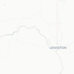
West Clarkston-Highland is a small residential community in Asotin County, Washington, situated on the south bank of the Snake River directly across from Lewiston, Idaho. With a population of around 5,000, it functions as a quiet suburb within the larger Lewiston-Clarkston Valley — a binational urban area straddling the Washington-Idaho border.
The community sits at the confluence of the Snake and Clearwater rivers, a geographically striking location where deep basalt canyons meet wide river bottomlands. Elevation here is relatively low for eastern Washington, which gives the valley a milder climate than much of the inland Northwest — warm, dry summers and comparatively mild winters.
For travelers, West Clarkston-Highland is less a destination in isolation and more a gateway into the broader valley. The area's appeal lies in its river access, canyon scenery, and proximity to the historic Lewis and Clark trail corridor. Visitors typically combine it with neighboring Clarkston, Washington and Lewiston, Idaho, both of which offer more developed visitor infrastructure.
Before You Go
Visas and Entry
West Clarkston-Highland is in the continental United States. For visa and entry requirements, check TravelerPulse's Visas section and consult the U.S. Customs and Border Protection website for current official guidance.
Climate
The Lewiston-Clarkston Valley has one of the warmest climates in the Pacific Northwest interior. Summers are hot and dry, with temperatures frequently exceeding 90°F (32°C) in July and August. Winters are mild relative to the region, though frost and occasional snow do occur. Spring and early autumn offer pleasant conditions for outdoor activities.
What to Pack
- Sun protection (sunscreen, hat, sunglasses) is essential in summer
- Layers for cooler mornings and evenings, especially in spring and fall
- Water shoes or sandals if you plan on river access
- A reusable water bottle — heat can be significant in peak summer
Getting There
By Air
The nearest commercial airport is Lewiston-Nez Perce County Regional Airport (LWS), located in Lewiston, Idaho, just across the Snake River. It offers regional connections; verify current carriers and routes directly with the airport or booking platforms. Larger hubs such as Spokane International Airport (GEG) are roughly 100 miles north and provide more flight options.
By Road
West Clarkston-Highland is accessed via US-12 and local roads connecting to Clarkston. The valley is roughly 100 miles southeast of Pullman, Washington, and about 30 miles from the Idaho border crossing at Lewiston. A car is strongly recommended, as the community has no meaningful public transit of its own.
By Bus
Intercity bus service to the broader Clarkston/Lewiston area is available; verify current schedules and stops locally, as service patterns change.
Getting Around
A personal vehicle is the most practical way to get around West Clarkston-Highland and the surrounding valley. The community is compact and largely residential, but key attractions, dining, and services are spread across Clarkston and Lewiston, requiring short drives.
The Snake River bridges connecting Washington and Idaho are straightforward to cross by car. Cycling is feasible along the river corridor, and a paved trail system in the broader Clarkston/Lewiston area supports non-motorized travel along the waterfront. Verify current trail conditions locally before planning a cycling itinerary.
Things to See & Do
Snake River and Hells Canyon
The most significant natural draw in the area is the Snake River corridor leading toward Hells Canyon — the deepest river gorge in North America. Jet boat tours depart from the Lewiston-Clarkston waterfront and travel into the canyon; operators and schedules should be verified locally or through the Lewiston-Clarkston Valley Chamber of Commerce.
Swallows Park and Beachfront Access
Swallows Park in Clarkston provides direct river beach access and is a popular spot for swimming, picnicking, and fishing in summer months. Nearby Hells Gate State Park, just south of Lewiston across the river, offers camping, a marina, and a visitor center focused on Lewis and Clark history.
Lewis and Clark History
The confluence of the Snake and Clearwater rivers is historically significant as a campsite and meeting point documented in the 1804–1806 Lewis and Clark Expedition. Interpretive sites and exhibits across the valley explore this history.
Hiking and Cycling
- The Lewiston Levee Parkway Trail runs along the river and is accessible from the valley
- Asotin Creek Wildlife Area, south of the community, offers hiking in a canyon landscape
- Verify trail access, conditions, and any permit requirements locally before visiting
Food & Drink
West Clarkston-Highland itself is a residential area with limited dining options within its boundaries. The practical dining scene for visitors is centered in adjacent Clarkston, Washington and across the river in Lewiston, Idaho, both of which have a range of restaurants, cafes, and bars to suit various budgets.
The valley's food scene skews toward casual American fare — burgers, sandwiches, pizza — with a handful of sit-down restaurants offering regional and international cuisines. Lewiston in particular has a more developed restaurant corridor. Local grocery stores and convenience options are accessible for self-catering.
Verify specific restaurant names, hours, and current status locally, as the dining landscape in smaller communities can change frequently.
Practical Information
Emergency Services
Dial 911 for all emergencies (police, fire, medical) anywhere in the United States.
Healthcare
St. Joseph Regional Medical Center is located in Lewiston, Idaho, and serves as the primary hospital for the valley. Verify its current services and location before travel.
Money
ATMs are available in Clarkston and Lewiston. Credit cards are accepted at most businesses. Smaller or rural services may prefer cash.
Connectivity
Cellular coverage is generally reliable in the valley floor, though canyon areas can have limited signal. Confirm with your carrier if you plan to travel into Hells Canyon.
Washington State and Idaho Border
The Snake River forms the state line. Crossing between Washington and Idaho here is seamless for US residents and most international visitors — no checkpoint or documentation required beyond normal US entry. Be aware that some regulations (e.g., cannabis laws) differ between the two states; Washington permits recreational cannabis for adults 21+, while Idaho does not.
Safety
West Clarkston-Highland is a quiet residential community with no notable safety concerns beyond standard travel awareness. As with any travel, keep valuables out of sight in parked vehicles and be aware of your surroundings.
River safety is a meaningful consideration in summer. The Snake River has strong currents in places; swim only in designated areas, heed any posted warnings, and exercise caution with children near the water. If undertaking jet boat or kayak excursions into Hells Canyon, follow all operator safety instructions and wear provided life jackets.
Summer heat can be intense. Stay hydrated, limit strenuous outdoor activity during peak afternoon heat, and recognize signs of heat exhaustion if hiking or spending extended time outdoors.